Communities east and southeast of Lake Ontario are hunkering down for yet another intense blast of lake effect snow, with forecasts calling for totals that could reach 1 to 2 feet in the hardest hit spots by Thursday evening. A Lake Effect Snow Warning is in place for northern Cayuga, Oswego, Jefferson, and Lewis counties from Tuesday morning through Thursday, and meteorologists expect travel to be very difficult at times as roads turn slick and visibility drops.
The National Weather Service says the snow band will repeatedly drift north and south during the week, which means some neighborhoods may dig out more than once while others catch a brief break between bursts. In its urgent winter weather message, the agency warns of “heavy lake effect snow” with local snowfall rates that could reach 2 to 3 inches per hour where the band stalls. It adds that “travel will be very difficult at times with snow covered roads and poor visibility,” especially during the morning and evening commutes.
How lake effect snow forms
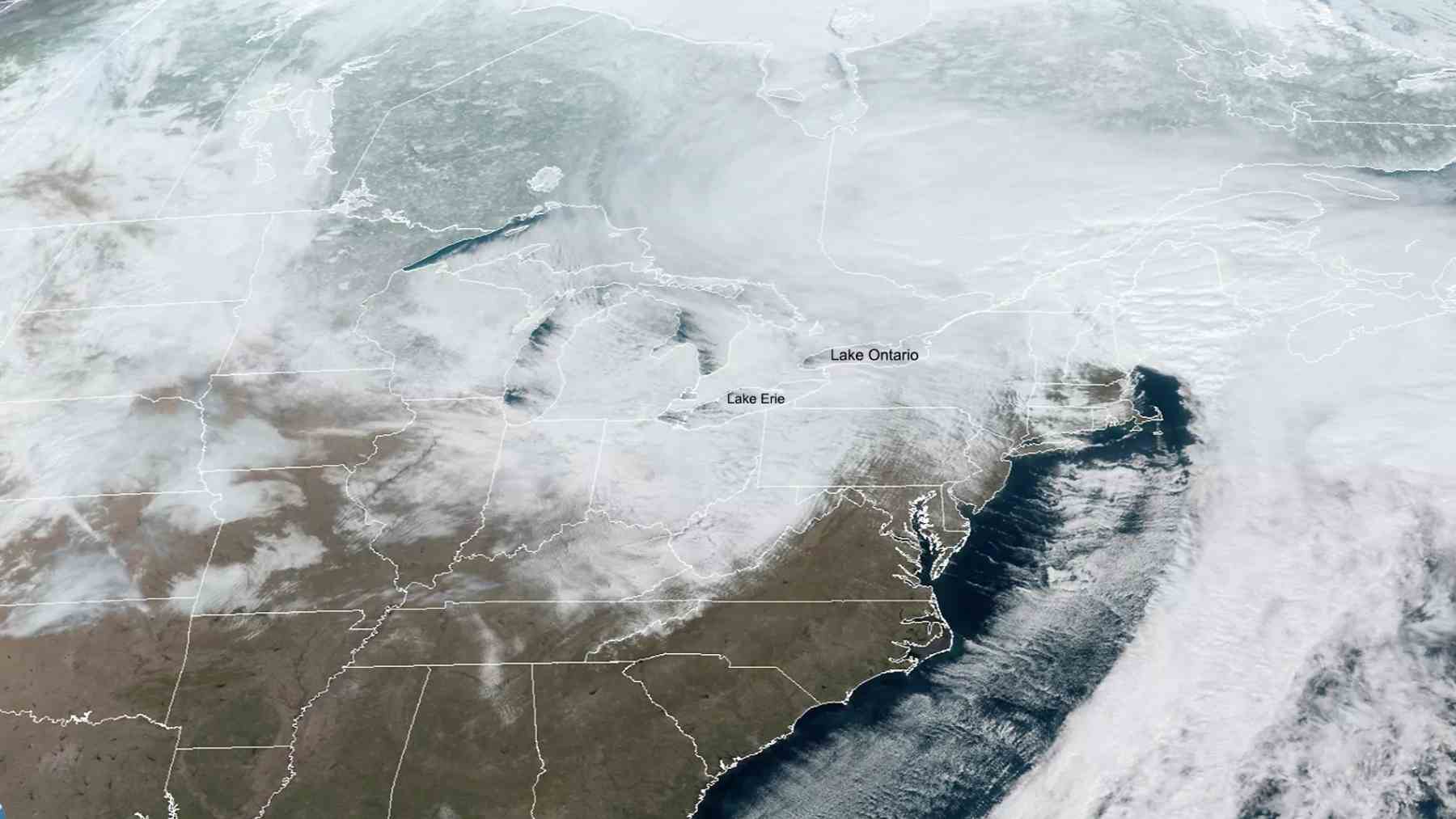
So what exactly is turning Lake Ontario into such a powerful snow machine this week? Lake effect snow forms when very cold air flows over the lake’s relatively warmer open water. The lake adds heat and moisture to the air, which then rises, cools, and forms narrow but intense snow bands that pile snow on the downwind shore.
A small shift in wind can move that band miles in either direction, so one town might be buried in deep drifts while a community a short drive away only sees flurries and gray skies.
Climate change and Great Lakes winters
At first glance, it might seem strange to talk about climate change during a week when people are shoveling chest high snow from their driveways. Yet scientists who study the Great Lakes say winters on these waters are already about two weeks shorter than they were in the mid nineteen nineties, with warmer lake temperatures and less ice cover becoming the new normal.
In the near term, that extra open water can feed stronger lake effect snow, since more moisture is available whenever Arctic air sweeps across the lake. Over the longer run, though, rising air temperatures are expected to tip more winter storms toward rain instead of snow, especially in southern parts of the lake effect belt.
What this means for New York counties this week
For people living in these New York counties, the science shows up in everyday details. Plow crews may need to make more passes as bands keep shifting. Families juggle school delays, risky commutes, and higher heating and electric bills when dangerous cold arrives with the snow.
Forecast centers are already testing improved models that track changing lake temperatures and ice cover more precisely, so that warnings arrive earlier and hit closer to home.
Winter weather risks and the bigger picture
At the end of the day, this week’s storm is one more reminder that a warming climate does not simply erase winter. Instead, it reshapes when snow falls, how intense it becomes, and which communities are most exposed along the shorelines of big lakes.
The official statement was published on National Weather Service Buffalo.