In spring 2025, people from the Cree community of Waswanipi in northern Quebec woke up to shocking news. Lac Rouge, a favorite fishing lake with sandy shores, had almost completely drained, leaving mud, dead fish, and stunned residents. The missing water carved a fresh channel through the forest and poured into a larger lake about 10 kilometers away.
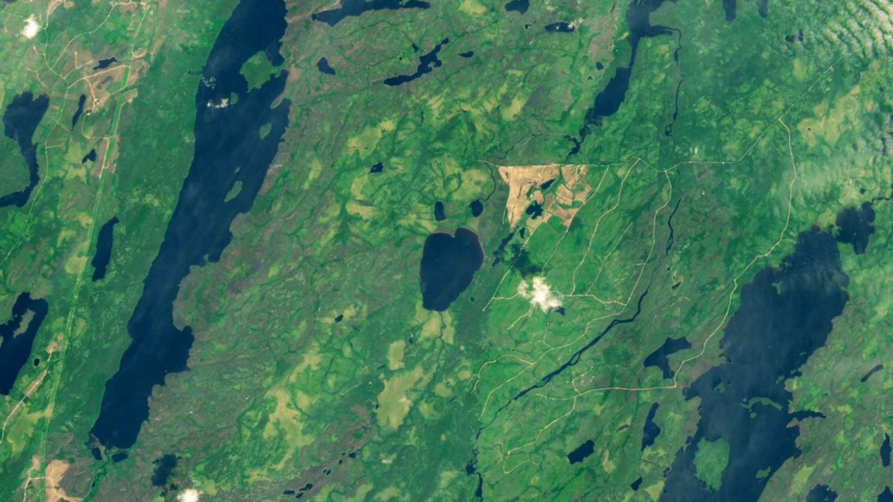
Satellite images later released by NASA Earth Observatory confirmed how dramatic the change was. From orbit, the dark heart-shaped lake seen in 2024 had become in 2025 a pale basin with a tan sediment streak, a classic sign of a sudden lake drainage called an outburst flood.
A lake that emptied almost overnight
The first alarm came from a washed-out logging road northwest of Waswanipi in early May. When community members checked the area, they saw that Lac Rouge’s banks had collapsed along one side and that the lakebed was nearly dry except for a few shallow pools.
Landsat 9 images show the breach opened in the lake’s eastern bank and water flowed northeast, punching through a string of ponds before reaching Lac Doda about 10 kilometers away. For hunters and trappers, it felt like the map of their territory had been quietly rewritten.
An outburst flood scientists rarely see
Geomorphologists classify the event as a sudden lake drainage or outburst flood, a term usually reserved for glacial lakes or man-made reservoirs when ice or dams fail. Experts say they have almost never seen a natural, non-glacial lake drain by cutting its own new outlet.
Diana Vieira at the Joint Research Centre within the European Commission described Lac Rouge as an “absolutely amazing” case because the water ignored its normal outflow and opened a brand new exit through soft shoreline sediments. That suggests the lake was already perched near a tipping point, just waiting for the last push.
Fire, logging, and what it means for other lakes
So what pushed this quiet northern lake over the edge? Scientists point to a mix of natural and human-driven factors, from an elevated basin with soft banks to a snowy winter followed by rapid spring melt that poured extra water into soils already close to saturation.
Around Lac Rouge, two recent wildfire seasons and decades of logging have stripped away much of the mature forest that once shaded snow and helped anchor the ground. Younes Alila at the University of British Columbia notes that when land is disturbed by fire or clearcutting, the soil tends to stay saturated longer, which weakens lake and river banks over time.
Indigenous leaders in the Cree First Nation of Waswanipi now want nearby lakes with similar conditions mapped for risk, since no one wants to see a favorite dock backed by cracked mud.
The main press release has been published by the NASA Earth Observatory.