Aboriginal ranger-divers and archaeologists have pulled nine stone tools from a drowned freshwater spring in Flying Foam Passage, in Western Australia’s Murujuga, a “wonky hole” where fresh water seeps up through the seabed. It is the second such spring in the passage to yield tools, and it went under the sea at least 9,000 years ago.
Some of that stone traveled. In the new study, the authors write that “44% are volcaniclastic sedimentary rocks that currently outcrop only on or near Rosemary Island, approximately 23 km from the submerged site,” which is about 14 miles.
The work was led by Jonathan Benjamin, a professor and marine archaeology specialist at Flinders University’s College of Human Sciences and Culture, with The University of Western Australia, James Cook University, the University of York and the Murujuga Aboriginal Corporation. “These landscapes did not simply disappear when they were flooded,” Benjamin said in the Flinders University announcement. “They remain part of Country and continue to preserve evidence of people’s lives, knowledge and connection to place.”
Country beyond the shoreline
Murujuga, the Dampier Archipelago, is the land and Sea Country of the Ngarda-Ngarli and has been on the UNESCO World Heritage List since 2025. “The Ngarda-Ngarli people have cared for Murujuga for at least 50,000 years,” Vincent Adams, a director of the Murujuga Aboriginal Corporation, said in the Flinders announcement.
Peter Jeffries, then chief executive of the Murujuga Aboriginal Corporation, expected more to turn up when the project’s first underwater finds were announced in 2020. “Further exploration could unearth similar cultural relics and help us better understand the life of the people who were so connected to these areas of land which are now underwater,” he said in the Flinders University release.
The first wonky hole, WH1, yielded one tool in 2019 at 46 feet (14 meters). By 2023 there were five, and Benjamin said then, “We had a narrow window of 40 minutes for each dive when current speeds were low enough to search the passage and our scientific divers focused on locations where fortunately the cultural artefacts were waiting to be discovered.”
Picking up rocks in low light
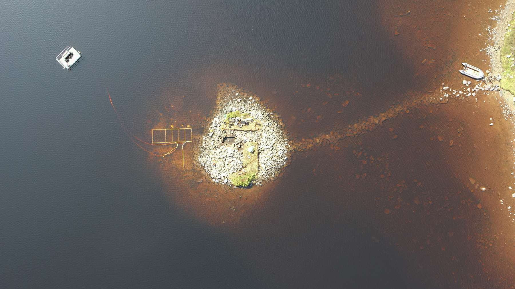
The new spring, WH2, sits about 460 feet (140 meters) from the first. The team dived it on neap tides in late 2025 and early 2026, because, the paper says, “diving these windows provided the lowest currents, which enabled more productive and safer diver surveys in a region which is subject to >4 m tidal amplitude.”
The job on the bottom was slow and fiddly. “Divers had to work quickly in low light to identify rock samples as potential artefacts, and this was made more difficult by the fact that the rocks were generally covered in marine growth,” the authors write.
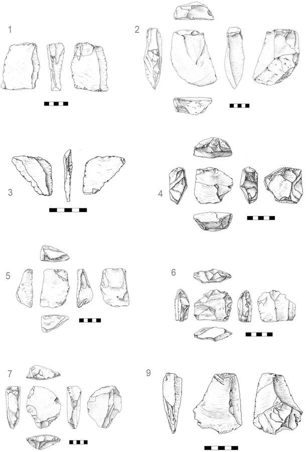
“Some stones were immediately discounted as natural and placed back in the water,” they add. Of 158 brought up and soaked clean in diluted acid, nine were confirmed as tools, eight flakes and one core.
Stone carried from Rosemary Island
A handheld X-ray fluorescence scanner, which reads the chemistry of a rock’s surface, sorted the tools by source. “The majority (56%) of artefacts are composed of the local granophyric rock,” the paper says, from outcrops about 0.6 mile (1 kilometer) away. The rest came from the Rosemary Island rock.
That mix is the point. “The submerged spring sites argue against a model in which people at Murujuga procured stone opportunistically from whatever was immediately underfoot because there is ample local granophyre in the vicinity,” the authors write, calling the springs “almost certainly important gathering places.”
Rising seas made the archipelago into true islands around 10,000 years ago. Before that, the spring’s visitors, in the authors’ words, “brought tools with them, including those from non-local sources.”
A quarry on a drowned riverbank
The second site, the Maitland River Hummock, is a boulder mound about 377 by 197 feet (115 by 60 meters) on the bank of an old river channel, roughly 0.8 mile (1.3 kilometers) off Eaglehawk Island. Its 12 tools were all made of nearby rock.
“The context of exposed hummocks such as the one at MRH means they would have been a visible raw material source that could have easily been seen and selected for stone tool production,” the paper says. The people working there “probably used the hummock as a local quarry,” and “it does not appear to be an aggregation site.”
Rangers who dive
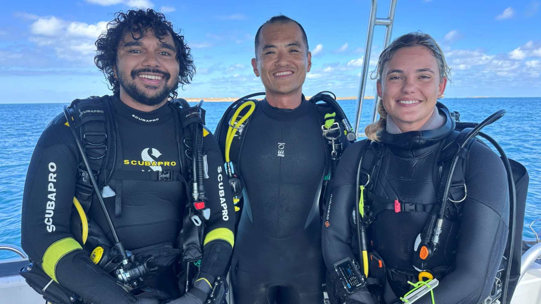
Malik Churnside and Richard Variakojis, rangers with the Murujuga Aboriginal Corporation’s Land and Sea Unit, dived both sites and are co-authors. Churnside found one of the hummock tools, cataloged as MRH-A12, and the authors call the rangers’ role “a significant cultural step for underwater archaeology and marine geoscience in Australia.”
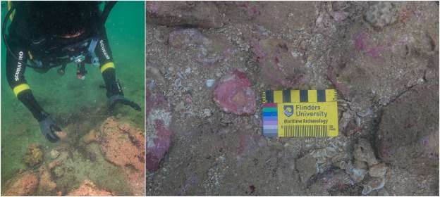
“The Murujuga Rangers are critically important to this research. Their knowledge, connection to Country and enthusiasm are essential to working in the submerged cultural landscapes of Murujuga Sea Country and diving with them is a great privilege,” said Louise Brooke, a Flinders PhD candidate who evaluated rock samples underwater at WH2.
Adams said the new study shows “our cultural landscape extends far beyond the shoreline and into Sea Country, where important parts of our story remain preserved beneath the sea.” The Elders also decided what the public sees. “At the direction of Murujuga Elders, artefact WH2-A08 is not pictured,” the paper notes.
Land the sea took back
When the project announced its first finds in 2020, Benjamin said, “Now we finally have the first proof that at least some of this archaeological evidence survived the process of sea level rise.” He meant the more than 2 million square kilometers (about 772,000 square miles) around Australia that went under after the last ice age.
People were in Australia long before those seas rose, and a study of more than 2,400 genomes puts their arrival about 60,000 years ago. Europe has its own drowned record, from the submerged village of Gran Carro in Italy to the lost land under the North Sea.
What the tools cannot tell us yet
The 9,000 years is a minimum, set by when the sea covered the ground. The sites stood dry “for many thousands of years before final sea-level rise and were obvious attractors of human activity for much of that period,” the authors write, so the tools “could represent a palimpsest of different episodes of visitation and activity at different times.”
They are frank about the numbers, too. Their reading “needs to be tempered by the relatively small sample size: 12 artefacts at MRH and 17 at the two WH sites.” And whether the Rosemary Island stone came by “individual movement, embedded procurement during routine foraging across the landscape, or exchange between groups cannot be resolved from the geochemical data alone.”
So far the team has only worked in water shallower than 98 feet (30 meters), and the old shoreline lies about 427 feet (130 meters) down. Chelsea Wiseman, then a Flinders PhD researcher, said in 2020 that “although these sites are located in relatively shallow water, there will likely be more in deeper water offshore.”
In the university’s 2023 statement, Benjamin said, “There is a high likelihood that more artefacts exist at nearby locations with similar geographic features throughout the archipelago, so protecting the underwater cultural heritage needs to be a priority for the federal and state governments.”
The full study was published in Quaternary Science Reviews.
“We are only beginning to understand the scale and significance of Australia’s submerged cultural heritage,” Benjamin said in the Flinders announcement of the new study. “Each new discovery helps reveal another chapter of Australia’s deep human story.”
Photo: Flinders University