The warning from West Antarctica is not only that ice is melting. It is that the melt is happening in one of the hardest places to see, beneath floating ice shelves where relatively warm ocean water can reach the base of glaciers before anyone on the surface notices a dramatic change.
A 2026 satellite analysis led by the University of California, Irvine (UC Irvine), puts the Amundsen Sea at the center of that concern. The study found Antarctica lost about 4,950 square miles of grounded ice between 1996 and 2025, while Smith Glacier retreated about 26 miles, Pine Island about 20.5 miles, and Thwaites about 16 miles.
A hidden melt engine
The Amundsen Sea sits on the Pacific-facing side of West Antarctica, where glaciers drain inland ice toward the ocean. That makes the region a key test case for understanding Antarctica and the way its ice can respond when the ocean gets into the wrong places.
A floating ice shelf does not add much to sea level when it melts because it already floats, but when it weakens, it can remove the natural braking force that holds grounded ice back. That is where the risk begins.
The grounding line is the boundary where ice stops resting on bedrock and begins to float. The European Space Agency describes it as a critical stability marker because retreat there can let more ocean water reach areas once protected by ice.
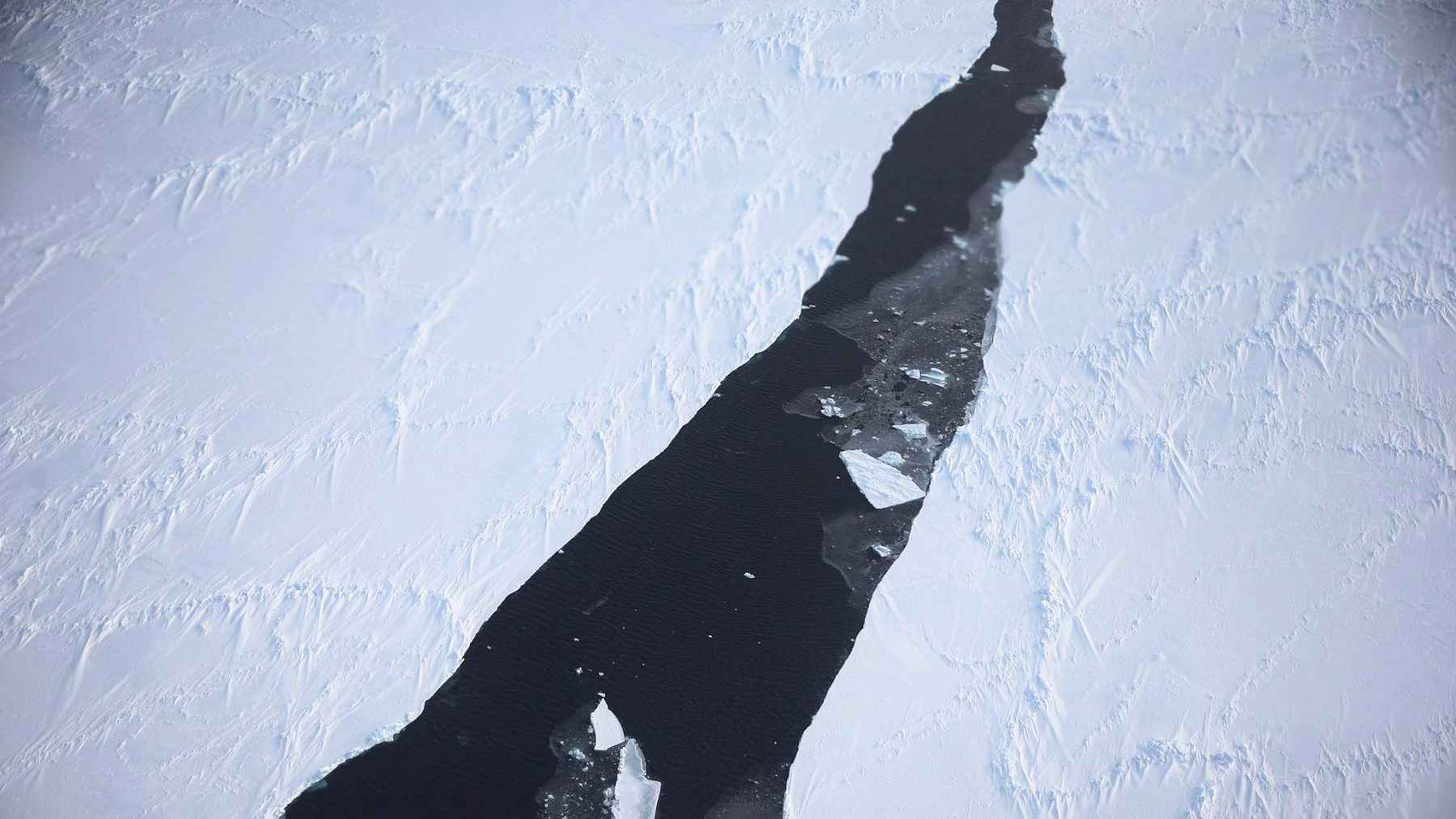
What satellites found
Radar satellites allow scientists to watch this border move from space. By tracking slight vertical motion caused by tides, researchers can separate floating ice from grounded ice and map changes over decades.
A separate paper in The Cryosphere used one-day repeat Sentinel-1 radar data to update Amundsen Sea Embayment grounding-line maps for 2025. It found the region deserves special attention because several basin floors sit below sea level and deepen inland.
Across Antarctica, much of the coast remained stable, but that headline does not cancel the local damage. UC Irvine said the grounding line retreated by about 171 square miles per year on average, with the sharpest changes concentrated in the Amundsen Sea and Getz sectors.
Why warm deep water matters
The phrase “warm water” can sound strange in Antarctica. A NASA visualization shows temperatures ranging from roughly 29.75°F to 34.25°F, but in salty water under pressure and against ice, that difference matters. Warmer deep currents can circulate under Pine Island and near Thwaites, eroding ice from below.
This is also why direct ocean measurements matter. The British Antarctic Survey reported more than 62 miles of underwater survey tracks beneath Dotson Ice Shelf using AutoSub Long Range, measuring turbulent mixing and heat flow in places traditional fieldwork cannot easily reach.
For everyday readers, think of it less like a sunny day melting snow and more like a slow leak under a floor. You may not see the damage at first. Then the support starts to give way. In climate terms, that support is part of the reason sea-level rise can become more difficult to predict.
Thwaites and Pine Island are the pressure points
Concern about the Amundsen Sea did not start in 2026. In 2014, NASA Earth Observatory reported that the region’s fast-moving glaciers, including Pine Island, Thwaites, Smith, Kohler, Pope, and Haynes, were already showing signs of a long-term decline.
The same basic mechanism keeps appearing. Warm ocean currents thin the floating extensions from below, the buttressing weakens, and grounded ice can move more freely toward the ocean. That is the part that matters for coastal cities, flood maps, and insurance bills far from Antarctica.
Thwaites and Pine Island are often described as major drainage outlets for West Antarctica. They sit in a system where the bed slopes down inland, so once the grounding line retreats into deeper areas, the ocean can keep moving in. That geometry is what makes hidden waters beneath ice shelves so important.
The wider warning for sea level
A 2023 Nature Climate Change study found that ocean-driven melting in the Amundsen Sea is currently the main process controlling Antarctica’s contribution to sea-level rise. It projected rapid ocean warming at roughly three times the historical pace over the 21st century, with more basal melting in places that help hold grounded ice back.
That does not mean every piece of West Antarctica collapses tomorrow. Scientists are careful about timing because ice sheets respond over years, decades, and centuries. Still, the Amundsen Sea Embayment contains enough ice to raise global sea level by about 4.1 feet, which explains why small grounding-line changes receive so much attention.
A 2024 Nature Climate Change study adds another layer. It warns that if colder cavities under giant ice shelves such as Ross and Filchner-Ronne shift into warmer regimes, melt rates could rise from a few feet per year to several dozen feet per year. The Amundsen Sea is not just a local problem, it is a glimpse of what other sectors could become if warm deep water gains access.
What comes next
The cleanest lesson from the Amundsen Sea is that surface images alone are not enough. The most important action is often below the ice, where tides, currents, seabed shape, and ocean heat determine how much support an ice shelf can provide.
That is why satellites, autonomous vehicles, and polar research vessels are becoming part of the same story. One carries the big map, while the others put instruments into the water. Together, they help scientists catch changes before they become obvious from the surface.
There is a human side to this, too. If seas rise faster, the cost shows up in ports, roads, undersea infrastructure, and neighborhoods that already deal with high-tide flooding. The Amundsen Sea may feel distant, but the way ocean heat moves under ice can eventually reach the budget of a coastal town.
For now, the message is not to panic. It is precision. The ice is not failing everywhere at once, but where the system is vulnerable, the retreat is deep enough to demand close attention.
The study was published in Proceedings of the National Academy of Sciences.