The season’s first named storm might morph out of Gulf Coast rainclouds—Mother Nature’s reminder she writes the calendar
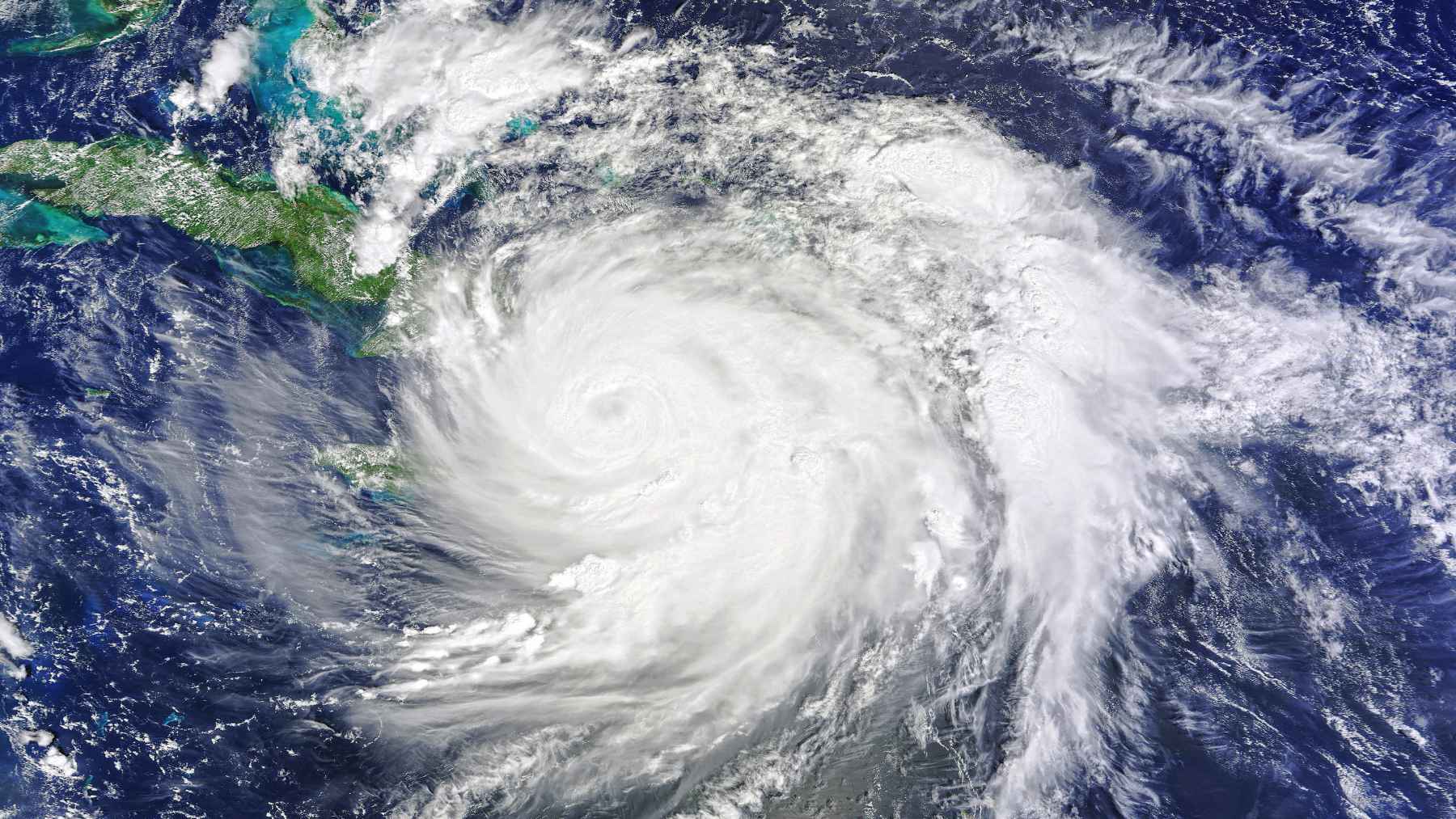
Arthur was not a blockbuster hurricane. It became the first named storm of the 2026 Atlantic hurricane season near the Texas coast, and by Wednesday night, June 17, it had already softened into a post-tropical low. Still, for people watching water creep over streets and underpasses, the name itself wasn’t that important.
That is the uncomfortable lesson from Arthur. A storm can look modest on a wind chart and still carry enough tropical moisture to flood homes, paralyse traffic, and make a regular trip to the store suddenly feel risky. By Friday, federal forecasters were still tracking Arthur’s leftover rain bands across the Southeast.
Deserving of a name
The system started as a broad cluster of thunderstorms along the Gulf Coast. On Tuesday afternoon, it could be pinpointed about 55 miles south-southwest of Corpus Christi, Texas, with winds near 30 mph, below the 39 mph threshold for a tropical storm. Forecasters still gave it a 70 percent chance of becoming a tropical cyclone within two days.
A tropical storm watch already stretched from Sargent, Texas, to Morgan City, Louisiana. That meant coastal communities could see tropical storm conditions even before the system looked especially organized on satellite images. Anyone who has watched a Gulf rain band park over the same road for hours knows why that matters.
The rain was the real hazard
Before Arthur got its name, National Hurricane Center Director Michael Brennan warned that flooding would drive the danger. “The main hazard with these types of systems is largely the flooding from the heavy rainfall,” he said. He also warned of potentially life-threatening flash and urban flooding from the Texas coast toward central Mississippi.
Once Arthur formed, the National Hurricane Center forecast 5 to 10 inches of rain, with isolated totals near 20 inches, from the mid and upper Texas coast into Louisiana, Mississippi, Alabama, western Georgia, and the Florida Panhandle.
What that means practically-speaking is enough water to overwhelm drains, bayous, roadside ditches, and a neighborhood’s usual shortcuts. A weak-looking storm can still turn the morning commute into a labyrinthine ordeal.
The totals told the story
By Friday afternoon, the Weather Prediction Center said a low connected to Arthur’s remnants was moving across the Carolinas. Doppler radar showed thunderstorms over southern Alabama and Georgia, with torrential rain falling at rates of 1 to 2 inches per hour. Flood warnings were in effect in parts of southern Alabama and southern Georgia, while flood watches stretched from Louisiana to Georgia.
Preliminary totals showed the scale. Cottonport, Louisiana, reported 29.06 inches, Plaucheville, Louisiana, 22.53 inches, Perkinston, Mississippi, 12.39 inches, and Village Mills, Texas, 11.41 inches. Those numbers are not just weather data. For a household, they can mean water in the garage, a closed school route, or another night listening for alerts.
Arthur weakened, but the water did not
At 10 p.m. CDT on Wednesday, the National Hurricane Center said Arthur had degenerated into a low pressure area along the upper Texas coast. The center was about 35 miles north-northeast of Galveston, Texas, and about 85 miles west-southwest of Lake Charles, Louisiana, with maximum sustained winds near 35 mph. Coastal watches and warnings were discontinued.
But the agency made clear that the rain threat was still alive. Arthur’s remnants were expected to keep producing widespread heavy rains across the southeastern United States for several days. In other words, the storm’s wind story ended before its flood story did.
A quiet outlook still needs respect
NOAA had already predicted a below-normal Atlantic hurricane season for 2026. Its outlook called for a 55 percent chance of a below-normal season, a 35 percent chance of a near-normal season, and only a 10 percent chance of an above-normal season. The same outlook projected 8 to 14 named storms.
That does not mean coastal residents can relax. As of Saturday morning, June 20, the National Hurricane Center said tropical cyclone formation was not expected in the Atlantic basin during the next seven days. Good news, yes. But clogged storm drains, soggy soil, and swollen creeks do not reset just because the tropical outlook goes quiet.
What families should look out for next
Floodwater is hard to judge from the driver’s seat. The National Weather Service says 6 inches of fast-moving water can knock over an adult, 12 inches can carry away most cars, and 2 feet can carry away SUVs and trucks. That is why “Turn Around Don’t Drown” is more than a slogan.
For Gulf Coast and Southeast residents, the lesson is simple. Follow local National Weather Service alerts, keep phones charged, and do not treat fading tropical winds as an all-clear signal. Tornadoes, feeder-band downpours, and river flooding can arrive after the center has disappeared.
Arthur was a small first chapter, but it landed early enough in the season to make one point obvious. The storm name may fade fast. The water is what people remember.
The official statement was published on National Hurricane Center.