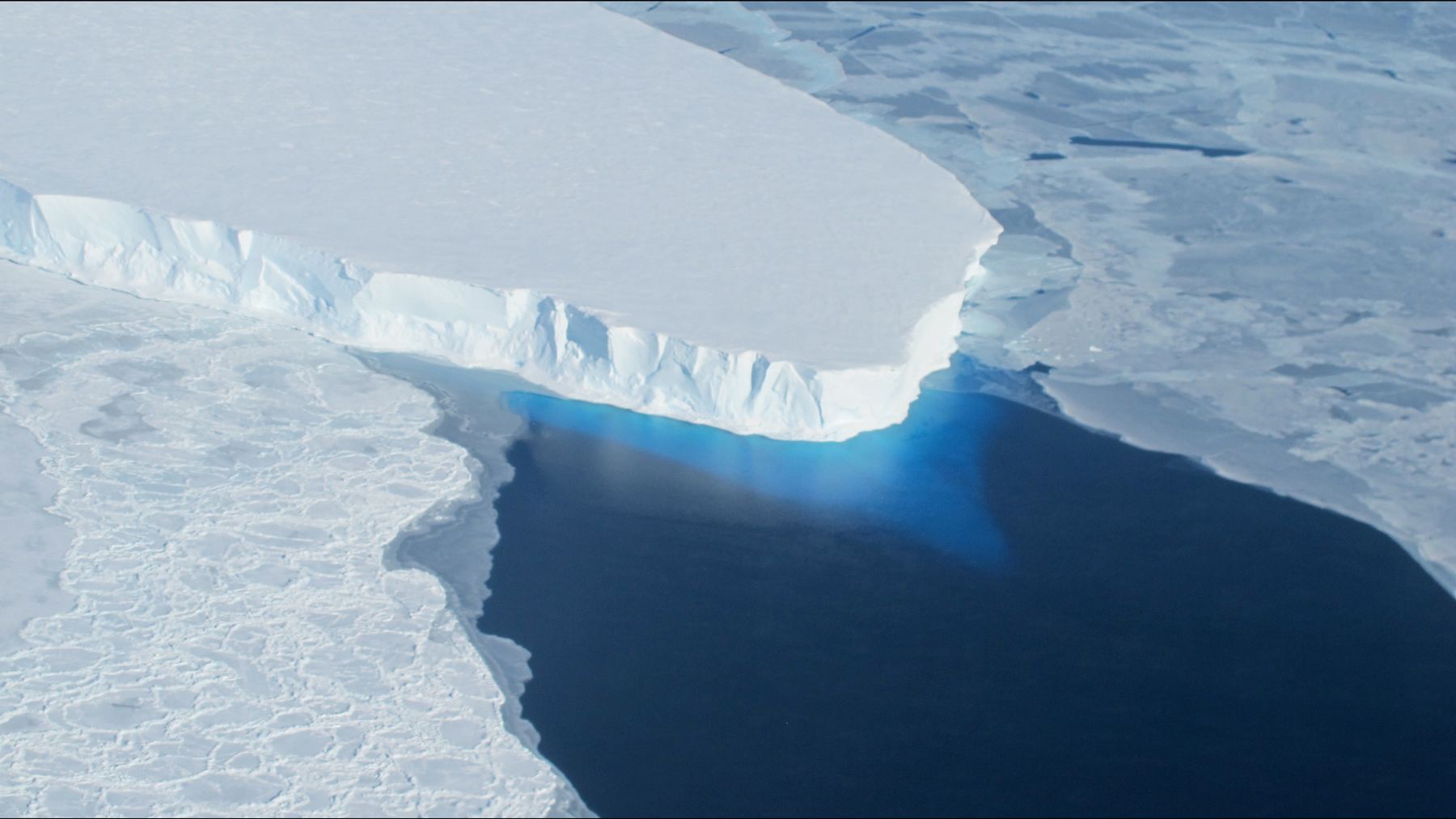
From March to June of 2023, Finland’s ICEYE radar satellites passed over Thwaites Glacier in West Antarctica day after day. They watched the ice near its edge rise, fall and bend with the tides.
Eric Rignot, a professor of Earth system science at the University of California, Irvine, led the team reading those images. “These ICEYE data provided a long-time series of daily observations closely conforming to tidal cycles,” he said in a 2024 UC Irvine news release. “We see the seawater coming in at high tide and receding and sometimes going farther up underneath the glacier and getting trapped.”
He also made a prediction. “If we put this type of ocean-ice interaction into ice sheet models, I expect we will be able to do a much better job of reproducing what has happened in the past quarter century,” Rignot said.
On Oct. 12, 2026, Rignot and five colleagues published that model in Nature Communications. It matches the glacier’s retreat from 1996 to 2023. It also projects that Thwaites could add up to 30 millimeters (about 1.2 inches) to global sea level by 2100, give or take 6 millimeters, even without more climate warming.
The study calls that “approximately double previous projections.” Mattia Poinelli led the work as a UC Irvine postdoctoral scholar. He is now a project scientist at UCLA and a research affiliate at NASA’s Jet Propulsion Laboratory in Pasadena.
The most unstable place in Antarctica
Thwaites sits on the Amundsen Sea Embayment. That stretch of coast accounts for about one third of all the ice Antarctica loses, the study says. The authors call Thwaites “a major contributor to Antarctic mass loss and a key source of uncertainty in future sea-level rise.”
Christine Dow, a professor at the University of Waterloo in Canada, worked on the 2024 ICEYE study with Rignot. “Thwaites is the most unstable place in the Antarctic and contains the equivalent of 60 centimeters of sea level rise,” she said in that year’s UC Irvine release. “The worry is that we are underestimating the speed that the glacier is changing, which would be devastating for coastal communities around the world.”
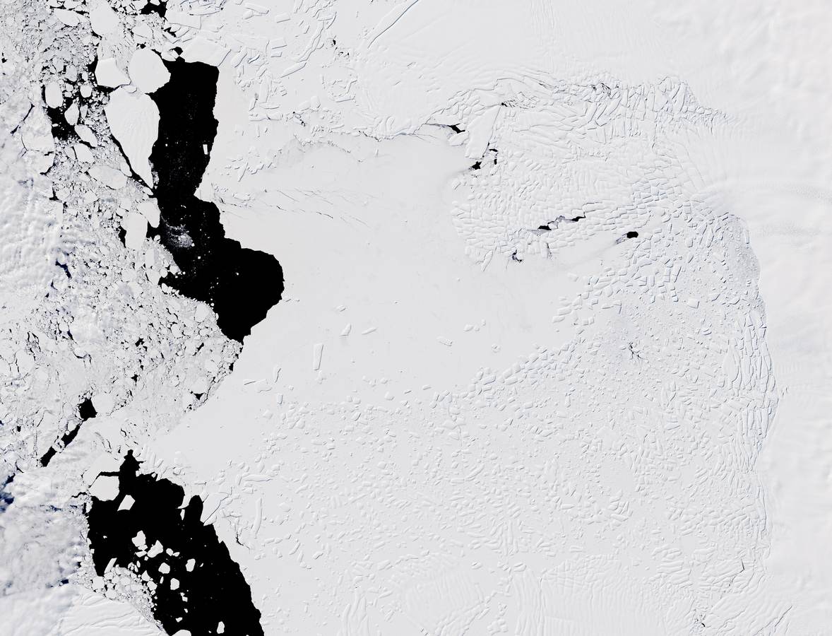
Warm, salty ocean water called modified Circumpolar Deep Water has eaten at the glacier’s underside since at least the mid-1990s. In the fastest section, the Thwaites Main Trunk, the ice has pulled back about 15.5 miles (25 kilometers) since 1996. That is roughly half a mile (800 meters) a year.
Computer models kept missing that pace. They “generally struggle to simultaneously reproduce historical glacier retreat, ice-flow acceleration and thinning,” the authors write. Other teams have tracked the same warm water at work under Thwaites and neighboring Pine Island Glacier.
A zone instead of a line
Poinelli thinks he knows why. Most models draw one sharp border where the ice lifts off the seabed and starts to float.
“Glaciologists have long based their assumptions of ice sheet dynamics on the ‘grounding line,’ a discreet, narrow and mostly stable demarcation where ice leaves the land and begins floating on water,” Poinelli said in a UC Irvine release. “We have come to acknowledge a different arrangement beneath Earth’s major ocean-terminating glaciers.”
“Satellite observations demonstrate the existence of a ‘grounding zone,’ sometimes kilometers wide, where warm ocean water is reaching deep underneath the ice sheets and causing vigorous melting,” he said.
The ICEYE data show what happens there. According to UC Irvine, “seawater penetrates several kilometers beneath grounded ice and lifts it during tidal cycles, flushing the ice with pressurized, warm seawater being pushed to the Antarctic coastline by currents that have been altered by climate change.”
Rignot put it in simpler terms in 2024. “There are places where the water is almost at the pressure of the overlying ice, so just a little more pressure is needed to push up the ice,” he said. “The water is then squeezed enough to jack up a column of more than half a mile of ice.”
105 runs from 1996 to 2023
In 2024, Rignot had laid out the test. “If we could add this process we outlined in the paper, which is not included in most current models, the model reconstructions should match observations much better,” he said. “It would be a big win if we could achieve that.”
Poinelli and co-author Hélène Seroussi of Dartmouth’s Thayer School of Engineering wrote that process into the Ice-sheet and Sea-level System Model, or ISSM. They set up the glacier as it looked in the mid-1990s. Then they ran it forward to 2023 a total of 105 times, changing the melt rate and the width of the zone each time.
Every run was scored on ice speed, thinning and where the grounding line sat. Runs with no zone needed 150 meters (about 490 feet) of melt a year to match the early years, and they still fell short after 2004.
Simulations with no grounding zone “are four times less likely to reproduce the historical trend than simulations with a grounding zone of a few kilometers,” the authors write.
A ridge 3,100 feet down holds the glacier
Mouginot Ridge, the seafloor bump the glacier’s trunk now rests on, is only a few kilometers across. It lies roughly 3,100 feet (950 meters) below the sea surface, yet ICEYE has caught the ice lifting off the bed as far as 6 miles (10 kilometers) behind it.
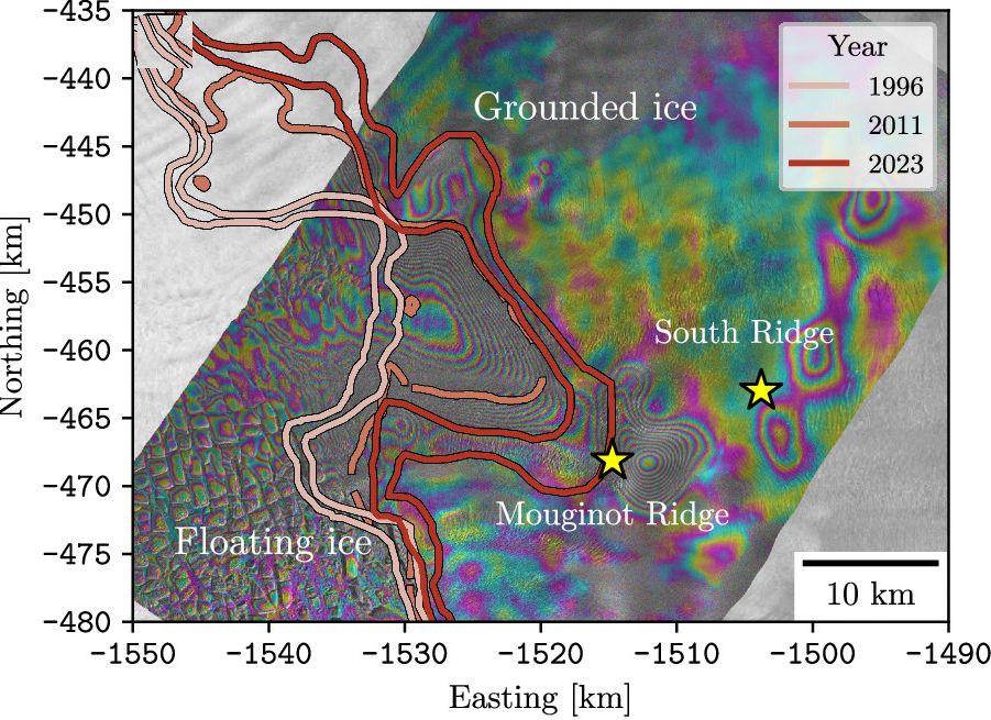
“The Thwaites main trunk is being temporarily stabilized by the Mouginot Ridge,” Poinelli said. “Once that ridge is unpinned, the glacier will continually retreat across a predominantly retrograde seafloor toward its next topographic high, the South Ridge.” On a retrograde seafloor, the bed gets deeper the farther inland you go.
For the forecast, the team held the climate at its 1996 to 2023 average through 2100, which the authors call a lower-bound scenario. With no zone or a 1-kilometer zone, the glacier never got past the ridge. Poinelli said runs with a 4- to 6-kilometer zone, the width satellites suggest today, gave a 60 percent chance of unpinning the ridge by the end of the century. At 5 to 6 kilometers, the ice slid off as early as 2038.
Up to 1.2 inches from one glacier
A 5-kilometer zone, in line with recent satellite views, added 30.1 millimeters (1.19 inches) to global sea level by 2100, plus or minus 5.7. The best fit to the past, a 3-kilometer zone, gave 19.4 millimeters (0.76 inches).
The yardstick is ISMIP6, a large set of runs from many ice sheet models, which averages 15.2 millimeters (0.6 inches) for Thwaites under the same steady climate. The authors call their top result “twice the mean of the ISMIP6 ensemble under a constant climate forcing scenario.”
“All simulations produce sustained sea-level contributions throughout the century,” the study says, “without indication of slowdown or stabilization feedback.”
“Most projections up-to-present have struggled to match the rapidity of the mass loss because of missing physics; our new model with more complete physics is able to match the record and then produces projections that are twice larger than before,” Rignot said.
What the model leaves out
The authors list their own gaps. “A remaining limitation of our simulations is the assumption of a fixed grounding-zone length,” they write. In reality the zone likely grows and shrinks with tides, slopes and water pressure.
The ice front stays put in the model, so no icebergs break off. “Our experimental design intentionally excludes these processes,” the authors write. Melt comes from a simple formula, not a full ocean model. The team also lifted parts of the mapped seafloor by about 330 feet (100 meters) so the 1996 starting point would fit.
One missing piece could make things worse. The warm layer of water may rise in the future, which “would likely increase melt rates by exposing a larger fraction of the ice shelf base to relatively warm mCDW,” the study says.
Dow saw the same gap in 2024. “At the moment we don’t have enough information to say one way or the other how much time there is before the oceanwater intrusion is irreversible,” she said. The new paper agrees that “expanded in-situ observations near grounding zones are urgently needed.”
More flooding risk for coasts
“We have documented and quantified the impacts of climate change on our planet’s sensitive ice sheets for decades, but a mounting realization gained in recent years of what is happening on the undersides of glaciers like Thwaites is leading to an even greater sense of alarm,” Rignot said.
“These results predict greater risk of and exposure for coastal flooding than anticipated in the coming decades,” he added. A group of engineers and climate scientists has even proposed an underwater curtain about 50 miles (80 kilometers) long to slow the so-called Doomsday Glacier, whose ice shelf is already cracking.
The other authors are Joshua Cuzzone of UCLA and JPL, Tyler Pelle of Scripps Institution of Oceanography and Eric Larour of JPL. NASA and the National Science Foundation were among the funders. The new grounding zone code is free to use in ISSM version 2026.1.
The full study was published in Nature Communications.
“When you factor in key physical processes and calibrate against historical observations, you gain a reliable pathway for narrowing uncertainty in projections,” Poinelli said.
Photo: NASA/James Yungel