Czech cave explorers and a Portuguese-developed robot have traced the Hranice Abyss to 1,476 feet (450 meters) below its water surface. Ten years after the cave first became the deepest flooded cave in the world, nobody has reached the bottom.
Back in September 2016, a remotely operated vehicle got to 1,325 feet (404 meters) on a National Geographic expedition. On August 1, 2022, the UX-1Neo robot beat that by 151 feet (46 meters), the cave’s exploration group reported. No deeper dive appears in the project’s published reports since.
A green lake at 228 feet
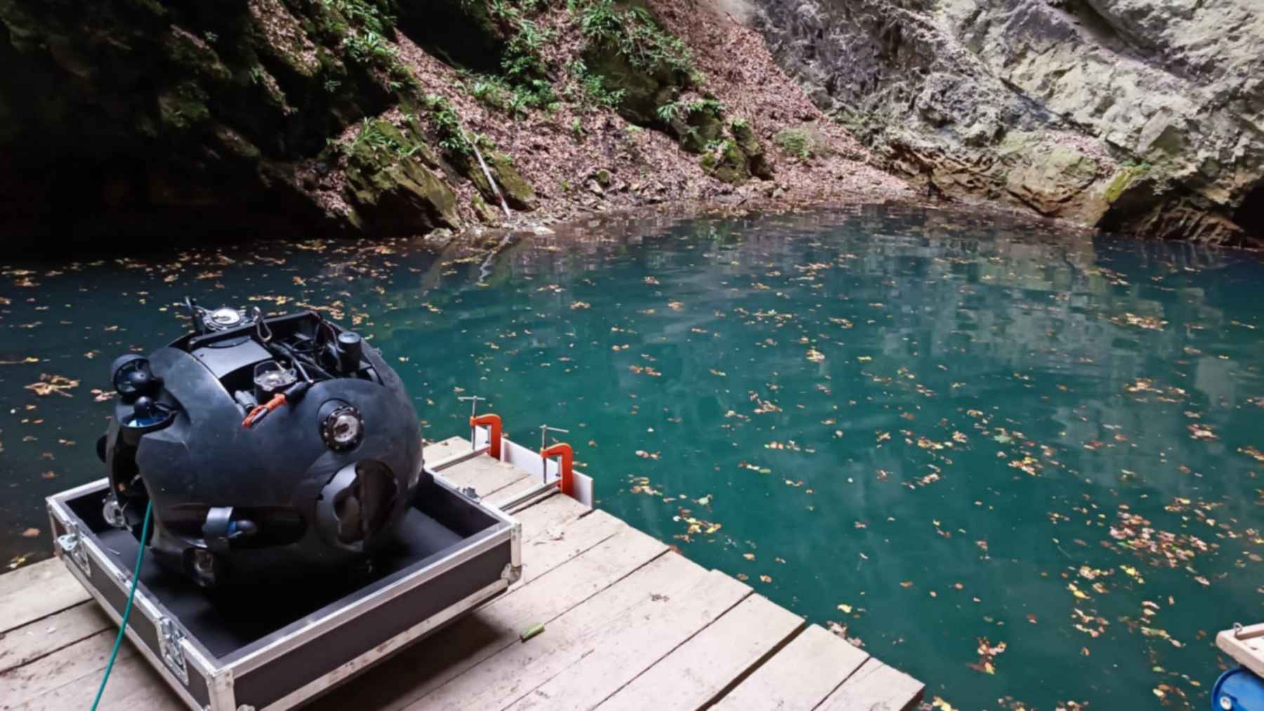
The abyss lies in the Hůrka u Hranic National Nature Reserve in eastern Czech Republic, near the Bečva River. Its dry entrance shaft is 341 feet long and 112 feet wide (104 by 34 meters). It drops 228 feet (69.5 meters) to a small green lake, according to the town of Hranice.
From the viewing platform the lake looks like the floor of the pit. It is really the lid on the flooded section. Add the dry shaft and you get 1,704 feet (519.5 meters) in total, so do not be surprised to see two numbers quoted.
The water below is carbonated mineral water at about 59°F to 72°F (15°C to 22°C). That figure comes from a 2023 summary in Ochrana přírody, the journal of the Czech Nature Conservation Agency. The same article says carbon dioxide-rich water dissolved the limestone from below, and this helps explain the extreme depth.
People have tried to plumb the lake for centuries. In 1580, the physician Tomáš Jordán described a friend’s failed breath-hold dive. Members of the Hranice Karst unit of the Czech Speleological Society have explored it without a break since 1978.
Divers stop near 656 feet
Human divers handle the upper part. Alfredo Martins is a researcher at the INESC TEC institute in Porto and a professor at the Porto School of Engineering. He said the cave “has been explored by divers, who reached close to 200 meters,” in an INESC TEC release from August 2022.
Below that, machines take over. The 2016 vehicle had no navigation system, so a skilled pilot steered it from camera images, Martins explained. The UX-1Neo, by contrast, is a round robot about 2.3 feet (0.7 meters) across, which INESC TEC developed for the European UNEXUP project and describes as autonomous.
It carries a multibeam sonar, two rotating scanning sonars and six cameras. In 2022 it first surveyed a section called Mikado, at about 656 feet (200 meters). Then it headed down.
The local cavers ran the mission with UNEXMIN GeoRobotics of Hungary. Czech firefighters from the Hlučín rescue unit and the state Main Mining Rescue Service also took part.
The corridor kept going
The robot did not stop because the cave ended. “The areas we explored and mapped are huge and at 450m depth we were stopped by technical limitations of the underwater robot,” the exploration group wrote. Its report on the new record appeared on August 3, 2022.
The UNEXUP project saw the same thing in its data. The passage continues below 1,476 feet with an equally wide corridor. The team added that “previous geophysical work indicates a potential 800–1300m depth,” or roughly 2,600 to 4,300 feet.
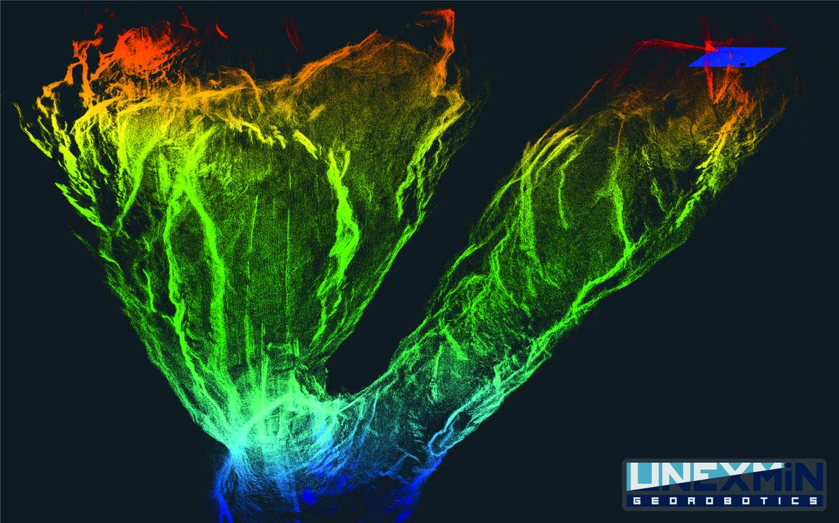
That range comes from surveys made at the surface, not from a robot touching the floor. For a future attempt, the project names a larger vehicle, the UX-2. It is rated to about 4,900 feet (1.5 kilometers).
Two days of sonar
The record was almost a side result. The main goal in 2022 was a precise 3D map plus water measurements, the UNEXUP team says. The work resembles the seabed scans of an underwater robot in the North Sea.
Older maps relied on divers down to about 590 feet (180 meters), Martins said. One diver reached 712 feet (217 meters), and two acoustic probes on a cable went to 1,260 feet (384 meters).
The INESC TEC release quotes one of the expedition divers. The robot mapped “after two days of diving missions, what has been explored over the past 50 years,” the diver said.
According to Ochrana přírody, the three sonars showed the size, shape and orientation of the flooded chambers for the first time. By the time that article appeared in August 2023, the data had become a three-dimensional model.
About 750 bats in Rotunda
Above the waterline, a dry chamber called Rotunda holds the only known underground summer colony of greater mouse-eared bats in the country. The exploration group counts about 500 adult females before birth season. After the young are weaned, around 750 bats fly out.
Cavers started netting bats at the rim in 2000 and listening for their ultrasonic calls with detectors, and so far they have logged 16 species. In 2011, a European free-tailed bat turned up in a crevice inside the abyss, the first record of that species in the Czech Republic.
Four of the species are critically endangered, and five are protected under Natura 2000. As with the bat colony near Texas’s Devils River, much depends on one roost.
Ammonium in the deep water
The water in the abyss has an unusual chemistry too. A team from Mendel University in Brno assessed 257 samples from 36 sites in the Hranice Karst. Cave divers from the Czech Speleological Society collected the abyss samples underwater.
Plant-health maps built from a vegetation index flagged sandstone patches where rain soaks in fast. One sits near the abyss. “As the presence of carbon dioxide creates an anoxic setting underground, the entering nitrates are transformed into NH4+ ions,” the authors write, which means the oxygen-starved water turns nitrate into ammonium.
The highest ammonium reading in the Hranice Karst groundwater hit 9.4 milligrams per liter, against 0.02 to 0.04 in other Czech karst areas in 2021. The authors say that does not signal acute pollution. Nitrate also complicates groundwater elsewhere, as a study of U.S. drinking water found.
No probe has touched bottom
Any depth you read for Hranice Abyss is a minimum. The 2,600 to 4,300 foot figure is still an estimate. The record is also limited to flooded caves, since Veryovkina Cave in Georgia, the deepest known cave of any kind, reaches 7,257 feet (2,212 meters).
On the Caribbean coast, the deepest known blue hole is Taam Ja’ in Mexico’s Chetumal Bay, at least 1,378 feet (420 meters) deep. That is shallower than Hranice, and it is a different kind of feature, but its bottom has not been reached either.
The nitrogen study has limits too. Its entry points are a hypothesis that the data do not contradict, not a traced route.
The full study was published in Environmental Earth Sciences.
Bat monitoring at the rim will continue, according to the exploration group.
Photo: UNEXUP / UNEXMIN GeoRobotics