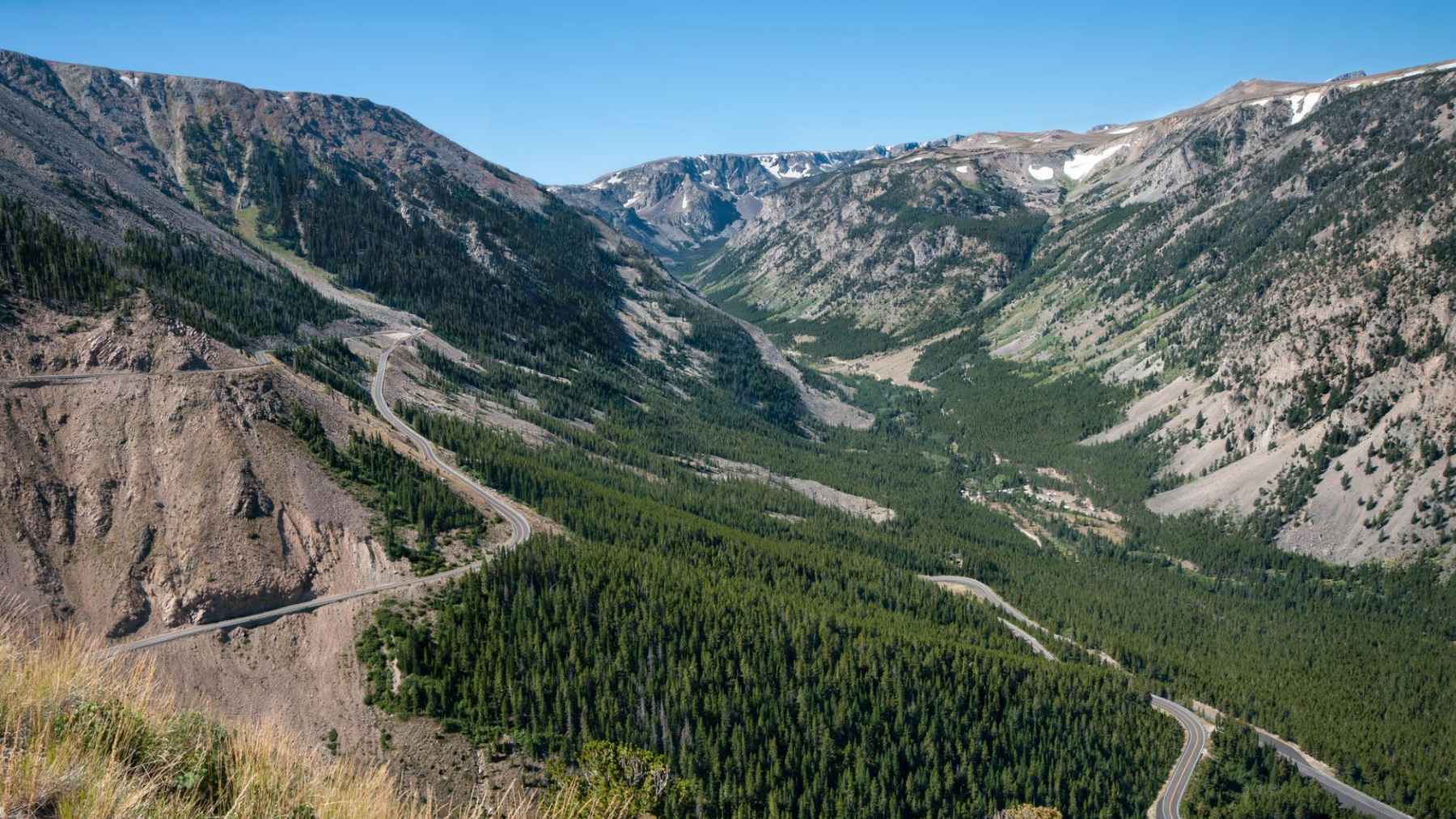
If the drive to Yellowstone feels like something to rush through, Beartooth Highway makes a strong case for slowing down. The 68.7-mile stretch of U.S. Route 212 runs through Montana and Wyoming, linking Red Lodge with Cooke City and the park’s Northeast Entrance near Silver Gate. Federal officials classify it as an All-American Road, a label reserved for routes that can be destinations in their own right.
That is the heart of its appeal. Beartooth is not just a pretty access road to Yellowstone, but a high-country climb that moves from town streets to forests, lakes, open tundra, and windswept overlooks in a relatively short drive.
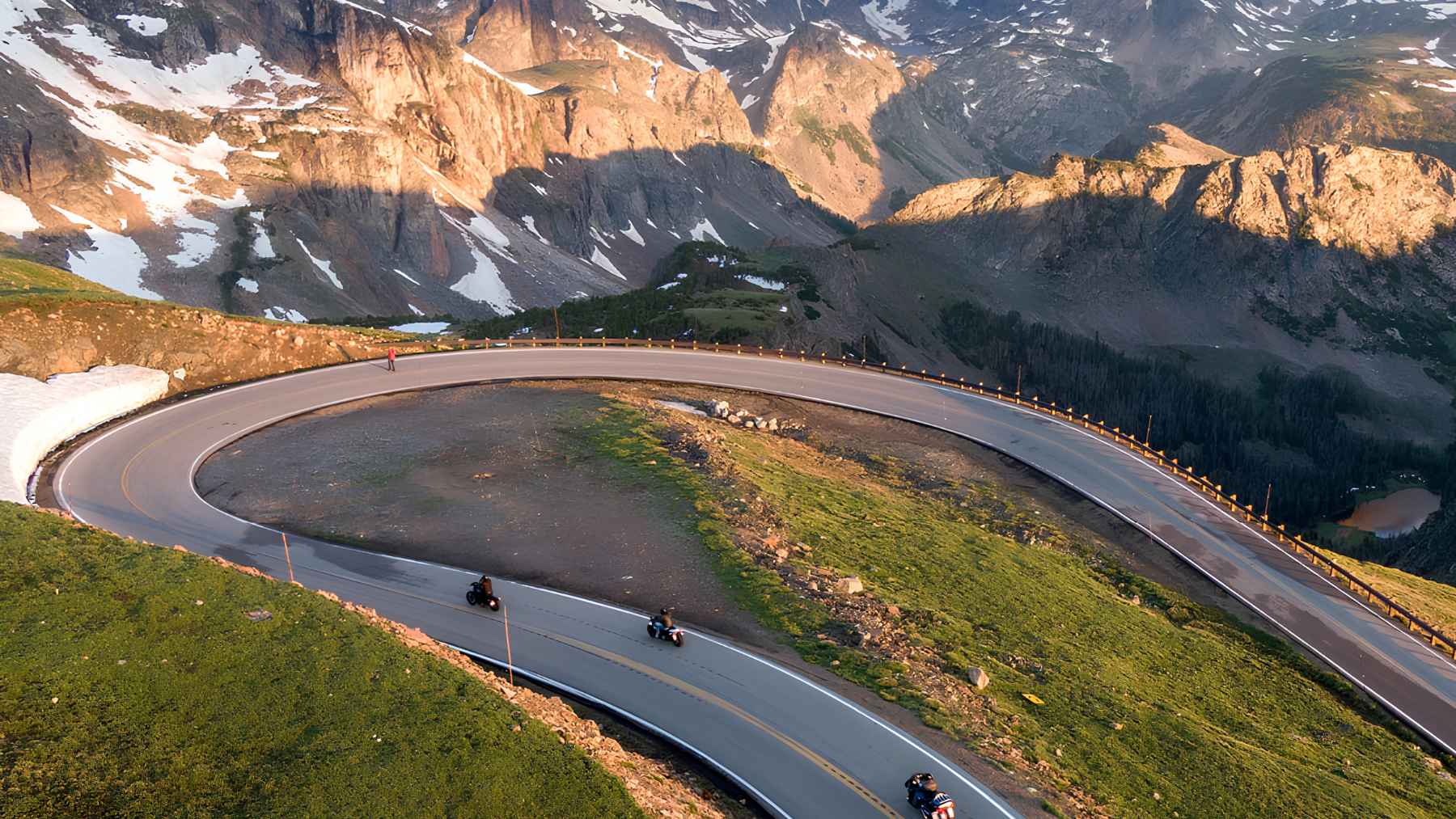
The catch is the same thing that makes it memorable, because at nearly 11,000 feet, the highway can behave less like a summer road and more like a mountain pass with its own schedule.
Why this road stands out
An All-American Road is not a casual nickname. The Federal Highway Administration says a byway in that category must have nationally significant qualities, one-of-a-kind features, and an experience strong enough that travelers would make the drive a primary reason for the trip.
Read More: {{post_title link:post}}
The Beartooth Highway fits that definition on paper and from the windshield. The official America’s Byways listing gives the route a length of 68.7 miles and says travelers should allow at least two hours to drive it, or three hours to experience the full byway.
The climb changes everything
The road climbs to Beartooth Pass, where the overlook reaches 10,947 feet above sea level. That elevation is why drivers can see lingering snowfields, alpine lakes, and wide views that feel far removed from traffic jams, engine noise, and the exhaust fumes of a normal highway.
Travel + Leisure writer Lydia Mansel recently highlighted the route with local voices, including Marci Dye of Sylvan Peak Mountain Shop and Akio Joy of Beartooth Mountain Guides. Dye described the road by saying, “There is really nothing like the Beartooth Highway,” while Joy warned that the biggest mistake is trying to squeeze it around a full Yellowstone day.
Best time to drive
For most travelers, July and August offer the safest bet for scenery, access, and fewer surprise closures. The National Park Service lists Beartooth Highway as open from the Friday of Memorial Day weekend to mid-October, but it also says weather can cause occasional closures after the initial opening.
For 2026, Yellowstone’s road schedule projects regular vehicle travel on Beartooth Highway from May 22 to October 12, with every date still subject to weather. That detail matters because a sunny hotel forecast in Red Lodge does not always match what is happening near the pass.
Weather can change fast
The Montana Department of Transportation says crews work to keep the road plowed and open, but high elevation and unpredictable weather can still shut it down during summer. MDT also points travelers to its 511 traveler map for current pass conditions and closures.
Read More: {{post_title link:post}}
In practical terms, that means packing like the mountains might surprise you. A warm jacket, gloves, a hat, and rain gear can feel excessive when you leave town, but they may make sense at the top, especially for motorcyclists and anyone stepping out for photos.
Stops worth your time
The drive can be done quickly, but that misses the point. Rock Creek Vista Point, Beartooth Pass Overlook, Top of the World Store, Beartooth Basin Summer Ski Area, Clay Butte Fire Lookout, and Pilot and Index Peak Overlook are among the route’s better-known stops.
Top of the World Store sits at about 9,400 feet and offers fuel, food, gifts, and lodging, which makes it more than a photo stop on a remote road. The Pilot and Index Peak Overlook is also listed by the National Scenic Byway Foundation as one of the most photographed scenes along the route.
Wildlife is part of the draw
The high country is not a zoo, even when animals wander close to the pavement. Travelers may see mountain goats, moose, elk, mule deer, bears, wolves, marmots, and birds, but distance is part of the experience too.
Read More: {{post_title link:post}}
That is especially important near Yellowstone, where one roadside crowd can form quickly around a single animal. Pull over only where it is safe, keep traffic moving, and let binoculars or a zoom lens do the work your feet should not do.
A better way to enter Yellowstone
The Beartooth Highway leads toward Yellowstone’s Northeast Entrance, which the National Park Service calls the quietest of the park’s five entrances. From that side, travelers pass through the Absaroka Mountains and follow Soda Butte Creek toward the Lamar River.
At the end of the day, what the road asks for is patience. Stay in Red Lodge or Cooke City if you can, leave time for pullouts, and treat the Beartooth as a mountain experience that happens to have pavement.
The official route information has been published by the Federal Highway Administration’s America’s Byways program.