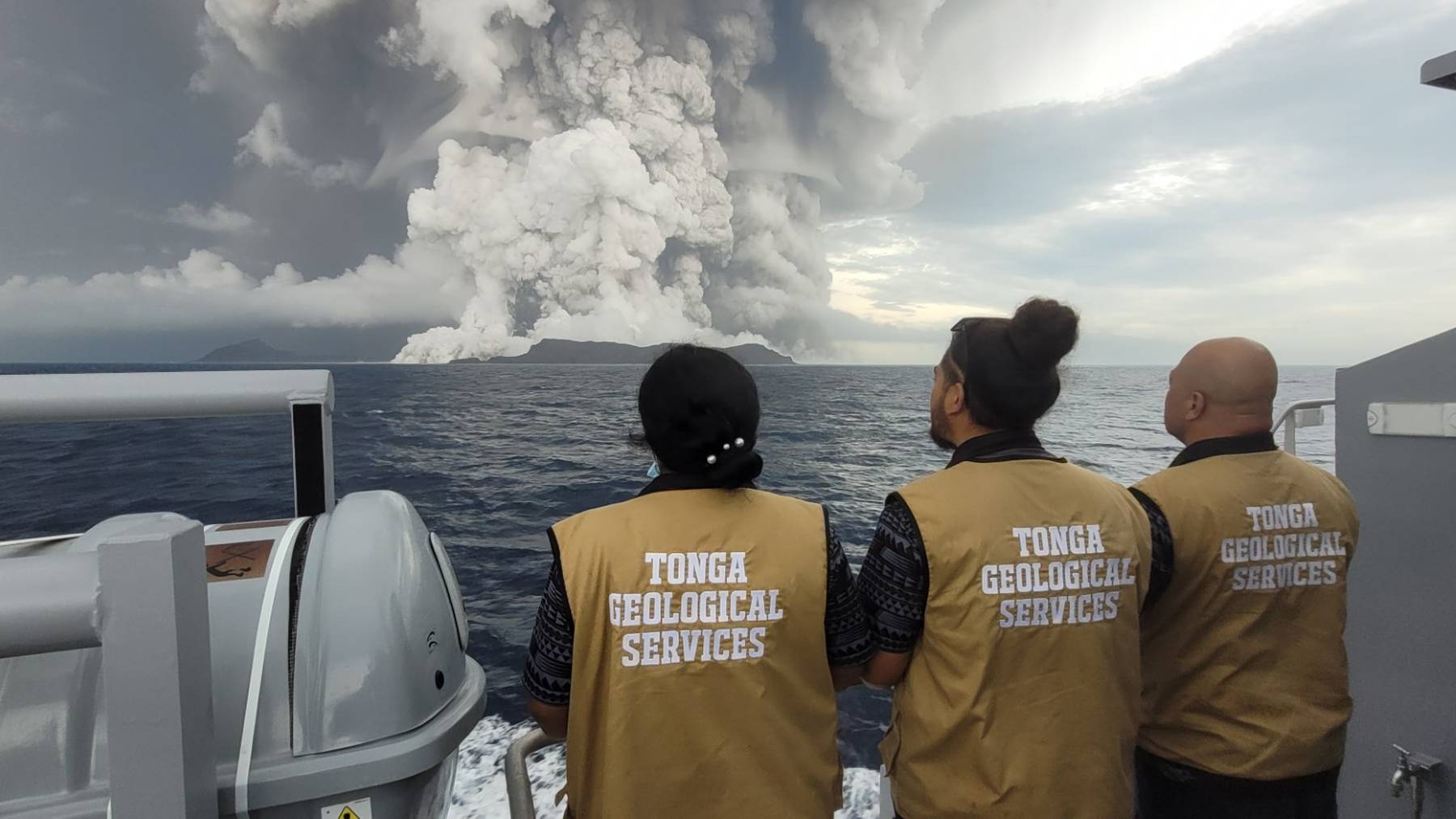
The underwater volcano in Tonga that erupted on January 15, 2022, moved about 2.1 cubic miles (8.9 cubic kilometers) of rock and debris. That is enough to fill 1,500 Great Pyramids. An international team reported the figure on September 11 in Nature Geoscience, after comparing maps of Hunga volcano made before and after the blast.
The study was led by Marta Ribó of Auckland University of Technology, with 22 collaborators from five countries. According to the National Oceanography Centre announcement, the maps show the volcano’s caldera caved in fast. That speed helps explain the huge tsunami that followed.
From 490 feet to 2,790 feet
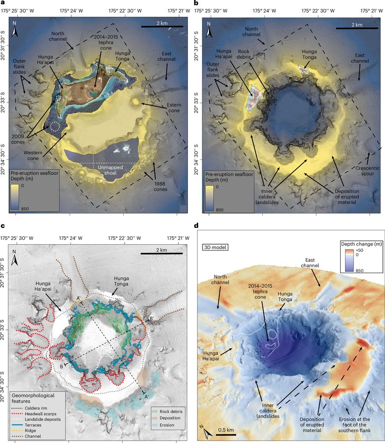
A caldera is the large hollow left when the ground above a magma chamber sinks. Before 2022, the floor of the Hunga caldera sat about 490 feet (150 meters) below sea level. Its deepest point now lies at about 2,790 feet (850 meters), in the northwest corner.
About 1.6 cubic miles (6.85 cubic kilometers) of the lost material went with the collapse itself, the paper reports. The rest was scraped off by fast currents of ash, rock and water racing down the flanks.
The hollow also widened a little, from about 2.8 to 3 miles (4.5 to 4.8 kilometers) across. Counting the ash that later settled inside, the ground sank by around 3,300 feet (1,000 meters) on average.
Sonar surveys from 2015 to 2022
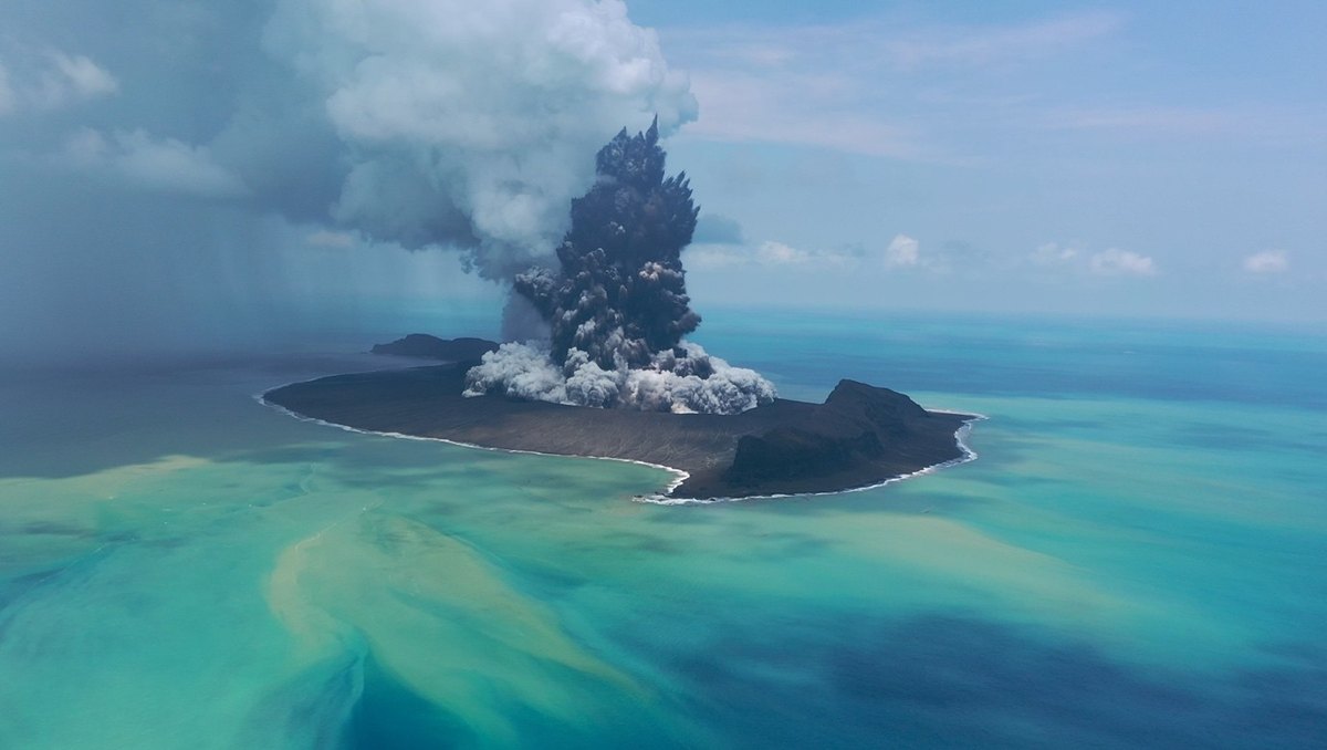
Hunga rises about 5,900 feet (1,800 meters) from the seabed, some 40 miles (65 kilometers) north of Tonga’s main island. The team compared sonar maps from 2015 and 2016 with four new surveys made in 2022. The South Korean research ship Araon also collected seismic profiles of the caldera floor.
Isobel Yeo, a senior volcanologist at the UK’s National Oceanography Centre, is a co-author. “It is rare to have detailed maps of the seafloor from before a hazardous event,” she said. Those older maps let the team measure the change directly.
The authors rank the blast among the most explosive of the last century. Magma and seawater mixed violently for about 11 hours. The plume rose more than 34 miles (55 kilometers), and more than 118 miles (190 kilometers) of undersea telecommunication cables were damaged.
Landslides layered inside the ash
The seismic profiles show landslide deposits below, between and above flat layers of erupted ash. According to the paper, the walls were giving way while the eruption was still going.
On the northwest side, the walls now drop at a slope of about 70 degrees. On the east and south, they step down in terraces 330 to 490 feet (100 to 150 meters) high. The authors read those steps as faults formed as the floor dropped like a piston.
From the caldera’s shape, the team estimates that about 1.9 cubic miles (8 cubic kilometers) of magma erupted before the collapse began. That is less than 30 percent of the magma thought to sit beneath the volcano.
Waves higher than Krakatau’s
Calderas like Hunga’s sit behind some of the deadliest eruptions on record. The 1883 eruption of Krakatau in Indonesia killed more than 30,000 people, mostly through hot ash flows and tsunamis. The volcano that grew in its place is still active.
Hunga’s tsunami was even larger. Waves reached about 130 feet (40 meters) at distances of up to 62 miles (100 kilometers). The study calls it the largest and highest tsunami ever recorded from an underwater eruption, though few lives were lost.
Steep walls and a fast drop likely pumped up the wave, in the authors’ reading. Yet Hunga’s caldera is small, about 2.5 miles (4 kilometers) wide. It ranks in the lower 12 percent of a global list of 177 calderas.
Gas plumes gone by October
In May 2022, sonar picked up columns of gas and fluid rising from vents inside the caldera. The largest stood about 1,500 to 1,600 feet (450 to 500 meters) tall. By October the deep vents had vanished, either because the magma withdrew, the team suggests, or because hydrothermal minerals plugged the cracks.
Near Hunga Ha’apai island, on the northwest rim, small plumes were still bubbling up in October less than 490 feet (150 meters) down, which the team takes as magma lingering below. Inside the bowl, CTD casts found warm, fresher water sitting on a cold, dense bottom layer that barely mixed for nine months. The same eruption pushed methane into the stratosphere, according to separate research.
74 volcanoes, few maps
Treat the 1.9 cubic miles as a floor, not a total. Gravity readings hinted that new magma was feeding the chamber mid-eruption, and the paper can’t count that. Nor did anyone sound the old caldera’s loose fill before 2022, so the authors plugged in 1,150 feet (350 meters) as a cautious stand-in.
Yeo put it bluntly: “Most submarine volcanoes are still very poorly mapped and monitored.” Ribó counted at least 74 along the Tonga-Kermadec Arc, with 20 caldera complexes, and said “they are not well-understood as they remain unexplored.” Much of the deep seafloor has never been seen in detail.
“The 2022 eruption event exposed a critical gap in global preparedness for submarine volcanic hazards,” Ribó said. Yeo called repeat surveys vital for coastal towns and for the cables on the seabed.
The full study was published in Nature Geoscience.
Photo: Tonga Geological Services / National Oceanography Centre