NOAA’s National Geodetic Survey is replacing the framework behind every official coordinate in the United States. The agency says existing latitudes, longitudes and heights will change by as much as 13 feet (4 meters). Houses, roads and mountains stay where they are, because only the reference point is being corrected.
On September 15, 2026, the survey opened the new system’s core tools to public testing. NOAA says this National Spatial Reference System supports aviation, agriculture, emergency response and construction.
Seven feet off Earth’s center
Every coordinate needs an agreed starting point, which surveyors call a datum. The country still runs on two from the 1980s. NAD 83 handles horizontal position, and NAVD 88 handles height.
According to the survey, NAD 83 sits about 7.2 feet (2.2 meters) from the center of the Earth. An agency presentation traces that gap to ground observations from the 1970s and 1980s. It adds that the datum’s model of North American plate motion rotates too fast.
GPS and similar satellites orbit Earth’s center of mass and report positions relative to it. For now, the survey has to convert those measurements back into NAD 83.
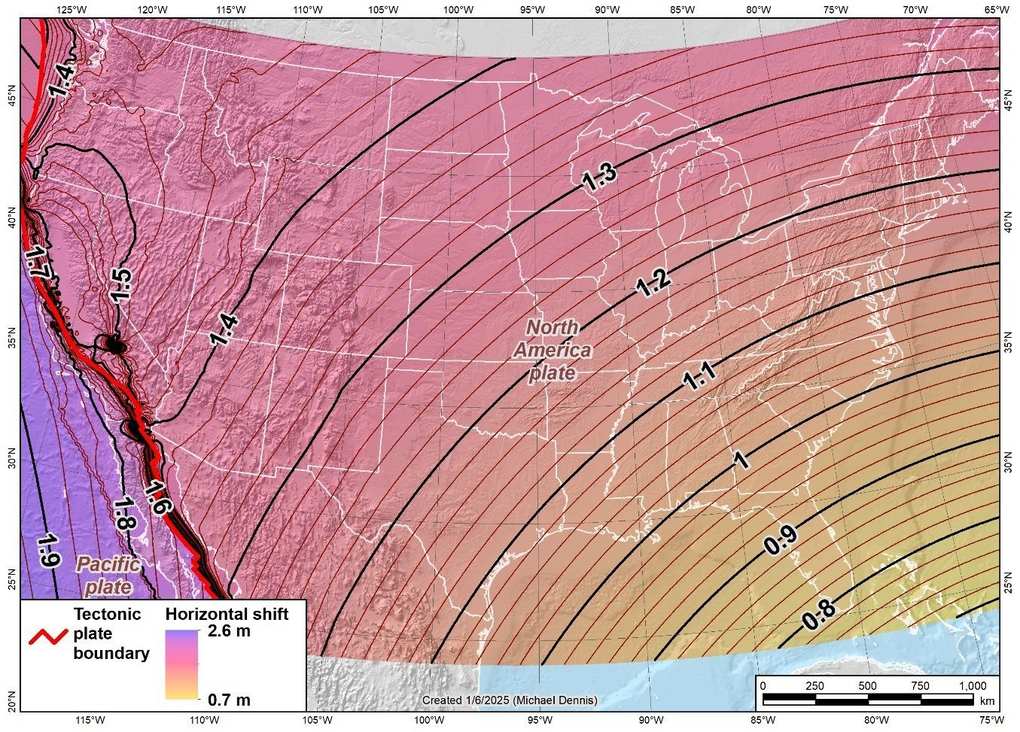
An agency map shows the horizontal shift to the new North American frame. It comes to about 2.6 feet (0.8 meters) across South Florida and about 4.6 feet (1.4 meters) across much of the Mountain West.
Three feet of national tilt
Height measurements carry a separate problem, according to the same agency page. NAVD 88 is biased by about 1.6 feet (half a meter) against the best global models of the geoid. It is also tilted about 3.3 feet (1 meter) from coast to coast.
The geoid is a surface that roughly follows global mean sea level. That tilt belongs to the reference surface, so nobody should picture the continent leaning.
Survey crews built NAVD 88 through geodetic leveling, and a gravity-based datum called NAPGD2022 will replace it. Aircraft from the agency’s GRAV-D project measured gravity over the entire United States. Those flights fed GEOID2022, the model that will define zero height.
Earth’s gravity is far from uniform, as the gravitational low beneath Antarctica shows.
A million markers lose top billing
Today the system combines more than 1,000 continuously operating satellite stations with a far older layer. The survey calls it “an aging network of over 1,000,000 geodetic survey marks.” Many of those marks are small metal disks set into stone.
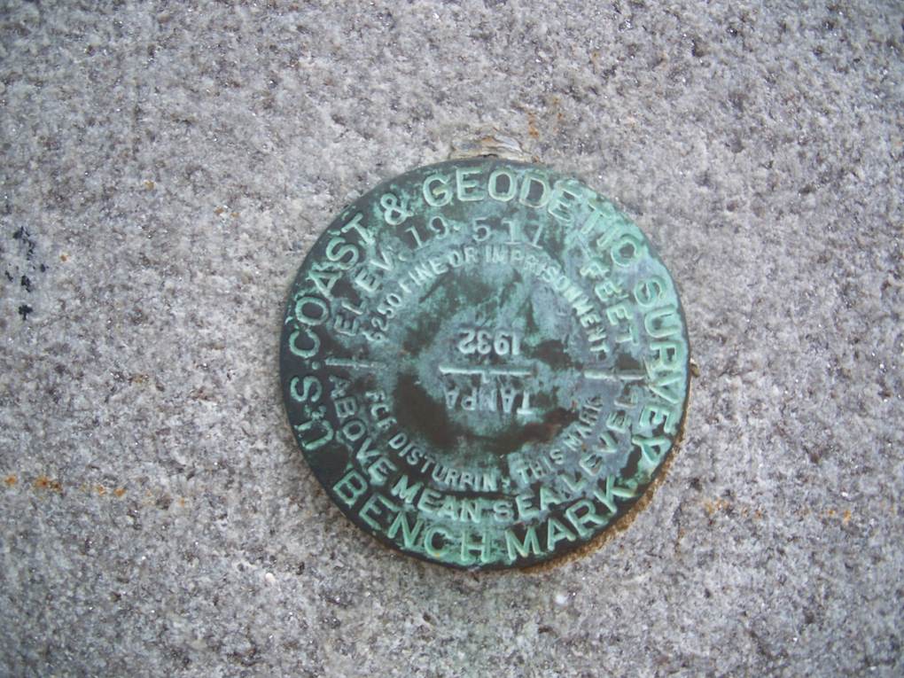
Satellite stations get checked for movement every day. The agency warns that marks are often “deteriorated, destroyed, and/or not maintained.” Outdated values make it harder to follow sea level rise and subsidence, a problem Osaka knows from groundwater pumping.
According to the survey’s frequently asked questions, surveyors will still be able to contribute satellite data collected on individual marks. Access moves mainly to the station network, a change the agency calls “a paradigm shift.”
Four frames riding four plates
Horizontal positions will move from three NAD 83 frames to four new ones. Each is named for a tectonic plate and rotates at that plate’s average rate. North America, the Pacific, the Caribbean and the Mariana plate each get one.
Many areas drift roughly 0.4 to 0.8 inches (1 to 2 centimeters) a year, according to the survey. Published values will therefore carry a date, known as an epoch. The agency plans 2020.00 as the first reference epoch.
Navigation has its own moving target, since the magnetic north pole has shifted more than 1,400 miles.
Flood maps and state grids
Floodplain maps depend on elevation, so the survey ran a pilot project with FEMA in North Carolina in 2010. Coastal planners watching wetlands fall behind rising seas need the same consistent baseline.
The Geospatial Data Act of 2018 covers civilian federal agencies that handle geospatial data. They must use the new frames within five years of adoption. State bodies spending federal money on such data must conform as well.
Local engineers will also meet a third generation of the State Plane Coordinate System. The survey says states designed most of its zones themselves. Its units are meters and international feet, with no U.S. survey foot.
A federal vote still pending
NAD 83 and NAVD 88 remain the official datums during testing. The agency says its beta products “should not be used for operational or authoritative purposes.” Projects that update control in the current system must arrive by January 13, 2027.
The survey’s FAQ gives two timelines, and neither is firm. One passage expects a federal subcommittee vote “likely in mid 2027,” while another says the modernized system becomes official sometime around March 2027. Moving everything to the official website would then take several months.
The 13-foot figure is a ceiling, and the agency’s maps of expected change are approximate. Results vary by current datum, location and epoch. A lower published elevation will not, by itself, show that a home has sunk.
NOAA’s National Ocean Service posted the beta release notice on September 15, 2026, on its page about modernizing the system.
Image: NOAA National Ocean Service