When rain starts falling hard, the difference between a close call and a disaster can come down to minutes. NASA is now testing a machine learning system designed to help meteorologists spot the warning signs of flash floods faster, especially when storms are changing quickly and the data is mounting up.
The tool is called the Transient Artifact and Continuous Learning System, or TACLS. Built through a collaboration between NASA’s Jet Propulsion Laboratory, the University of California, San Diego, and NOAA’s National Weather Service, it uses satellite-network data and machine learning to flag unusual jumps in atmospheric moisture that can point to dangerous flooding ahead.
A more responsive look at flood danger
Flash floods are frightening because they can develop with little warning. A dry street can turn into a rushing channel before people have time to move cars, leave low-lying roads, or check on neighbors.

TACLS is meant to give forecasters another set of eyes. NASA says the system can operate in near real time and produce forecasts in as little as 15 minutes, a short window that can matter a great deal when water starts moving fast.
“That’s really what we wanted to do, to give meteorologists a tool to help decision making for flash flood warnings,” said Yehuda Bock, a distinguished researcher at UCSD’s Scripps Institution of Oceanography and principal investigator for TACLS. The key point is not that AI replaces the forecaster. It helps point the forecaster toward something urgent.
How TACLS reads the sky
So, how does a flood-warning system begin with satellites that many people associate with navigation? TACLS analyzes data from the Global Navigation Satellite System, the broad family of satellite networks used for positioning and timing around the world.
As those satellite signals pass through the lower atmosphere, water vapor slows them down slightly. That delay can be studied to estimate how much moisture is sitting above a specific place on Earth, which is useful because sudden moisture increases can be a clue that heavy rain is building.
In practical terms, TACLS watches for unusual moisture patterns. The machine learning model was trained with more than 30 years of GNSS data, then built to separate false distortions in the data from real, short-lived weather events that deserve human attention.
What the testing showed
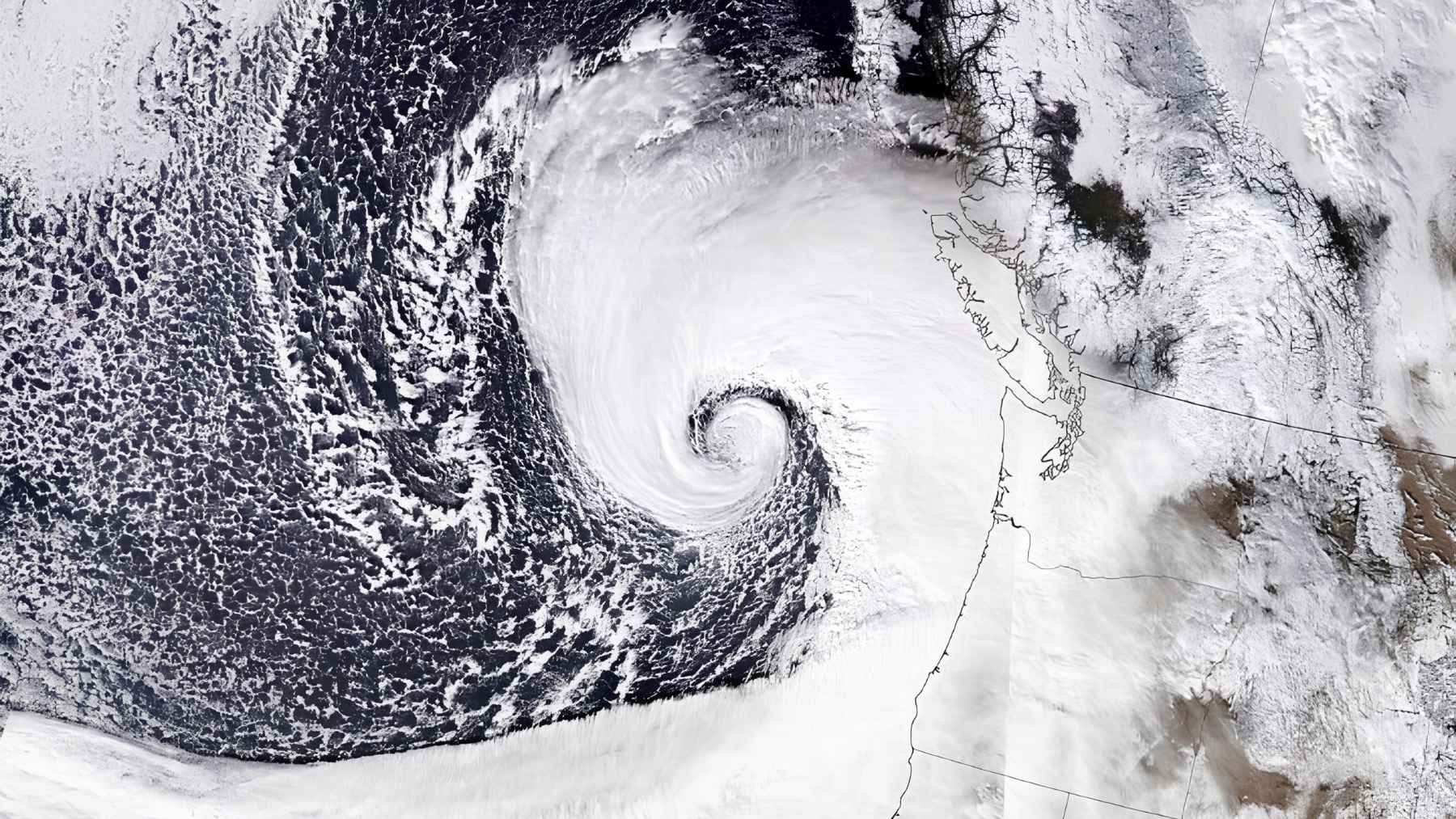
NASA says TACLS was tested on simulations using severe weather events from 2017 through 2023. Those cases included atmospheric rivers, monsoonal convection, and remnants of tropical cyclones, all weather setups that can bring intense rain.
In that testing, the system correctly identified 93% of issued flash-flood warnings. That does not mean every future flood will be predicted perfectly, but it does suggest the tool can recognize many of the same danger signals that lead human forecasters to issue warnings.
That number matters because meteorologists often work under pressure, scanning large volumes of information while storms evolve. Anyone who has watched a weather alert pop up during a commute knows the stakes are not abstract. Traffic jams, flooded underpasses, and fast-moving runoff can turn ordinary routines into emergencies.
Humans still make the call
TACLS has two main parts. The first is the analytic back-end software that processes the satellite data and identifies places where flooding may be more likely.
The second is visualization software called MGViz. It shows the flagged areas in a way that human analysts can review, interpret, and compare with the rest of the weather picture.
That last step is important. A machine can highlight a possible threat, but National Weather Service meteorologists still use their judgment and experience to decide whether a flash flood warning or weather advisory should be issued.
Why Southern California matters
NASA says National Weather Service meteorologists are now working to bring TACLS into existing flash flood forecasting systems in Southern California. That region is a strong test case because it can face intense bursts of rain, atmospheric rivers, burn-scar flooding, and steep terrain where water can move quickly.
A storm does not need to last for days to become dangerous. Sometimes, one hard band of rain over the wrong canyon, road, or neighborhood is enough.
That’s where a tool like TACLS could be useful. By flagging subtle moisture changes that might otherwise be missed, it can help forecasters focus attention before conditions get worse.
Built from space technology
TACLS also owes some of its development to NASA history. The visualization system is based on the Multi-Mission Geographic Information System, a platform originally developed at JPL for NASA’s Mars missions.
That may sound surprising at first. But the same basic challenge appears in both places. Scientists need to take complex location-based data and turn it into something people can understand quickly.
The analytic side also builds on earlier JPL work in anomaly detection and time-series forecasting. In other words, TACLS is not just a weather app with AI sprinkled on top. It is a bundle of Earth science, satellite navigation, data analysis, and human forecasting experience.
Open tools for future forecasts
One of the most promising parts of the project is what happens next. NASA says both the TACLS software and the data used to train it will be open source, allowing researchers to adapt the system or build their own models for different scientific needs.
That could matter beyond Southern California. Flood risk is not limited to one region, and climate-driven extremes are making fast, accurate warnings even more important in many communities.
For now, TACLS is best understood as a decision-support tool. It does not remove uncertainty from the forecast, but it may help meteorologists catch dangerous patterns sooner. Sometimes, that is exactly what people need.
The official statement was published on NASA Science.