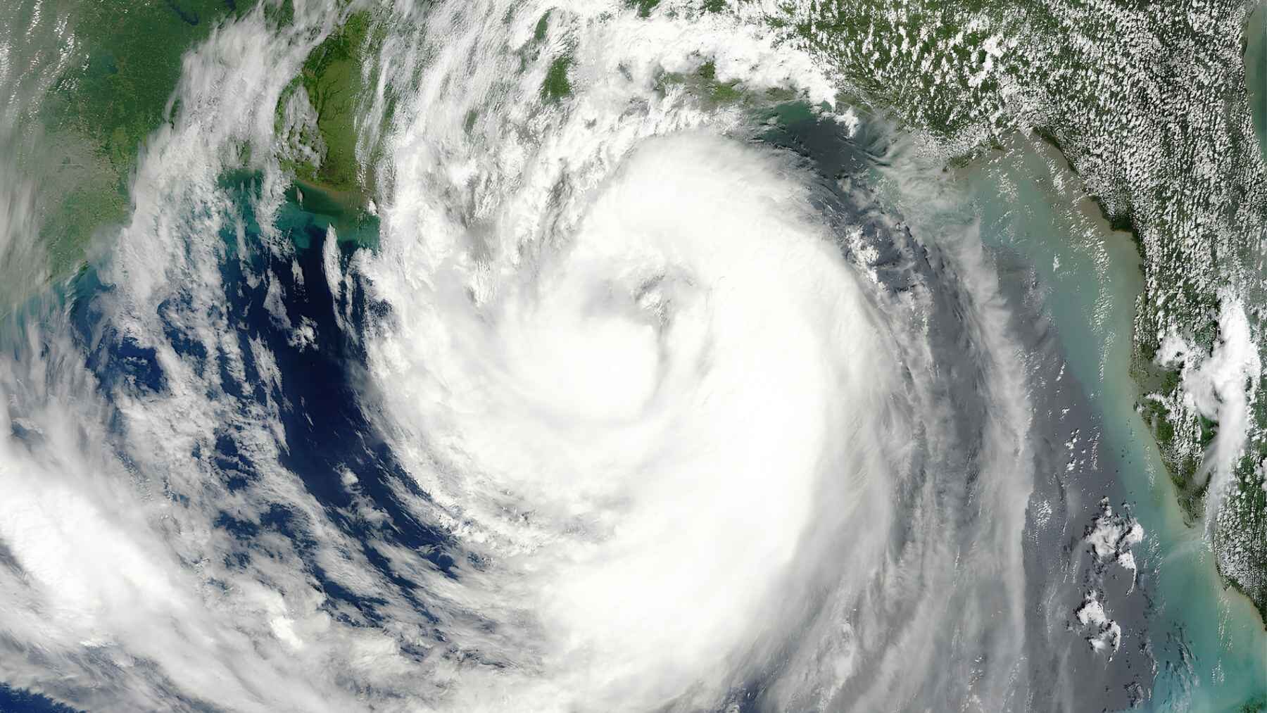
When Hurricane Isaac barreled over Louisiana in 2012, it pressed down on the Earth so hard that sensors built for earthquakes felt the ground flex. Stanford researchers report that these seismic networks could offer a surprising new way to track a hurricane’s shifting intensity near the surface.
The method combines seismometers, which register tiny ground movements, with infrasound microphones that detect pressure waves too low for human ears, so one tracks movement in the ground while the other tracks pressure changes in the air. It is not yet an operational forecasting system, but the study suggests existing geophysical stations could work alongside satellites, radar, buoys, and aircraft.
A storm leaves footprints underground
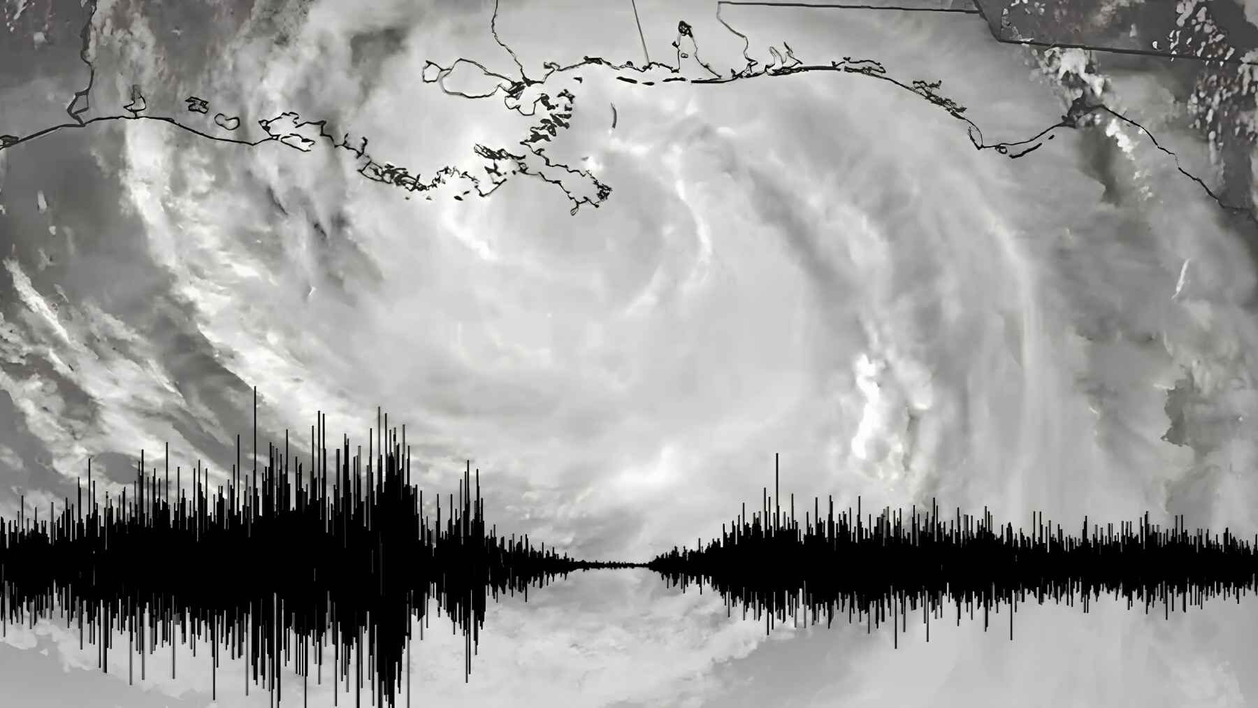
Hurricane winds and pressure changes do more than bend trees and rattle windows. They repeatedly press down on and lift the ground, creating tiny vibrations that sensitive seismometers can record even when people feel nothing.
Infrasound supplies a second view by tracking low-frequency atmospheric pressure fluctuations. Together, the two signals let researchers follow changes in local turbulence instead of treating the storm as one giant wall of noise.
Why the lowest layer matters
Near the surface, wind, heat, and moisture churn through the hurricane boundary layer. This turbulent zone helps control exchanges of energy between the surface and the atmosphere, which is why it indicates so much about storm intensity and behavior.
That is also the layer coastal communities eventually experience directly, with damaging wind, rain, and storm surge arriving at street level. Better observations there could give forecasters a fuller picture during those tense hours when evacuation plans, emergency messages, and infrastructure decisions matter most.
Isaac created a rare experiment
The breakthrough began with a fortunate overlap in August 2012. As luck would have it, Hurricane Isaac, a Category 1 storm at Louisiana landfall, crossed stations equipped with seismometers and infrasound microphones for a National Science Foundation project that was mapping Earth’s interior.
Louisiana had relatively few seismic sensors because the region rarely experiences earthquakes, making the alignment unusual. “We were certainly a bit lucky,” lead author Qing Ji said, and that coincidence created a natural test of whether geophysical instruments could read a hurricane passing overhead.
The eye appeared in the data
The combined records revealed the calm eye moving over some stations, with the much more turbulent eyewall before and after it. When the researchers compared those measurements with conventionally collected boundary-layer observations, the patterns showed strong agreement.
The instruments were responding mostly to turbulence within only a few kilometers of each station, not to a confusing mixture of signals generated across the entire hurricane. That local sensitivity is the key reason the approach may be useful for studying how conditions change along a storm’s path.
The ground moved without anyone noticing
Over roughly 100 seconds, Isaac shifted the ground by only a fraction of a millimeter—a displacement akin to the Earth taking a faint, microscopic breath. Tiny as it was, the motion was comparable to an earthquake too weak for residents to feel, yet large enough for the instruments to detect.
Stronger hurricanes should produce larger signals, according to the Stanford team, but that remains a scientific expectation rather than a finished result. Isaac was one Category 1 case, so testing the method across storms of different strengths, tracks, terrains, and sensor layouts will be essential.
It would complement current tools
The National Oceanic and Atmospheric Administration (NOAA) already watches hurricanes with aircraft, dropsondes, radar, ocean gliders, drifting buoys, and uncrewed vehicles. These systems measure wind, pressure, temperature, humidity, rainfall, ocean conditions, and storm structure, giving forecasters direct information that earthquake sensors cannot replace.
So where would the new technique fit? With future storms, it could add continuous local measurements near equipped land areas, particularly as a storm crosses the coast, and may strengthen the observational picture while hurricane hunters and remote-sensing systems continue doing their specialized jobs.
One network could serve two sciences
The study’s most practical idea is not to build an entirely separate hurricane network. Instead, researchers propose making seismic stations multipurpose by pairing ground-motion instruments with pressure sensors, allowing the same sites to support geophysics and atmospheric science.
“The geophysics data can provide a fuller understanding of big storms,” Ji said. If the approach proves reliable, stations built to look beneath our feet could also help researchers watch the atmosphere above them.
Forecasting benefits remain ahead
The findings show that Hurricane Isaac’s turbulence left measurable seismic and acoustic fingerprints. Promising? Yes, but Stanford says the team now plans to study other hurricanes, so this should still be read as a research advance rather than a ready-to-use operational forecasting system.
Broader validation is needed to determine how quickly forecasters can analyze these measurements and integrate them into existing models before emergency managers or coastal communities can rely on the technique during a real storm.
Listening for the next landfall
Stanford’s team plans to extend the research to other hurricanes, including stronger storms that may generate clearer signals. The real test is whether this unexpected signal can move from a retrospective analysis of Isaac to dependable hurricane science across many different storms.
Hurricanes happen with or without modern-day tracking technology. However, for communities accustomed to boarded windows, flooded roads, and anxious waits for forecast updates, even one additional trustworthy source of storm information could matter.
The study was published in Science.