A historic discovery has just begun to rewrite the geography books. A continent that has lain sunken for years has just come to light – though not to the surface. The most curious thing of all? It has a population of its own and new countries you may never have heard of. It is as curious as this territory that the UN is asking Spain to return and we will never see again.
A continent lost under the sea: the seventh on the planet, and the subject of legends.
There was a time when Oceania, mostly made up of bodies of water and islands, was considered to have emerged from a sunken piece of land. It was between 2020 and 2023 when Zealandia was discovered through satellite measurements, which allowed to draw a spectacular underwater silhouette.
However, Zealandia was identified as a continent in its own right in 2017, after decades of research. It was previously thought to be part of the Australian tectonic plate, but geological studies showed that it has a distinct continental crust.
At 4.9 million km² in area, Zealandia covers 6 % of the planet’s land surface. Despite being mostly submerged, Zealandia is home to two large emerged land masses. These correspond to countries, colonies of European powers (which still exist) and islands.
The location of Zealandia, the lost continent: these are its countries
Zealandia is located in the Pacific Ocean, southeast of Australia. It stretches from New Zealand in the south to New Caledonia in the north, covering an area of some 4.9 million square kilometers. Can you imagine how spectacular its underwater mountains must be?
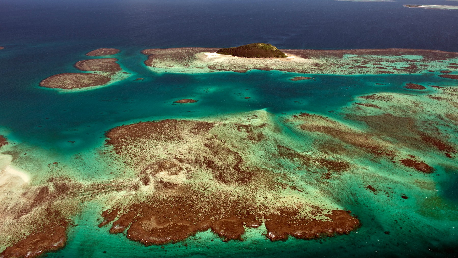
Although most of Zealandia is submerged under the sea, some islands emerge as part of this sunken continent. The main islands are New Zealand, composed of the North and South Islands, as well as the Macquarie, Auckland, Campbell, Antipodes, Chatham, Bounty, Snares, and other smaller islands.
Zealandia is surrounded by the Pacific Ocean and is bordered by the Tasman Sea to the west and the Coral Sea to the north. It is separated from Australia by the Tasman Sea and from the Antarctic continent by the Ross Sea. Its remote location in the southern hemisphere makes it a unique and isolated region.
The origin of this sunken continent is finally revealed: we have known about it since last year.
Zealandia is believed to have formed some 60-85 million years ago as a result of the breakup of Gondwana, the ancient supercontinent that grouped Africa, South America, Antarctica, Australia and India. When Gondwana fractured, Zealandia was isolated.
Then, it began to sink progressively under the ocean due to its lower density with respect to the surrounding oceanic plates. By about 23 million years ago, most of Zealandia was already submerged, with only a few islands and archipelagos remaining emerged.
The sinking continued until it reached its present form, with 94% of its surface under the sea and only New Zealand and New Caledonia visible. Despite being mostly hidden under water, Zealandia maintains its status as a continental landmass.
In terms of relief, Zealandia presents a submerged continental plateau of low altitude, with some submarine ridges and mountains that emerge forming the islands. Of particular note are the Lord Howe Ridge, the Norfolk Ridge and the Challenger Ridge, which contains the deepest point at -10 882 meters.
It is clear that Zealandia is a lost continent, but also enigmatic and beautiful in equal parts: who wouldn’t want to explore its coral-covered atolls, its white sandy beaches blurred with the blue sea or its tropical forests with flora and fauna never seen before in Europe? The most curious thing of all is that it is very close to these territories that Spain lost and will never be able to recover.