The sky over parts of Qatar recently filled with mammatus clouds, the pouch-shaped formations that can make a storm look as if it has turned inside out. The sight drew attention after Qatar Meteorology shared an image from the Al Sidriya area during a period of thunderstorms and unstable weather across the country.
At first glance, they can look unsettling. But meteorologists say the main message is not to panic. Mammatus clouds do not create severe weather by themselves, and they are not proof that a hurricane is coming, although they often appear around active thunderstorm systems.
What Qatar actually saw
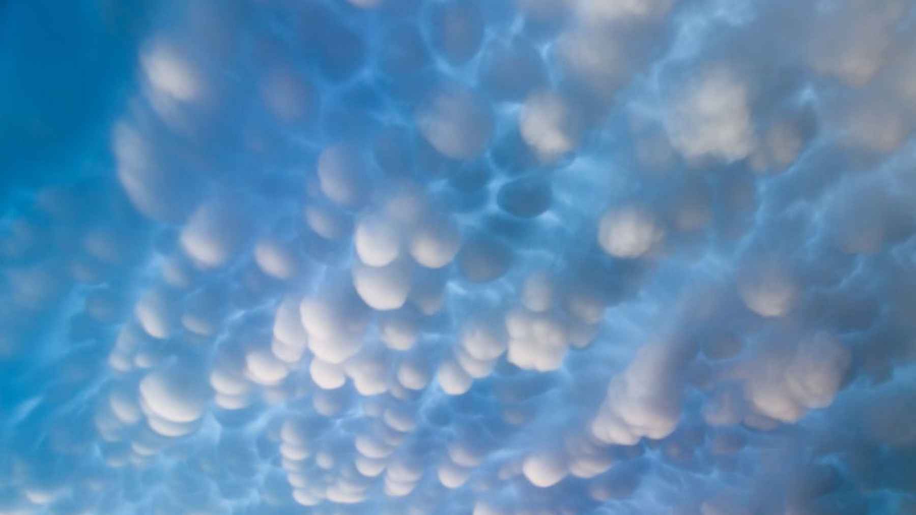
Mammatus clouds are the rounded bulges that hang from the underside of a larger cloud. They often look like rows of bags, bubbles, or soft pouches suspended from the sky.
According to Qatar Meteorology, these clouds are among the most distinctive cloud formations and often appear after the strongest part of a thunderstorm has passed. The agency also noted that they do not pose a danger on their own and are not an indication of hurricanes.
That last point matters. In practical terms, the clouds are not the storm’s weapon. They are more like its fingerprint.
Not a separate cloud
One common misunderstanding is that mammatus is a standalone cloud type. It is not.
The World Meteorological Organization uses the term “mamma” for this feature, describing it as hanging, udder-like protrusions on the underside of a cloud. The feature can occur with several cloud types, including cirrus, altocumulus, altostratus, stratocumulus, and cumulonimbus.
That means the parent cloud matters. When mammatus forms beneath a cumulonimbus cloud –the towering storm cloud linked to thunder, rain, hail, and lightning, the surrounding weather can still be rough. But the pouches themselves are not producing the danger.
 1")
Dramatic mammatus clouds spread across the sky during Qatar’s Al Sarayat storm season, a period linked to strong thunderstorms and shifting air currents.
How the pouches form
Most clouds grow because warm, moist air rises and cools. Mammatus clouds do something that feels almost backwards.
They form when colder air inside the cloud sinks toward a drier layer below. As that air drops, it carries water droplets or ice crystals downward, shaping the rounded lobes that people see from the ground.
Think of it as a storm cloud sagging in places where sinking air is dragging part of its base downward. The result can be beautiful, strange, and a little eerie, especially when sunset light catches the underside of the cloud.
Why they appeared over Qatar
The appearance of mammatus clouds came during Qatar’s seasonal period of unsettled weather known locally as “Al Sarayat.” Abdulla Mohammed Al Mannai, Director of the Meteorology Department, told Qatar News Agency that this period is a normal late-winter and spring phenomenon in the country.
He said Al Sarayat usually begins in the final third of March and can extend until mid-May. It is known for the rapid formation of cumulonimbus clouds, followed by thunderstorms that may bring heavy rain, strong downdrafts, dust, and sometimes hail.
So, the mammatus display was not random. It was a visible sign that the atmosphere over Qatar, or nearby, was busy with strong vertical movement, shifting moisture, and temperature contrasts.
What people should watch for
Here is the part that can feel confusing. Mammatus clouds are not dangerous on their own, but the storms around them can be.
Qatar Meteorology urged people to take caution during the unstable weather because of possible strong downdrafts, reduced visibility in open areas, and hail. The department also said rain intensity during the March 26 to 27 period could range from moderate to heavy.
For anyone driving, camping, or working outdoors, the practical advice is simple. Watch the official forecast, avoid unnecessary trips during active storms, and take shelter when lightning or strong winds approach.
Why the sky can look so dramatic
Mammatus clouds have a way of grabbing attention because they turn a familiar sky into something almost alien. They do not look like ordinary fluffy clouds drifting by on a quiet afternoon.
The Met Office explains that mammatus often forms with large cumulonimbus clouds, especially on the underside of the anvil as air descends. That same storm environment can also bring hail, heavy rain, and lightning nearby.
That is why photos of mammatus clouds can spread quickly online. They look dramatic, but the real story is the atmosphere behind them.
A warning sign, but not the whole warning
So, what should their appearance mean to the public? Not fear, for the most part. Awareness.
If mammatus clouds are overhead, it is reasonable to assume that the cloud system has been active and complex. But experts warn against treating them as a direct forecast of a tornado, hurricane, or disaster.
At the end of the day, they are a clue. The smarter move is to connect that clue with radar, local warnings, and official weather updates rather than relying on the look of the sky alone.
Mammatus clouds and everyday weather
For most people, this is less about cloud classification and more about everyday safety. A stormy sky can affect traffic, outdoor work, school pickups, and visibility on open roads.
That sticky, electric feeling before a storm is familiar in many parts of the world. In Qatar’s case, seasonal instability can build fast, especially during Al Sarayat, when storms may develop over short periods and sweep through with wind, dust, and rain.
Mammatus clouds simply make that hidden movement visible. They show us that the atmosphere is not still, even when we are standing quietly beneath it.
A rare view of storm science
There is something useful about these clouds beyond their beauty. They remind us that weather is not just what falls from the sky, but also what moves inside it.
For scientists and forecasters, formations like mammatus help illustrate how moisture, cold air, sinking motion, and storm structure interact. For the public, they offer a clear takeaway. Look up, be curious, but check the forecast before drawing conclusions.
The official statement was published by Qatar News Agency.