Researchers have found that a 310-mile trench beneath the Atlantic formed when a short-lived plate boundary split a region already weakened by deep mantle heat.
The discovery recasts one of the ocean’s strangest seafloor structures as evidence that deep forces beneath the planet can decide where the crust eventually tears apart.
Hidden trench evidence
Fresh maps and volcanic rocks hauled up during the German research vessel METEOR’s M168 expedition, an oceanographic survey cruise focused on mapping and sampling the region, gave scientists their first detailed cross-section of the whole feature.
Working from GEOMAR Helmholtz Centre for Ocean Research Kiel, marine geologist Dr. Antje Dürkefälden matched those samples to distinct parts of the trench.
Read More: {{post_title link:post}}
“Our results now explain for the first time why this remarkable structure developed precisely at this location,” said Dürkefälden.
Once that contrast appeared, the feature stopped looking uniform and revealed a sequence of events.
Rocks from below
Ages from the main trough clustered between about 45 and 38 million years, while Peake Deep pointed to later activity.
Because the magnetic pattern changed along the structure, the team concluded the opening progressed from east to west.
Younger lava also sat on older crust, showing magma erupted after the seafloor itself had already formed.
That timing ruled out a simple birth at the spreading ridge and pushed the story toward later rifting.
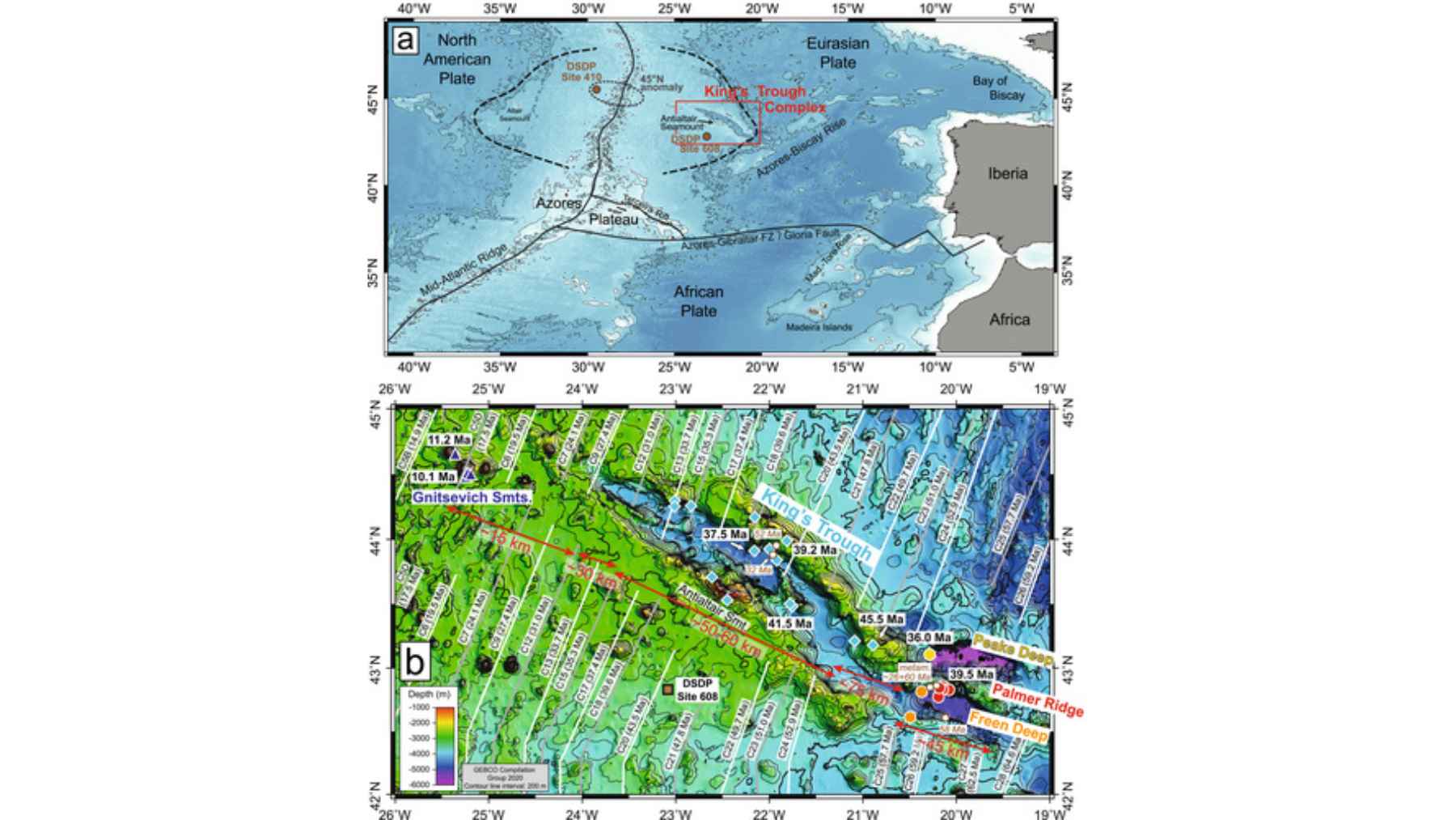
Researchers mapped the King’s Trough complex, revealing how deep mantle heat and shifting plates shaped the Atlantic seafloor.
Heat beneath the crust
Long before the trench opened, the seafloor there had already been built thicker than usual by extra volcanic activity.
The authors traced that excess to a mantle plume, a column of unusually hot rock rising from deep Earth.
Read More: {{post_title link:post}}
Heat from that source would have softened the overlying crust, making it easier to stretch and crack later.
That weakness helps explain why a temporary plate boundary cut through this patch instead of somewhere nearby.
The eastern break
At the eastern end, two narrower basins dropped even deeper, reaching nearly 20,000 feet below the sea surface.
Rocks from those basins lacked the enriched chemistry seen in the main trough and instead resembled ordinary upper mantle material.
That pattern fits decompression melting, where rising rock melts as pressure falls during crustal stretching. Those deepest cuts likely mark the first hard tearing, not the plume-fed stage that came before.
A moving boundary
Researchers place the crucial tectonic change between about 37 and 24 million years ago during a short-lived plate rearrangement.
As the boundary shifted between Europe and Africa, the seafloor opened into a graben, a long block dropped between faults.
The split did not mature into a new spreading center, which means the rift stalled before fresh ocean crust formed.
That stop-start history left King’s Trough as a preserved record of a plate boundary that came and went.
An Azores connection
Chemical signatures in the trough rocks closely matched volcanic material associated with the Azores, a Portuguese island chain in the mid-Atlantic.
That resemblance suggests the heat source beneath King’s Trough was an early branch of the same upwelling.
The Azores Plateau began building about 20 million years ago as the main plume focused farther south.
If that reading holds, the trench captures a moment before the modern Azores system settled into place.
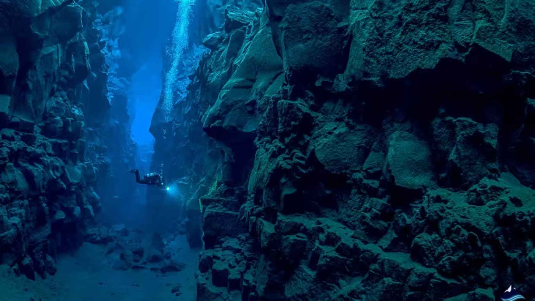
No river made this
Nothing like a river could have carved this feature, because deep ocean floors lack flowing water strong enough to gouge it.
Instead, faulting dropped blocks of crust while nearby ridges and seamounts rose along the broken edges.
Some flanking structures may be tilted shoulders of the rift, while others probably received later magma.
That mixed architecture explains why the trench looks canyon-like from above yet records tectonics, not erosion.
A living comparison
A similar process may still be playing out near the Azores, where the Terceira Rift cuts across thickened seafloor today.
Both regions sit on elevated crust beside the Mid-Atlantic Ridge and both show long, irregular basins rather than neat spreading lines.
That parallel gives geologists a rare before-and-after view of how an oceanic rift begins, stalls, and reshapes itself.
King’s Trough matters partly because it preserves an older stage that active settings usually keep rearranging.
Why ocean maps matter
This result depended on seeing the trench in detail, not as a vague line on a broad seafloor map.
High-resolution depth data showed how the basins, ridges, and seamounts line up, while rock samples supplied ages and chemistry.
Read More: {{post_title link:post}}
Without both kinds of evidence, the trough could still look like a single mystery feature with one cause.
Better ocean mapping will likely rewrite other seafloor stories that have stayed blurry for decades.
What scientists now know
King’s Trough now reads as two linked forces, mantle heat that weakened the crust and tectonic motion that tore it apart.
More samples from the deepest floors could refine the timeline, but this trench already stands as a benchmark for stalled ocean rifts.
The study is published in Geochemistry, Geophysics, Geosystems.