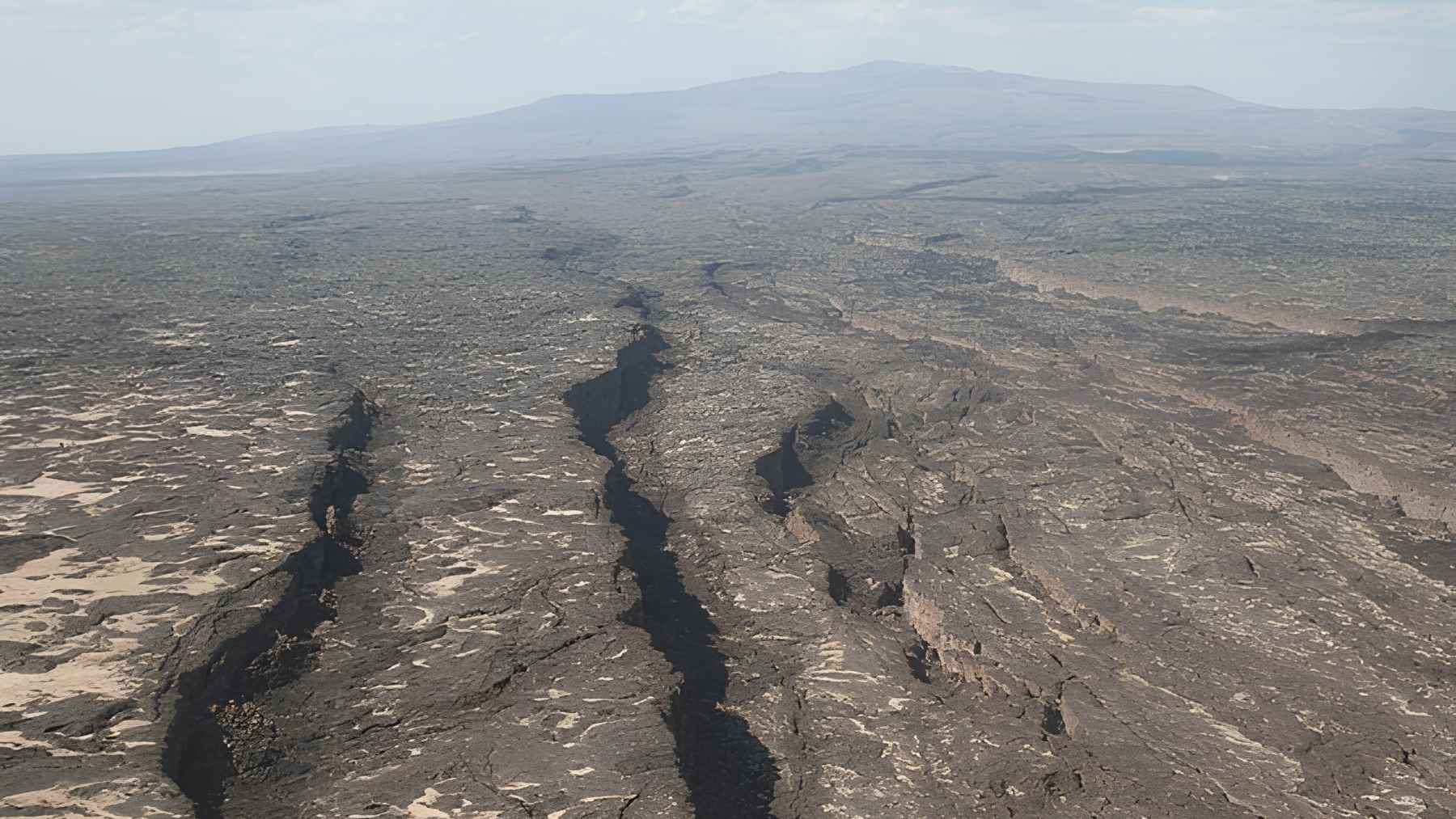
Something unusual happened under Ethiopia’s Afar region between late December 2024 and mid-March 2025. Ground that normally pulls apart at less than an inch a year shifted by nearly 24 inches, a sudden burst in one of Earth’s most important rift zones.
The new analysis, led by Chanel A. Deane at the U.S. Geological Survey, points to a 31-mile-long magma dike between Fentale and Dofen volcanoes rather than a volcano erupting at the surface. The finding matters because it shows how a continent can split not only in slow increments, but also in sharp pulses that jolt roads, wells, and nearby communities.
A rift with a long future
Afar sits at a rare place where the Arabian, Nubian, and Somalian plates meet. The Geological Society describes it as a Y-shaped rift system, where the hard outer shell of Earth is being stretched and split.
Think of a wooden ruler being pulled from both ends. Most of the time, the bend is too subtle to notice; then a crack can jump open when pressure finds a weak spot. Earlier work by Sean Polun and colleagues at the University of Missouri placed this slow tearing in a broader Afar landscape, where rivers and faults record long-term breakup.
That is why the ocean talk keeps coming up. Over geological time, thinner land can sink below sea level, and water from the Red Sea and Gulf of Aden may eventually help form a new ocean basin. This is not a new ocean on today’s map.
The sudden shove underground
So what happened underground? A dike is a steep crack filled with magma, the hot molten rock that can feed volcanoes. In this case, the magma stayed below ground and acted like a wedge.
Researchers found that the dike stretched about 31 miles between the two volcanic centers. As magma entered the crack, it pushed the crust sideways and helped produce surface deformation of up to 24 inches.
Read More: {{post_title link:post}}
The ground, in other words, did not need to spill lava to change. Some of the magma likely cooled in place, adding fresh rock inside the crust and leaving a hidden scar that may become part of a future ocean floor.
Earthquakes told the story
The same event triggered more than 300 earthquakes, with reported magnitudes from 4 to 5.9. The strongest one occurred on February 14, 2025, after weeks of shifting activity along the rift.
For people nearby, this was not just a map of dots. The crisis damaged roads and buildings, opened surface cracks, and pushed authorities into evacuations. The United Nations Office for the Coordination of Humanitarian Affairs reported in January 2025 that about 75,000 people were being evacuated.
Read More: {{post_title link:post}}
That human detail matters. A future ocean sounds like deep time, but rift hazards show up in everyday ways, through cracked pavement, shaken homes, broken supply routes, and sudden worry about where water will flow next.
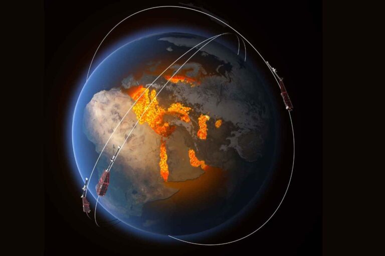
Satellites saw the hidden tear
Scientists used Interferometric Synthetic Aperture Radar (InSAR), a satellite radar method that compares repeated images of the same ground. If the ground rises, sinks, or shifts sideways, the satellite can catch the change even when field teams cannot safely reach the area.
The team also relocated earthquake positions using surface waves, which are seismic vibrations that travel along Earth’s outer layers. That method tightened a messy cloud of earthquake locations into a narrow 31-mile band, matching the visible surface signs and the strongest deformation.
Abdisa Kawo of Mada Walabu University, who was not involved in the study, told Al Jazeera Net that repeated satellite measurements make the roughly 24-inch result “scientifically very reliable.” He also warned that more ground instruments are needed to track magma paths, heat, gases, and water changes over time.
Not a one-time surprise
Ethiopia’s rift has pulsed before. The official paper notes earlier documented intrusions in 2015 and September 2024 near Fentale, but the late 2024 event was larger and more energetic.
Read More: {{post_title link:post}}
A separate 2025 Nature Geoscience study led by Emma J. Watts found that hot mantle material beneath Afar is not uniform. Its chemistry points to an upwelling shaped by the plates above, which helps explain why this region remains so active over long stretches of time.
That does not mean a devastating eruption is now guaranteed. For the most part, the latest findings point to a system that needs closer monitoring, not panic.
Why it matters now
The big story is not that Ethiopia suddenly has an ocean. It does not. The big story is that scientists watched a piece of continental breakup move fast enough to matter within a single season.
This means better hazard maps, better evacuation planning, and stronger monitoring near faults, roads, railways, wells, and towns. At the end of the day, the future ocean is a slow project, but the risks along the way can arrive much faster.
The official study has been published in Geophysical Journal International.