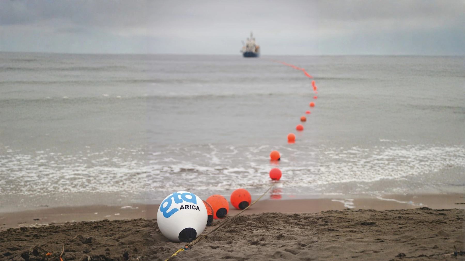
An undersea internet cable network that runs about 2,175 miles (3,500 kilometers) along Chile’s coast is being turned into an earthquake sensor. Universidad Técnica Federico Santa María (USM) announced the deal with the telecom company Gtd on December 29, 2025. The partners will connect a sensing instrument to one fiber of Gtd’s Prat cable and measure along 62 miles (100 kilometers) of it.
According to the university, the aim is to test an early warning system for earthquakes and, eventually, tsunamis. A French and Chilean team already used the same cable to record a magnitude 5.7 quake in November 2021. The newest study asks how fast the fiber can say how big a quake is.
First sensor planned for Concón
Tomás Bärthold, Gtd’s infrastructure strategy manager, signed for the company. Mónica Pacheco, USM’s director general of research, innovation and entrepreneurship, signed for the university. The deal runs for one year and renews automatically, according to the USM announcement.
Marcelo Soto, a professor in USM’s Department of Electronics and a researcher at the AC3E engineering center, leads the team. The first system will go in at the Prat cable’s landing node in Concón. Cartagena, Constitución, Biobío and La Serena could follow.
In Spanish, Soto said the data will feed artificial intelligence tools already built at USM and AC3E “and thus improve the precision in earthquake detection and optimize response times.” He added that the fiber could also track waves, currents and tides. Other projects already test fiber sensing on offshore mooring lines.
For Gtd, the monitoring could also help anticipate possible cuts in the cable. Chile’s Undersecretariat of Telecommunications has publicly backed the project.
Laser pulses inside the glass
The technique is called distributed acoustic sensing, or DAS. An instrument at one end of the fiber fires laser pulses. It then reads the tiny share of light that bounces back from natural impurities in the glass.
A passing seismic wave stretches or squeezes the glass by a minute amount, and the reflected light comes back a hair early or late. In the 2021 Chilean test, those delays were read every 4 meters (13 feet). That spacing shows how the cables that carry most of the internet could double as a ready-made listening network.
Diane Rivet, a seismologist at the Côte d’Azur Observatory and the Géoazur laboratory in France, described the method in 2021. In a University of Chile release, she said one fiber can act as several thousand seismic sensors. The reach goes up to 93 miles (150 kilometers).
The magnitude 5.7 test quake
The Prat cable first proved useful in the Submarine Earthquake Observation Project, known by its Spanish initials as POST. Rivet led it with Géoazur colleagues and Chile’s National Seismological Center (CSN), based at the University of Chile.
On October 27, 2021, the team plugged a DAS unit into one of the cable’s 36 fibers at Concón. It used 93 miles of that fiber as a line of seafloor sensors. On November 3, the cable recorded a magnitude 5.7 earthquake centered about 62 miles from Concón.
According to the University of Chile, it was the first experiment of this kind on a commercial cable. Rivet had earlier detected quakes with DAS in Europe, on cables built only for research.
CSN director Sergio Barrientos said in Spanish that the cable allows “direct observation on the seafloor, being able to be much closer to the seismic source.” Rivet estimated that fiber sensors could gain around 10 seconds, on average, in detecting earthquakes. She put a DAS warning prototype about five years away.
Five seconds to a magnitude
A study published on January 8, 2026, measured how fast these fiber records reveal an earthquake’s size. The team came from Italy’s National Institute of Geophysics and Volcanology, the University of Naples Federico II and Géoazur, with Rivet among the authors.
They analyzed 115 earthquakes, from magnitude 2.5 to 7.4, recorded on about 249 miles (400 kilometers) of seafloor fiber-optic cable off central Chile. Part of the data came from the 2021 survey. The rest came from the ABYSS network, three DAS units installed in September 2023 at Concón and La Serena.
In seafloor sediments, the first pressure wave arrives weak and short, while a converted wave called Ps dominates the early record. Ps forms where the sediments beneath the seafloor meet bedrock. Its peak size tracks the quake’s magnitude, and it does so “within a few seconds from the first arrivals, offering a valuable proxy for rapid magnitude estimation,” the authors write.
To check the method, the team replayed a magnitude 6.4 earthquake left out of the dataset. Five seconds after the first waves arrived, the estimate settled at 6.5, give or take 0.3.
Where the Nazca plate dives
Many of Chile’s largest earthquakes begin offshore, where the Nazca plate slides beneath South America. In a 2022 conference abstract, the POST team counted roughly 7,000 quakes of magnitude 3 or more in Chile each year. About 35 percent sat offshore, and the national network relies on coastal and inland stations plus two island sites, Rapa Nui and Juan Fernández.
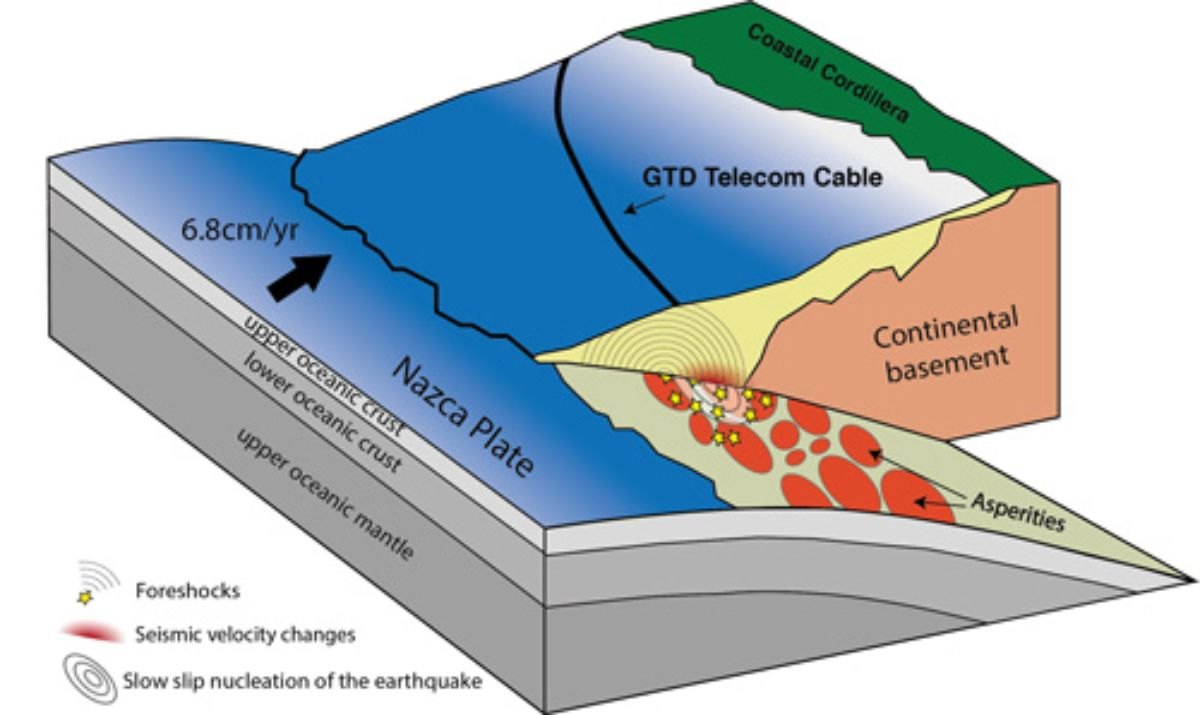
Land stations must wait for those waves to cross the coast, and every warning system has a blind zone. The U.S. Geological Survey explains that the fastest public alerting in Japan takes about 2 to 3 seconds.
With that delay, roughly 15 miles (25 kilometers) around the epicenter cannot be warned. Distant offshore quakes leave more room. During Japan’s magnitude 9.0 Tohoku-oki earthquake in 2011, the east coast had up to 15 seconds of warning, the USGS says.
The agency contrasts that with deadly inland California earthquakes such as Northridge. There, the hardest-hit areas would have received little or no warning.
Public alerts are not live yet
None of this means Chile already has cable-based alerts for the public. The USM agreement covers one 62-mile stretch and a first year of measurements. Linking the results to a unified warning system depends on future deals with government agencies, the university says.
The 2026 study also flags a hard limit, since DAS records saturate in strong shaking. With current settings, the ABYSS cables would saturate on later S waves at about magnitude 4.5 at 19 miles (30 kilometers). The earlier Ps wave holds out to roughly magnitude 6.
Four members of the Millennium Institute of Oceanography attended a DAS workshop at the University of Concepción on September 2 to 4, 2026. They practiced laying fiber in Dichato, aiming long term at monitoring the Atacama Trench. Darinka Pecarevic, a technical professional at the institute, said in Spanish that data analysis with this technology at sea “is still very much in its infancy.”
The full study was published in Communications Earth & Environment.
Photo: USM / Gtd