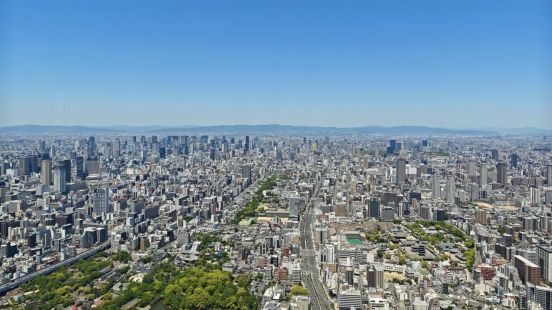
Decades of heavy groundwater pumping dropped parts of Greater Osaka, Japan, by more than 6.5 feet (2 meters). Now some of that land is coming back up, in places by about half an inch (12 millimeters) every year, according to a study published September 30, 2026.
The rise doesn’t come as one smooth sheet, though. It shows up in blocks with sharp edges, and those edges sit right on top of crustal faults that seem to trap water underground.
Forty years of falling wells
Between the 1920s and the 1960s, intensive pumping across the region lowered groundwater levels by as much as 98 feet (30 meters), and the ground sank with them. The textbook name for it is land subsidence.
Japan brought in strict rules on groundwater use in the early 1960s, and by the mid-1970s the ground had mostly stopped dropping. Water levels in the wells have climbed ever since.
Greater Osaka takes in the Osaka Plain and the Kyoto and Nara basins, home to about 15 million people. Beneath them lies a groundwater system of more than 1,160 square miles (3,000 square kilometers).
“Think of a gigantic water balloon beneath the city. When groundwater is pumped out, the ‘balloon’ deflates and the ground sinks,” said Dr. Jesse Kearse, an Earth scientist at Te Herenga Waka–Victoria University of Wellington, in a university statement.
293 radar scenes, 44 wells
Kearse and Saho Fukunishi share first authorship. They worked with Yoshihiro Kaneko of Kyoto University and Sylvain Barbot of the University of Southern California.
The team processed 293 images from Europe’s Sentinel-1 radar satellites, taken between December 2016 and December 2021. Ground stations for satellite navigation, known as GNSS, pinned those readings to a fixed reference. The result was a height-change map with a resolution of about 33 feet (10 meters).
They set that map beside records from 44 monitoring wells, covering 1985 to 2025. The deepest wells reach 1,840 feet (561 meters). Across the region, the satellite map shows an average rise of about 0.16 inch (4 millimeters) a year.
GNSS records in the Osaka Plain go back to 1996. They show the uplift has continued for at least 28 years.
The Uemachi Fault as a dam
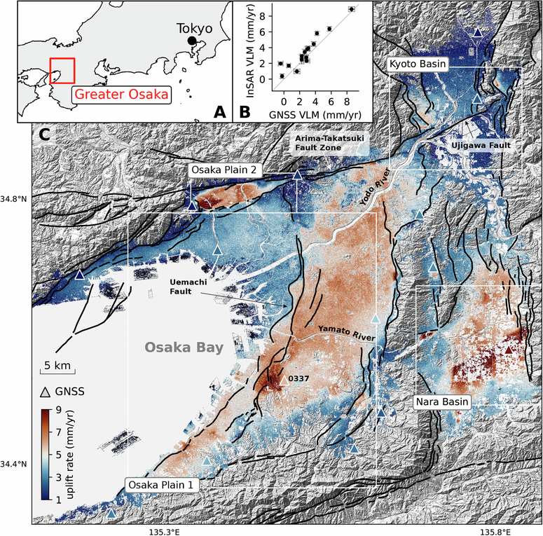
The Uemachi Fault runs north through the Osaka Plain. On the satellite map, it marks a boundary less than 330 feet (100 meters) wide. East of it, the ground rises 6 to 7 millimeters (about 0.25 inch) a year, while the west side gains only 3 to 4 millimeters.
All 31 wells studied in the plain showed rising water over 40 years. Wells on the eastern, upstream side gained about 1 foot (0.3 meter) a year. That is three times the rate recorded to the west.
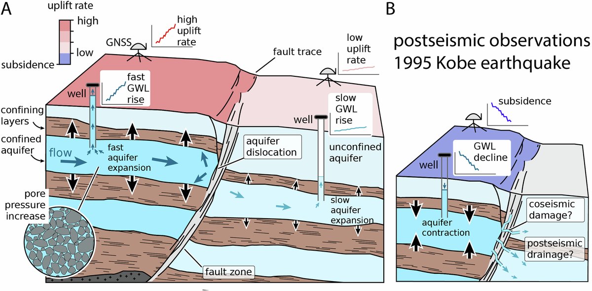
Water flowing toward Osaka Bay piles up behind the fault, so pressure in the aquifer climbs and lifts the ground above. “These faultlines can act like a dam, effectively stopping the flow of water and creating pockets where water builds up,” Kearse said.
In the Kyoto Basin, the Ujigawa Fault shows the same split. Wells on its upstream side rose about 21 inches (0.54 meter) a year. Those to the south barely moved, and some even dropped.
A hidden fault in Nara
In the Nara Basin, uplift peaks at about half an inch a year. There the map shows a straight boundary about 7.5 miles (12 kilometers) long, where no fault had been mapped. The team proposes a buried one, and independent borehole data point to a break at that spot.
Kearse sees a use for that trick in New Zealand, where some major earthquakes struck unknown faults. “Where aquifers and faults coexist, as they do in Christchurch, land uplift could be a proxy to tell us there’s a faultline in the area,” he said.
A wedge of land in the Arima-Takatsuki Fault Zone has its own story. It sank after the 1995 Kobe earthquake. Its groundwater turned upward in 2012, and it now rises up to 0.4 inch (10 millimeters) a year.
Roads across uneven blocks
Pipes, rail lines and streets do not stop at a fault. They can straddle two blocks of land that rise at different speeds. The authors say forecasts for cities refilling their aquifers must account for faults and for patchy uplift.
For coastal cities, sinking land adds to the effect of rising seas. Shanghai, for example, has used water injection to slow its own sinking. Other Chinese coastal cities face seas rising at a rate not seen in 4,000 years.
Kearse also has his own country in mind. “In Aotearoa New Zealand, we know about 80 percent of urban coastlines are sinking and groundwater extraction could be among the contributing factors in some areas,” he said.
Compacted clay stays compacted
Osaka’s rebound is real but partial, and the authors write that much of the early sinking will never be recovered, because the aquifer was permanently compacted. The U.S. Geological Survey explains that compaction can permanently reduce an aquifer system’s capacity to store water.
The study cannot yet say why the faults block water. Crushed rock in the fault core, offset rock layers, or both could be the cause. The models are simple, too, treating each aquifer as if it were the same all the way through. And some of the broad regional rise may simply reflect the earthquake cycle of the Nankai subduction zone offshore.
Not every aquifer is getting that chance, and groundwater losses in basins like the Upper Colorado keep piling up. Osaka shows what the ground does when pumping stops for six decades.
The full study was published in Communications Earth & Environment.
Photo: Loggieloggie / Wikimedia Commons (CC0)