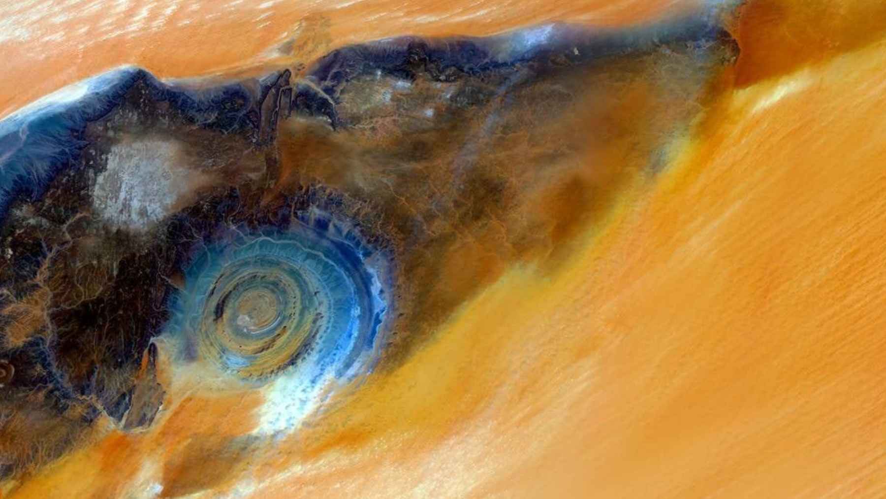
NASA Earth Observatory has spotlighted one of the Sahara’s most recognizable sights, the Richat Structure in Mauritania, often nicknamed the “Eye of the Sahara.” From the International Space Station, it reads like a giant pupil stamped into the sand, complete with concentric rings that seem almost too perfect to be natural.
Here is the twist that matters. NASA says the Eye is not the scar of a meteor impact, but an uplifted geologic dome that erosion gradually etched into ringed ridges, while the surrounding dunes map the winds that keep reshaping the desert.
A bull’s-eye you can see from orbit
NASA describes the Eye as about 25 miles across, though other NASA imagery places the broader feature closer to about 28 to 30 miles depending on the measurement. That slight disagreement is not a red flag, it is a reminder that nature does not come with a ruler.
Read More: {{post_title link:post}}
What is consistent is how it functions as a landmark. NASA notes that astronauts have been drawn to it since the earliest human missions, because the desert around it can look surprisingly featureless from above.
Not a meteor crater after all
The impact theory lingered for a long time for an understandable reason. Big meteors often leave round features, and the Richat Structure is very round, at least at first glance.
But NASA Earth Observatory points to geologic studies showing a different origin, an uplifted dome, also described as a “domed anticline.” Think of rock layers that were once relatively flat being pushed upward into a broad arch, then slowly exposed as the top wore away
In this type of structure, NASA explains that older rocks tend to be exposed toward the center, with younger layers forming rings farther out. That is the kind of clue you do not get from an impact crater, and it helps explain why geologists read the Eye as a product of Earth’s own internal forces.
How erosion turned rock into rings
Once the dome was exposed, differential erosion did the rest. NASA says different rock types erode at different rates, leaving circular ridges called “cuestas” where more resistant layers stand their ground.
The colors in the astronaut photo are not just pretty, they are informative. NASA notes that shifts in tone reflect different sedimentary and igneous rocks both inside the structure and in the wider landscape.
Dunes that reveal the wind
The Eye is surrounded by expansive dune fields, and NASA’s description gets surprisingly specific. Longitudinal (linear) dunes dominate parts of the view, while transverse dunes appear where sand builds up perpendicular to the wind direction.
Read More: {{post_title link:post}}
An older NASA Earth Observatory view makes the same point in a different way, describing dune fields that end abruptly near cliffs where wind funnels around rock and sweeps some areas clean. In other spots, isolated peaks trap and redirect sand, leaving streaks that extend downwind.
Ever watched dust collect in the corner of a garage, no matter how many times you sweep? Multiply that by a few dozen miles, add a steady wind, and you are not far off.
Why NASA’s photo matters beyond geology
The image at the center of this story was captured from the ISS on July 10, 2020, using a Nikon D5 digital camera, according to NASA. The agency also notes that the photo was cropped and enhanced to improve contrast and remove lens artifacts, which makes the patterns easier to interpret.
Read More: {{post_title link:post}}
That detail is easy to skim, but it matters for how Earth science gets done. Astronaut photography and satellite data are often used together to spot changes, compare seasons, and pick out subtle surface features that would be hard to map from the ground.
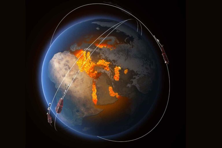
The Sahara is a global player, not just a backdrop
The same winds that sculpt dunes can loft enormous amounts of dust into the atmosphere. NASA Earth Observatory notes that dust storms can create breathing problems and poor visibility when particles concentrate near the ground, even as the dust can have benefits when it disperses over long distances.
NOAA describes the Saharan Air Layer as a mass of very dry, dusty air that forms over the Sahara from late spring through early fall and can travel thousands of miles, which is why satellites track it. When it reaches the United States, NOAA says it can cause hazy skies along with vivid sunrises and sunsets, and it can also influence tropical cyclone development.
On the ecological side, NASA research has estimated that winds and weather pick up an average of 182 million tons of Saharan dust each year, with about 27.7 million tons falling over the Amazon basin and delivering roughly 22,000 tons of phosphorus annually. NASA Earth Observatory has also highlighted research linking dust deposition to ocean productivity, including an estimate that dust supports about 4.5 percent of yearly global export production and as much as 20 percent to 40 percent in some regions.
What to keep in mind next time you see the “Eye”
The Richat Structure is a great example of why “looks like” can be misleading in science. A shape that resembles an impact crater can actually be a slow, layered story of uplift, rock chemistry, and erosion.
Read More: {{post_title link:post}}
It is also a reminder that deserts are active systems, not empty ones. The dunes around the Eye are a snapshot of wind in motion, and the dust those winds lift can affect air quality, weather, forests, and even ocean food webs far from Africa.
The official statement was published on “NASA Earth Observatory,” where NASA explains the Eye’s origins and the dunes around it.