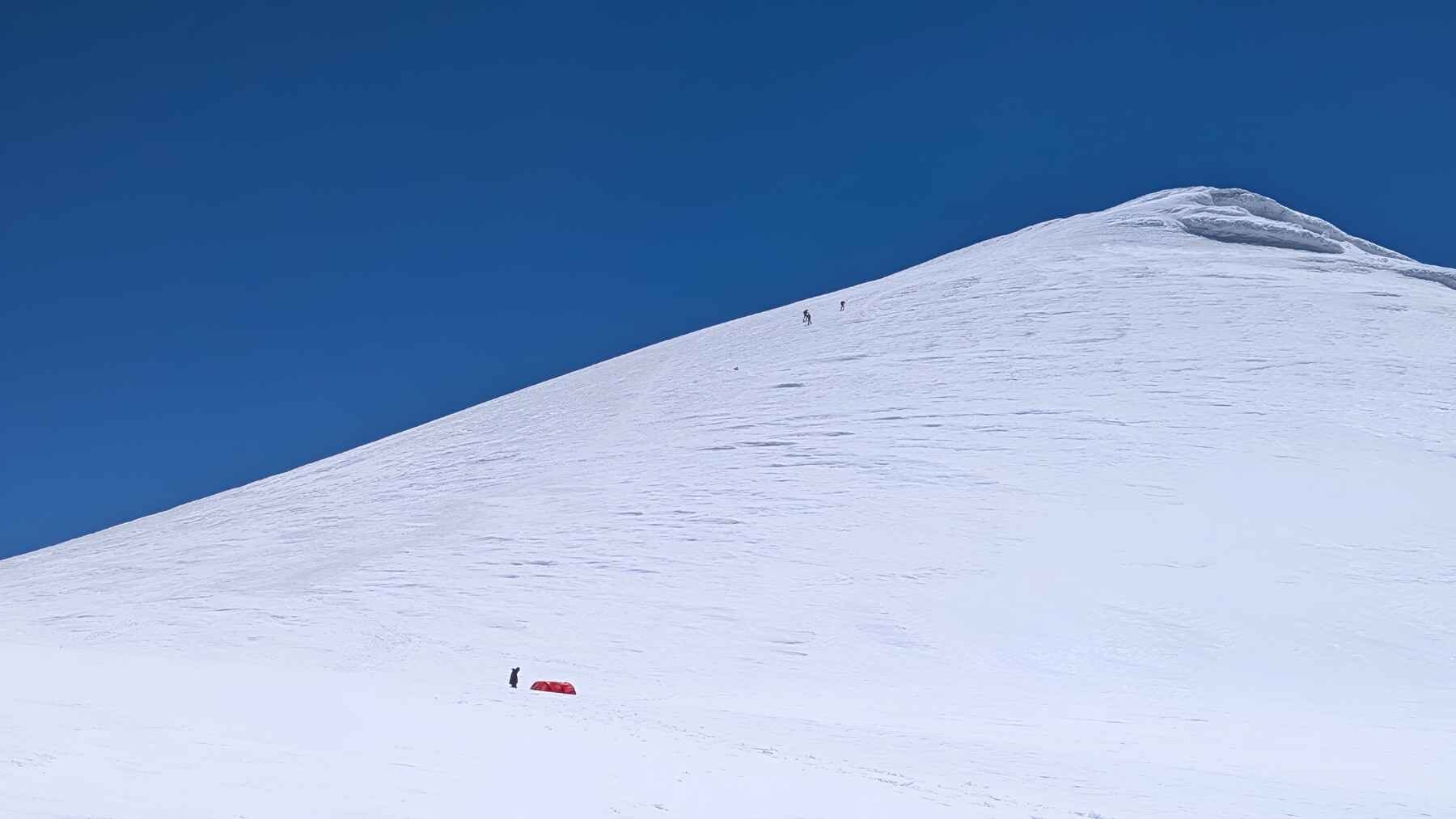
More than 16,000 feet above sea level an expedition of german-turkish scientists climbed the Mount Ararat in east Turkey to measure what is hidden under all the ice before it’s too late. Layer after layer of snow that accumulated over millennia created a glacier: a continuous frozen record that could explain how thousands of years of human activity may connect with regional climate shifts.
Knowing that the objective of the mission was to race against time in order to identify and catalog all that history before the glacier disappears. Together the team completed an impressive task: the first detailed geophysical survey of Mount Ararat’s summit ice, a blueprint to understand what history the mountain is trying to tell. The two-week expedition that took place in July 2026 mapped the terrain to identify the ideal spots to drill and retrieve the mountain’s first ice core.
A map before the drill
Through wind, freezing conditions and thin air they worked. At the elevations of above 5 thousand meters nature is at it’s harshest, pushing the limits of human endurance. First they combined ground-based radio echo sounding with seismic measurements to determine ice thickness and map what was underneath.
Then with those measurements in hand they were able to determine the best drilling location. Alfred Wegener Institute geophysicist Coen Hofstede said, “Now we can determine where to drill the longest continuous ice core.”
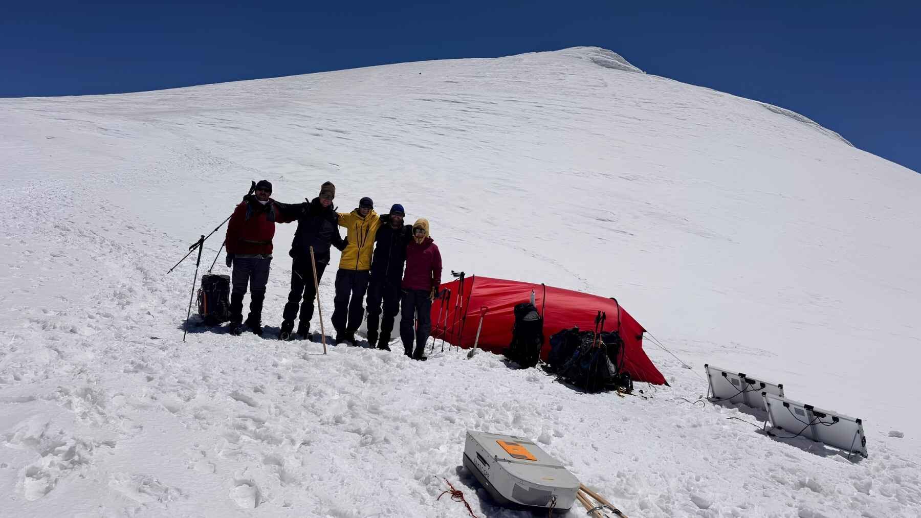
That said no core has been recovered yet! Things have to be done gradually due to how harsh the conditions are but the next expedition must determine whether the historical archive is deep and continuous.
The ice is already retreating
A peer-reviewed study found that Ararat’s glacier area declined by 1.48 miles between 1976 and 2014. Anyone that knows math would already be alarmed, but translating that even further sounds even worse: 30% of it has been lost. That is roughly the size of 445 American football fields. Researchers also reported a spring warming trend of about 32,09º Fahrenheit per year.
The same study also found that faster ice loss from the 1990’s onward and reduced winter snow cover at higher elevations. 32,09ºF alone may not sound like much, but when added up through many years it shows an alarming rate.
Climate history layer by layer
Airborne dust, volcanic material and other particles can land on fresh snow and get trapped as new layers accumulate. That matters because the snow that falls and becomes the layer contains those particles that also carry the history of what humans were throwing in the atmosphere during that specific period of time. If we could analyze that history and gather those pieces of information that are laying there much could be understood. An Arat ice core could therefore preserve information about ancient atmospheres, dust transport and eruptions.
With that in mind the scientists have high hopes. Periods of time like the Roman Climate Optimum and the Late Antique Little Ice Age most likely influenced the glacier and their footprints could be stored in the core. Since the area isn’t as studied and targeted as the Alps different data could be gathered.
An archaeological archive in the sky
Mount Ararat towers over a big area near Anatolia, Mesopotamia and the Caucasus, regions that are closely connected with the earliest discoveries of development of agriculture, mining and metallurgy.
The ice could even contain metal particles from ancient smelting or residues associated with early farming, that would be the dream to the researchers. Project leader Achim Lichtenberger said it may preserve “a continuous chronicle of human activity”, although nothing can be confirmed until a core or many cores have been recovered and analyzed.
With possible evidence much more could be understood and unveiled about the archaeology of the area. Frozen particles that tell histories could change how we understand the human timeline.
What the next expedition must prove
With the results of the July survey in hand the scientists already know where the drilling should begin, but they still need to determine the age, continuity and condition of the ice. It’s a delicate process that involves many factors, that curiously enough is potentiated by the shrinkage of the ice cap.
If successful, the project would produce Mount Ararat’s first ice core and potentially reveal a new environmental record of the whole wider region, bringing up a whole new chain of events. On one side if the melting has made the ice too shallow or disrupted parts of that timeline may already be gone, but on the other side it has made it more accessible to the researchers.
For decades satellite observations have shown from afar that Ararat’s glacier is retreating. It’s time for the scientists to take a closer look before the archive disappears.
The official statement was published by the University of Münster.