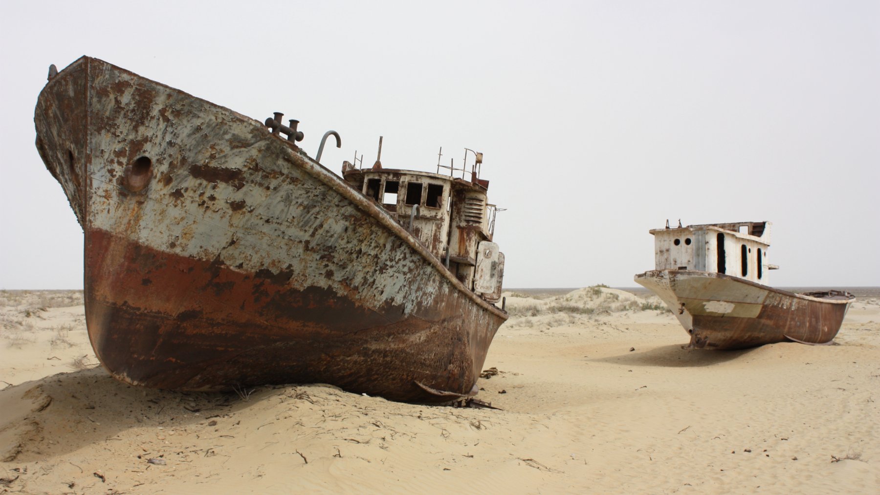
A fishing boat stranded in sand looks like something a storm might leave behind. At Moynaq, in western Uzbekistan, the ship graveyard tells a different story, one of rivers diverted for agriculture and an enormous lake shrinking away from its former port. These rusting hulls mark the retreat of the Aral Sea.
But the story is not simply about water disappearing. Kazakhstan has revived part of the northern lake, while Uzbekistan is planting hardy vegetation across the exposed southern lakebed to reduce damaging dust storms. Recovery here has two very different meanings, bringing water back in one place and making dry land safer in another.
How cotton fields drained a giant lake
Despite its name, the Aral Sea was a lake between Kazakhstan and Uzbekistan, once the fourth-largest on Earth. Its main water supplies came from the Amu Darya and Syr Darya, rivers fed by precipitation and snowmelt in Central Asia’s mountains.
In the 1960s, Soviet authorities diverted those rivers to irrigate farmland, including cotton fields. Agriculture expanded, but the lake lost the inflows that sustained it. By 2000, NASA’s satellite record showed separate northern and southern basins, with the southern basin itself divided into eastern and western sections.
The summer an entire basin dried up
In August 2014, NASA’s Terra satellite recorded the South Aral’s eastern basin completely dry. The imagery captured an especially dramatic moment in a longer decline, not the disappearance of every remaining part of the Aral Sea.
“This is the first time the eastern basin has completely dried in modern times,” geographer Philip Micklin told NASA’s Earth Observatory. He considered it likely the first complete drying in 600 years and attributed the event to reduced mountain rain and snow alongside continued irrigation withdrawals. Water levels in that shallow basin had already fluctuated sharply between wetter and drier years.
The missing water left an expensive problem
What replaced the water? The Aralkum, a desert covering roughly 60,000 square kilometers, or 23,000 square miles, contains salt and residues from agricultural runoff. Winds lift contaminated particles from the exposed lakebed and carry them into surrounding communities and farmland.
A December 2024 World Bank feature estimated annual losses from sand and dust storms in Karakalpakstan alone at $44.2 million, about 2.1% of the region’s economic output. Without action, it warned, cumulative losses over 20 years could exceed $844 million. The damage includes degraded soils, disrupted livelihoods and poorer air quality, making this much more than a distant landscape change.
An island lost its protective barrier
The retreat also exposed a troubling Soviet legacy at Vozrozhdeniye Island. According to the Nuclear Threat Initiative’s historical account, the island hosted open-air biological weapons testing, including agents associated with anthrax and plague, and became a burial site for anthrax stocks.
NASA documented the disappearance of the channel separating the island from the mainland by summer 2001. That loss of isolation heightened concerns about access to the former testing ground. A U.S.-Uzbek agreement later that year authorized work aimed at destroying residual viable anthrax spores in burial pits and dismantling laboratory facilities.
The northern lake showed recovery was possible
Kazakhstan completed the roughly eight-mile Kok-Aral Dam in 2005 with World Bank support. By retaining water in the northern basin rather than allowing it to drain south, the project gave that smaller body of water a chance to recover.
In its 2014 account, the World Bank reported that northern water volume had increased 68% by 2008. It also reported salinity cut in half and fish production more than tripled, alongside the return of residents to fishing and other income-generating work. Those gains were substantial, but they represented a northern recovery, not restoration of the entire sea.
Planting a different future on the lakebed
On Uzbekistan’s exposed lakebed, the response has focused on plants such as saxaul, a desert-tolerant shrub that helps hold loose soil in place. Mongabay reported in May 2024 that planting efforts had covered about 1.7 million hectares, or 4.2 million acres, over the preceding five years.
Survival is another matter. Forestry researcher Turaxon Ziyotov told Mongabay that wetter conditions could produce survival rates of 50% to 70%, while low rainfall could bring that figure down to around 30%. Planting a vast area does not automatically create a lasting forest.
The contrast suggests that environmental recovery need not mean rebuilding exactly what was lost. For communities around the Aral, cleaner air can matter alongside getting fishing boats back onto water.
The official feature examining these landscape-restoration efforts was published on the World Bank website.