As Lake Mead plunges to a record low of 1,040 ft., the receding reservoir has fully exposed the ghost town of St. Thomas, Nevada—a settlement drowned in 1938 that now stands as a stark marker of the Colorado River’s deepening water crisis. According to Bureau of Reclamation data, the reservoir holds just 6.96 million acre-feet of water, or roughly 27% of its capacity.
St. Thomas is not a newly discovered city, and it did not vanish all at once in 1935. Lake Mead began filling that year, but the final resident left in 1938, and visitors can now walk among foundations that once lay about 60 ft. underwater.
A desert town before the lake
Mormon settlers founded St. Thomas in 1865 near the Muddy and Virgin rivers, where irrigated land supported crops and trade in an unforgiving desert. The place was not empty before their arrival, since Ancestral Puebloan and Basket-Maker communities had already lived in the wider area.
After many of the first settlers left during a dispute over Nevada taxes, newcomers rebuilt the community and its population eventually reached about 500. St. Thomas had a school, post office, stores, a church, a soda fountain and automobile garages, but no indoor plumbing or electricity.
How Hoover Dam erased it
The Boulder Canyon Project Act of 1928 authorized construction of Hoover Dam, and the rising reservoir behind it began spreading into nearby valleys in 1935. Residents were reimbursed for their property, dismantled homes and gradually left as the water moved closer.
On June 11, 1938, Hugh Lord rowed away from his house as the last citizen to leave St. Thomas. At Lake Mead’s high-water mark, the town sat about 60 feet beneath the surface, with ordinary streets and gathering places sealed under the reservoir.
The lake gives it back
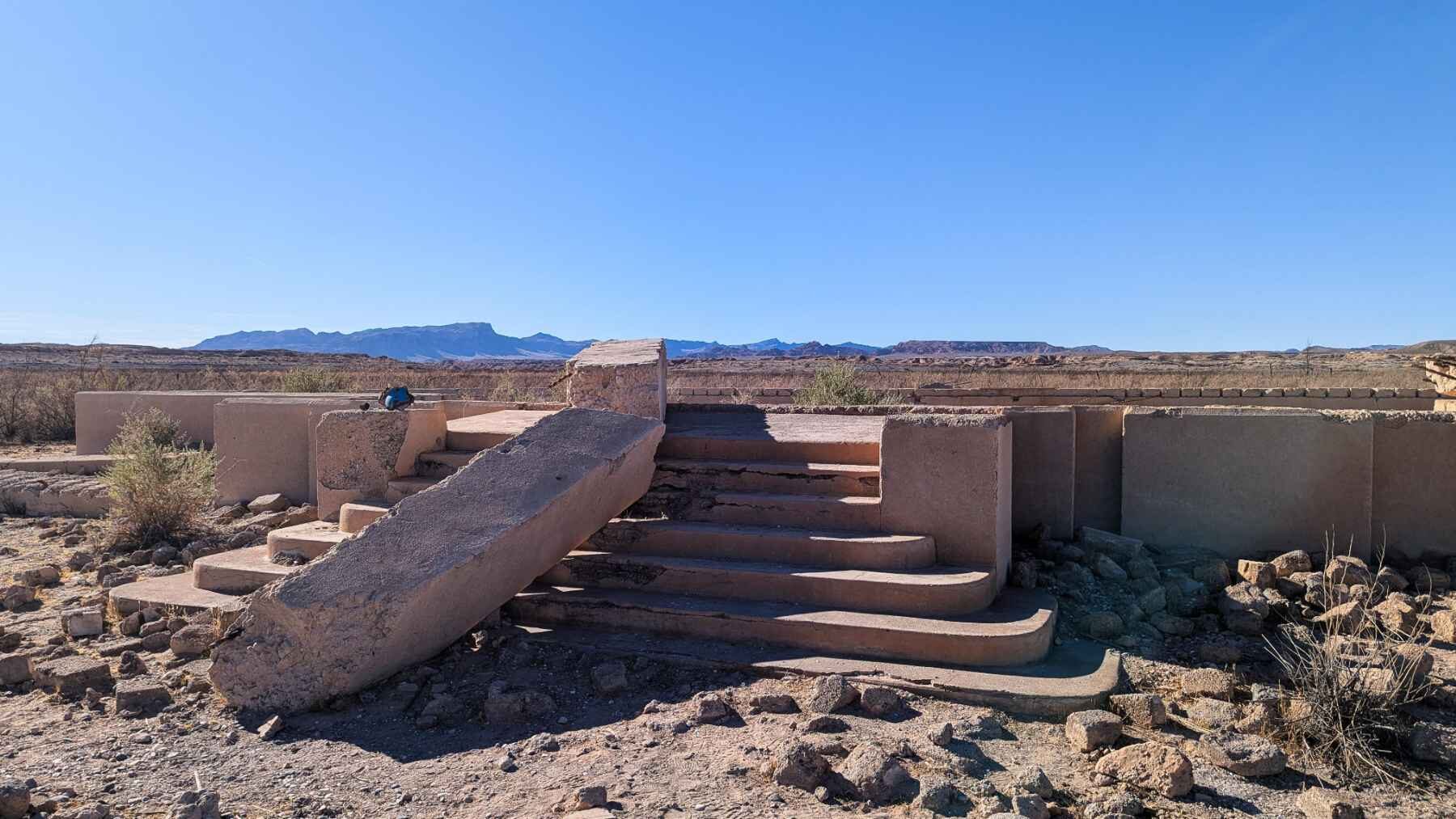
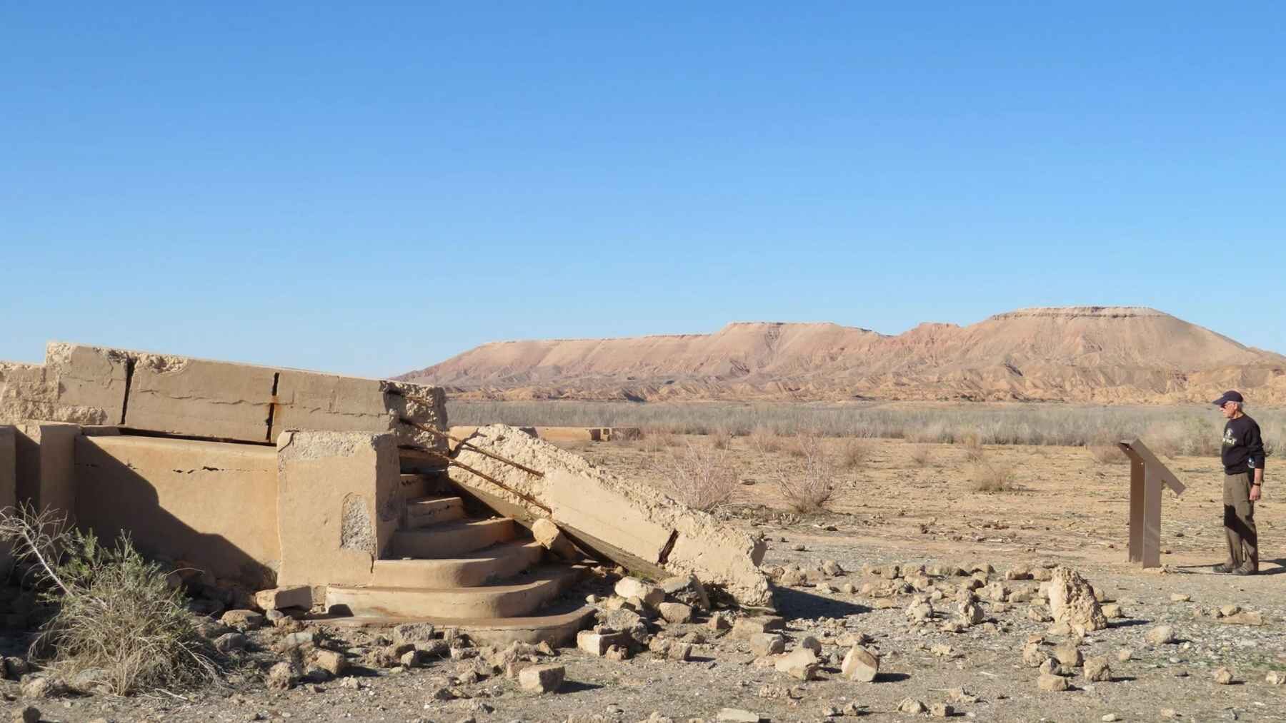
Fluctuating water levels later uncovered the site, and the National Park Service now describes St. Thomas as a place where visitors can roam the remains of an authentic Western town. What survives is not a perfectly preserved city, but a scatter of foundations, partial walls, glass fragments and street patterns that let the old layout come back into focus.
That makes St. Thomas more than a curious ghost town. A reservoir elevation on a federal chart can feel distant, but a school foundation emerging from dust turns water loss into something almost anyone can picture.
Lake Mead’s new low
The reservoir first broke its July 2022 record in early August 2026, when its elevation fell below 1,040.58 feet. Reclamation’s preliminary daily table then recorded 1,039.70 feet on August 14, while the August 17 storage figure of 6.962 million acre-feet worked out to about 27 percent of the listed available capacity.
The decline may continue. Reclamation’s August 3 hydrologic update projected an elevation of 1,037.31 feet at the end of 2026, although forecasts can change with releases, conservation, precipitation and inflows from the rest of the Colorado River system.
Hoover Dam’s shrinking power margin
The current lake level is only about five feet above an important hydropower threshold at 1,035 feet. Reclamation estimates that Hoover Dam’s generating capacity at that elevation would drop from 1,274 MW to 382 MW. At that low level, only five specialized wide-head turbines could operate without suffering cavitation—the collapse of shock-producing vapor bubbles that pit and erode metal turbine blades.
This does not mean the powerplant is about to shut down. Its minimum power pool is listed at 950 ft., but the federal analysis makes clear that output and economic performance deteriorate long before the reservoir reaches that point, which is why Reclamation announced a $52 million investment that includes replacing up to three older turbines with wide-head models.
Walking through the warning
The St. Thomas trail is a 2.5-mile round trip on an unmaintained route with uneven rock, sand and little relief from the desert heat. There is no drinking water at the trailhead, and the National Park Service warns visitors not to move artifacts, climb on foundations or leave graffiti.
Those rules matter because the exposed ruins are both an archaeological site and a record of choices about land and water. St. Thomas first grew because water made settlement possible, then disappeared because a dam stored that water elsewhere, and now the shrinking reservoir is bringing its outline back.
What St. Thomas tells us
The town does not explain every cause of the Colorado River crisis, nor does its reappearance provide a solution. Still, it gives the crisis a human scale, with concrete steps, broken walls and former streets standing where deep water once covered them.
The ruins are quiet, but their message is not.
The latest report was published by the Bureau of Reclamation.