Roughly 300 holes surrounding a shipwreck off Queensland, Australia, are offering a striking lesson in underwater detective work. Researchers suspect marine animals helped shape these depressions, creating a pattern that could guide searches for other sunken vessels. The clue is the disturbed seabed extending well beyond the wreck itself.
The observations came during a September 2026 voyage aboard Investigator, operated by Australia’s national science agency, CSIRO. Twenty Australian university students joined the CAPSTAN training expedition from Brisbane to Fiji, taking part in shipwreck surveys that connected marine biology with maritime history.
A ring of holes around Althea II
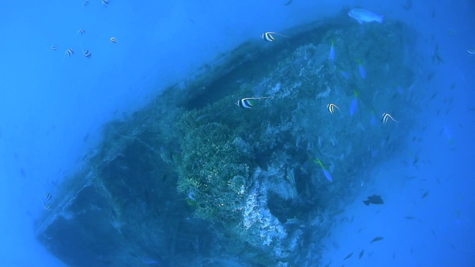
The team was mapping Althea II, an already known dive wreck resting about 131 feet (40 meters) below the surface near Bundaberg. Around it, they identified approximately 300 depressions, typically 26 feet (8 meters) wide and 6.6 feet (2 meters) deep. These are substantial hollows, wide enough to span several parked cars.
Lara Picton, a geology honors student at Queensland University of Technology, reported that the holes extended roughly 328 feet (100 meters) from the wreck in every direction. Against an otherwise flat seafloor, their nearly circular arrangement stood out clearly. A camera lowered from the ship revealed abundant marine life, strengthening the team’s suspicion that animals were involved.
How marine animals reshape the seabed
The proposed explanation is bioturbation, the movement and mixing of sediment by living organisms. Fish and crustaceans disturb the bottom while searching for food, digging, or making sheltered places to rest. What looks like an ordinary feeding routine can gradually reshape an animal’s surroundings.
Maddison Cross, a marine biology doctoral candidate at the University of the Sunshine Coast, described that influence in CSIRO’s account. “The organisms responsible act as ecosystem engineers and can dramatically alter the shape of the seafloor,” she said. The camera observations support this explanation, although they do not establish exactly how each depression formed.
Why predatory fish are leading suspects
Cross reported seeing goldspotted rockcod repeatedly using some of the holes. The team suspects large predatory fish may help create these spaces and use them for shelter or to ambush prey attracted to the wreck. According to Fishes of Australia, goldspotted rockcod feed mostly on small crabs and fish, consistent with that proposed role.
But why are the holes so similar? Cross suggested their repeated use might produce dimensions that suit the animals living there, while a separate gap immediately around the wreck might reflect the danger posed by resident predators. Both ideas remain explanations to investigate, rather than settled findings about the animals’ behavior.
The clue that helped solve a 74-year mystery
For CSIRO voyage manager Ben Arthur, the pattern recalled the 2017 search for SS Macumba. Japanese aircraft sank the merchant ship off northern Australia on August 6, 1943, and its resting place remained unknown for 74 years. CSIRO’s original discovery announcement describes a search lasting about 10 hours before sonar located the wreck.
In the newer account, Arthur recalled a biologist noticing circular depressions near the search boundary as time was running out. The suggestion that they might indicate a nearby underwater structure prompted an acoustic technician to request a wider turn, taking Investigator over the wreck. That experience shows how interpreting the surrounding habitat can help a search team decide where to look next.
Shipwrecks become busy underwater neighborhoods
A wreck provides structure and shelter, drawing small fish and crustaceans that can attract larger predators. This concentration of life helps explain why fishing communities sometimes know about promising sites before researchers identify the vessel below. For the animals, the wreck is part of their daily surroundings, with places to hide and opportunities to feed.
Local knowledge and underwater imaging have already contributed to other identifications. In 2023, researchers confirmed MV Blythe Star off Tasmania after investigating a location previously pinpointed by fishing vessels and seafloor surveys. A separate collaboration confirmed MV Noongah off New South Wales in 2024 using mapping and video from a site reported by members of the public.
A bigger footprint to search for
The practical promise is that animal activity may make a wreck’s surroundings easier to recognize across a much larger area. That could give researchers additional targets to investigate with sonar and cameras, although the Althea II observations do not establish how reliably this approach would work elsewhere. A suggestive pattern still needs checking.
Finding these sites also matters beyond identifying a ship, since surveys can help heritage specialists assess its condition and potential environmental risks such as leaking fuel. The official account of the Althea II observations was published on CSIRO on September 22, 2026.
Photo: CSIRO