The 2026 Atlantic hurricane season entered November with 10 named storms, according to the National Hurricane Center’s storm archive. Only one of them became a hurricane. A full season averages 14 named storms, 7 hurricanes and 3 major hurricanes, based on 1991-2020 data.
That storm, Isaias, reached Category 3 strength over the Gulf of America. It made landfall near Destin, Florida, on the evening of October 9, and the season officially runs until November 30.
Ten names from Arthur to Josephine
The season has used ten names so far. In order, they are Arthur, Bertha, Cristobal, Dolly, Edouard, Fay, Gonzalo, Hanna, Isaias and Josephine.
All but Isaias peaked as tropical or subtropical storms, and Josephine was classified as a subtropical storm.
On average, the eighth named storm of a season forms by September 9, according to the hurricane center’s climatology page. This year, the first advisory on Hanna, the eighth name, came on September 28, nearly three weeks later.
The center’s outlook on October 30 said that tropical cyclone formation was not expected during the next seven days. No storms were active in the Atlantic, the Caribbean Sea or the Gulf of America on that date.
A forecast that held below normal
NOAA’s outlook of May 21, 2026, gave a 55 percent chance of a below-normal season. It put the odds of a near-normal year at 35 percent and of an above-normal one at 10 percent.
The May forecast called for 8 to 14 named storms, 3 to 6 hurricanes and 1 to 3 major hurricanes. “It only takes one storm to make for a very bad season,” said Ken Graham, director of the National Weather Service, in the NOAA release.
The Climate Prediction Center raised the odds of a below-normal season to 75 percent in its August 6 update. It lowered the ranges to 7 to 13 named storms, 2 to 6 hurricanes and 0 to 2 major hurricanes.
By the end of October, the named storm count sat inside the August range. With a single hurricane, the season stood below the low end of NOAA’s forecast for hurricanes.
Forecasters are also testing new ways to read storms, from seismometers paired with infrasound microphones to AI models that flag rapid intensification.
Isaias at 120 mph
The hurricane center began issuing advisories on the system that became Isaias on October 6. By 4 a.m. local time on October 8, its advisories called the storm Hurricane Isaias, with maximum sustained winds of 80 mph (130 km/h).
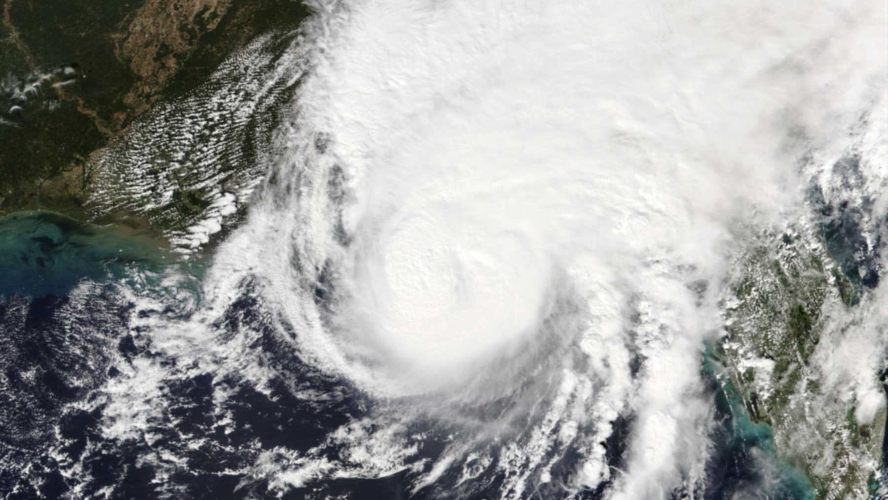
Over the Gulf, the storm kept strengthening through the next day. At 10 a.m. local time on October 9, the center reported 120 mph (195 km/h) winds and a pressure of 959 millibars. “Isaias is a category 3 hurricane on the Saffir-Simpson Hurricane Wind Scale,” the advisory stated.
That made Isaias the season’s only major hurricane so far. Every storm before it, from Arthur to Hanna, stayed at tropical storm strength, according to the hurricane center archive.
Landfall near Destin, Florida
Isaias made landfall near Destin at about 8:30 p.m. local time on October 9. It carried maximum sustained winds of 105 mph (165 km/h) and a pressure of 971 millibars, the hurricane center said in a landfall update.
At landfall, the center was about 40 miles east of Pensacola, moving north at 19 mph.
The same update reported a 116 mph gust at a WeatherFlow station near Santa Rosa Sound. A NOAA tide gauge in Panama City Beach measured water 5.6 feet above mean higher high water. The advisory warned of life-threatening storm surge along the Gulf Coast.
Coastal wetlands help absorb surges like that one, and 84 percent of US coastal wetlands are not keeping pace with rising seas, which leaves that buffer weaker.
Final storm reports still pending
The hurricane center has not yet published its final tropical cyclone reports for 2026. Those reports usually arrive months after a season ends and can revise peak winds, pressures and landfall categories.
The advisories do not state the category at landfall. Its 105 mph winds fall in the Category 2 range of the Saffir-Simpson scale. The official classification will come with the final report.
Season totals for damage, deaths and accumulated cyclone energy circulate in industry and media estimates. None of them has an official NOAA figure yet, so this article does not use them. A storm forming before November 30 would also change the count.
The figures come from the National Hurricane Center’s 2026 storm archive, its Isaias advisories and NOAA’s outlooks of May 21 and August 6, consulted on October 30, 2026.
Image: NOAA-21 VIIRS imagery of Hurricane Isaias on October 9, 2026, via NASA Worldview