King tides hit the West Coast over Thanksgiving week: Caltrans is closing a Bay Area tunnel for five days, Washington is canceling ferry runs, and NOAA predicts about 7 feet in San Francisco
King tides reach the West Coast this Thanksgiving week, closing the Posey Tube in the Bay Area and canceling some Washington ferry runs.

· 4 min read
King tides, the highest predicted tides of the year, reach the West Coast this Thanksgiving week, and transportation agencies are already responding. Caltrans is closing the Posey Tube between Alameda and Oakland from 8 p.m. Sunday, November twenty-second, until 5 p.m. Friday, November twenty-seventh, as a precaution. The agency wants to avoid flood damage that could force an even longer shutdown. In Washington, state ferries have canceled at least one evening round trip each day on the Port Townsend to Coupeville route through November twenty-seventh. NOAA predicts San Francisco's highest water at about seven feet on November twenty-fifth, and Los Angeles at about seven point two feet. Those predictions leave out storm surge and El Niño, so actual levels could run higher. The California Coastal Commission asks people to photograph the tides safely, to show how sea level rise is changing the shoreline.
Key points
- King tides
- Posey Tube closure
- Washington State Ferries
- NOAA tide predictions
King tides, the highest predicted tides of the year, arrive on the West Coast this Thanksgiving week. In California and Washington, transportation agencies are already closing a tunnel, canceling ferry sailings and warning travelers.
Caltrans is shutting the Posey Tube, a road tunnel to Oakland, from Sunday night until Friday afternoon. In Washington, the state ferry system has canceled evening sailings on one route all week because of big tidal swings.
The tides peak around November 24 to 26 along the California coast, according to the California Coastal Commission. The agency wants residents to photograph them, to help show how sea level rise is changing the shoreline.
How high the water will get
King tide is a popular, non-scientific term for exceptionally high tides, NOAA explains. Higher than normal tides typically occur around a new or full moon, when the moon is closest to Earth, or in certain seasons.
NOAA's tide predictions put the week's highest water in San Francisco at about 7.0 feet on November 25. The prediction is for about 10:50 a.m. at the station near the Golden Gate. It is measured above mean lower low water, a reference level based on the lower of each day's two low tides.
Los Angeles is forecast to reach about 7.2 feet that morning and La Jolla, near San Diego, about 7.0 feet, NOAA's tide tables show. Farther north, Seattle's predicted high is about 12.7 feet on November 27.
The Coastal Commission notes that these astronomical predictions leave out storm surge and El Niño. Actual water levels can end up higher.
A Bay Area tunnel shuts down
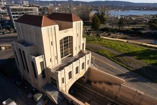
The Posey Tube carries State Route 260 between Alameda and Oakland. Caltrans is closing it from 8 p.m. on Sunday, November 22, through 5 p.m. on Friday, November 27, as a precautionary measure, according to the City of Alameda.
The closure covers drivers, cyclists and pedestrians alike, the city says. El Niño conditions combined with king tides raise the risk of flooding. Caltrans wants to avoid damage that could require extensive repairs and an even longer shutdown.
The nearby Webster Tube stays open, and detours run over the Park Street, Fruitvale Avenue and High Street bridges. The schedule may change with the weather and the tides. Caltrans will watch the peak period of November 24 to 26, and more closures are possible.
The city ties part of the flood risk to El Niño. NOAA has said the 2026 El Niño is already the second strongest on record.
Ferry riders in Washington
Washington State Ferries expects more than 300,000 riders from November 25 through November 29, according to the Washington State Department of Transportation.
On the Port Townsend to Coupeville route, at least one round trip is canceled each evening through Friday, November 27. Large tidal swings and strong currents near the Coupeville terminal are the reason for the cancellations, the department says.
Very low tides are also a problem, because they make the loading ramps too steep. Vehicle restrictions apply on both Vashon Island routes through November 29, and other routes could get them if conditions warrant.
The department suggests that travelers reserve a vehicle spot and sail early in the morning or late at night. It also recommends walking or biking on board when possible.
The busiest crossings should be westbound on November 25 and 26 and in both directions on Friday, November 27. Eastbound traffic is expected to peak over the weekend that follows.
Photos for a rising sea
The California King Tides Project lists three statewide windows: November 24 to 26, December 23 to 25 and January 21 to 22. Parts of Northern California may see extra days.
The commission uses the photos to understand how these tides affect the coast. They also show how sea level rise is changing the shoreline. Its question is simple: what will the coast look like when today's king tides become everyday high tides?
The dates are picked from the highest predicted astronomical tides in the state, based on the positions of the Earth, moon and sun. Very high tides also occur in June and July, but the project focuses on winter tides that come in daylight.
Stay safe near the water
The commission is urging extra caution this year because scientists expect a historically strong El Niño. Kelvin waves, which temporarily raise sea level, are also expected. Together they can push water above the predictions.
Coastal communities may see more frequent storms, heavy rain and high waves, with risks that include landslides and flooding. People should only go out for photos if they can do so safely, the commission says. It also asks them to follow all closures and warnings.
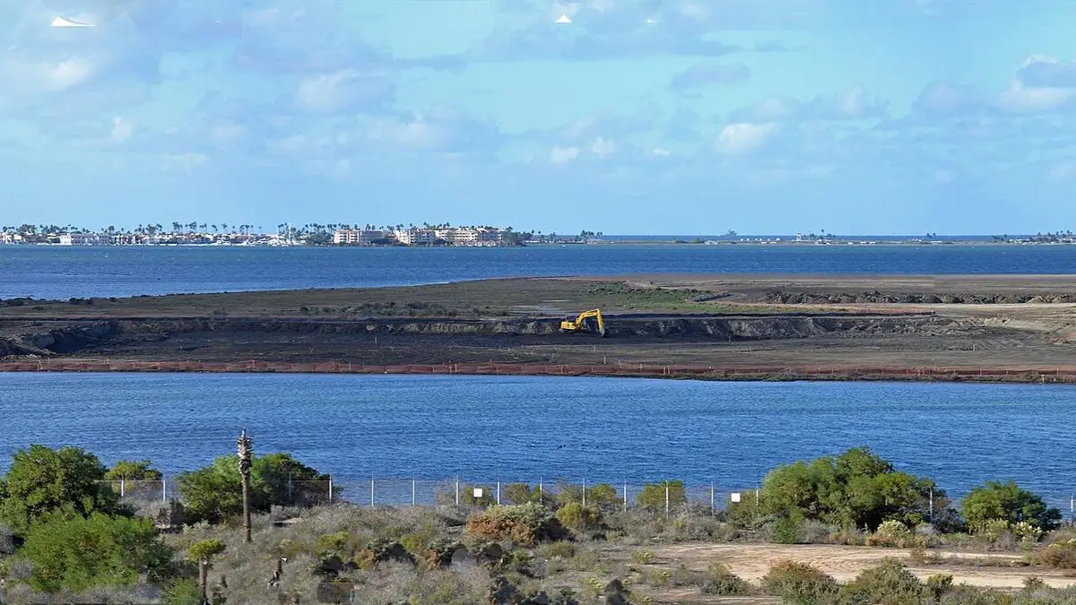
Photo: L. Cox/USFWS
Glossary for this story
- Sea level rise
- The rise in average ocean height caused by melting ice and by seawater expanding as it warms.
- NOAA
- The National Oceanic and Atmospheric Administration: the U.S. agency that tracks weather, climate, oceans and fisheries.
- Storm surge
- An abnormal rise in sea level pushed ashore by a storm's winds and low pressure. It can cause severe coastal flooding, especially when it coincides with high tide.
- El Niño
- A natural pattern in the tropical Pacific: El Niño warms its waters and La Niña cools them, and both shift weather around much of the world for months.
Adrian Villellas
Writer at ECOnewsAdrián Villellas is a computer engineer and entrepreneur in the fields of digital marketing and advertising technology. He has led projects in data analysis, sustainable advertising, and solutions for new audiences. He also contributes to scientific initiatives related to astronomy and space observation. He writes for science, technology, and environmental media outlets, where he makes complex topics and innovative advances accessible to a broad audience.
More from Adrian VillellasComments · 0
Rules ›No comments yet. Be the first to share your view.