The earthquakes most people notice are the ones that rattle dishes and set off phone alerts. But a new study suggests the tiniest quakes, the ones you never feel, may be some of the most useful for understanding Northern California’s earthquake risks.
By tracking swarms of low-frequency earthquakes deep offshore, scientists found signs of hidden, moving structures beneath the Mendocino Triple Junction, where the San Andreas fault system meets the Cascadia subduction zone.
The research points to at least five moving pieces at depth, not just the three tectonic plates usually shown on maps, and that could shift how seismic hazard is estimated in this region.
The triple junction
The Mendocino Triple Junction sits off the coast of Humboldt County, at the meeting point of three major tectonic plates. Tectonic plates are giant slabs of Earth’s outer shell, and they move slowly all the time, even when the ground feels quiet.
Read More: {{post_title link:post}}
To the south, the Pacific plate slides roughly northwest past the North American plate, helping form the San Andreas fault system. To the north, the Gorda plate heads northeast and sinks beneath North America.
That sinking is subduction, and it happens when one plate dives under another and descends into Earth’s hot interior. Subduction zones can store stress for a long time, then release it in huge earthquakes, which is why this stretch of coastline keeps scientists on edge.
Tiny quakes, big clues
The new work focuses on low-frequency earthquakes, which are small events with a softer, lower-pitched signal than typical quakes. They often arrive in clusters called swarms, and those swarms can act like breadcrumbs that trace where rocks are slipping far below the surface.
To find them, the team used a network of seismometers across the Pacific Northwest. Seismometers are sensitive instruments that can capture motions thousands of times weaker than anything a person could feel.
Coauthor Robert Skoumal helped analyze how these tiny signals line up with the movement of the plates. An official summary of the study is available at USGS, along with the technical description of how the signals were interpreted.
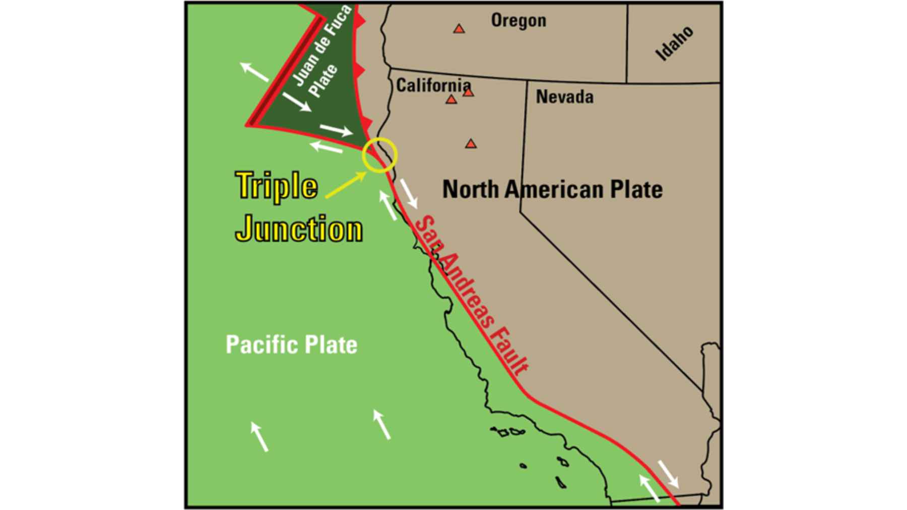
Tectonic map highlights the Mendocino Triple Junction, where three plates meet and hidden fault systems are now being uncovered.
The Sun and Moon test
The researchers did not just count earthquakes and draw lines on a map. They also checked their model using tidal forces, the same gravitational pull from the Sun and Moon that drives ocean tides.
Those forces also stretch and squeeze solid rock by a small amount, including the buried plate boundaries. When that tug lines up with the direction a plate tends to move, the study found that more low-frequency earthquakes tend to occur.
Amanda Thomas, a professor of earth and planetary sciences at the University of California, Davis, framed the practical reason for doing this work, saying, “If we don’t understand the underlying tectonic processes, it’s hard to predict the seismic hazard.”
It is a reminder that even tiny quakes can feed into the decisions that shape building design and emergency planning.
Hidden pieces at depth
So what did the team’s model add that older maps left out? It suggests that two important moving pieces are buried out of sight, meaning they cannot be traced by surface cracks or obvious landforms.
David Shelly, a research geophysicist at the U.S. Geological Survey, compared the problem to an iceberg, saying, “You can see a bit at the surface, but you have to figure out what is the configuration underneath.” Low-frequency earthquakes are part of how scientists do that, because they tend to happen where rocks are sliding, rubbing, or overlapping.
Read More: {{post_title link:post}}
One buried feature appears to be a chunk that broke off the North American plate near the southern end of the Cascadia subduction zone and is being pulled down with the sinking Gorda plate. Another is the Pioneer fragment, a block of rock being dragged under North America as the Pacific plate moves north, along a boundary described as almost horizontal.
Why 1992 still matters
The Mendocino region is not just a theory problem. In 1992, a magnitude 7.2 earthquake struck in this general area and occurred shallower than many scientists expected, a mismatch that has lingered in the background of hazard discussions.
The new model offers a possible explanation, because it places the subducting surface shallower than previously thought in this part of the system. In simple terms, if the sliding boundary sits closer to the surface, it can change where damaging shaking might start.
Kathryn Materna, a geophysicist at the University of Colorado Boulder, summed up the surprise, saying, “It had been assumed that faults follow the leading edge of the subducting slab, but this example deviates from that. The plate boundary seems not to be where we thought it was.” That is a big statement, because a mislocated boundary can mean a misread risk.
What changes for risk estimates
This study does not predict when the next major earthquake will happen. Instead, it sharpens the deep geometry that hazard models rely on, using tiny quakes as markers of motion underground.
It also suggests an older plate fragment from the long-gone Farallon system may be moving north beneath North America, extending the deep plate interface fault, the surface where two plates press together and slide.
Read More: {{post_title link:post}}
That idea challenges some explanations for how the triple junction opened up at depth, including the concept of a slab window, a gap left when a subducting plate breaks.
Scientists have wrestled with triple junction behavior for decades, starting with a foundational 1969 paper on how these three-way boundaries evolve, available at nature, and a later synthesis of the Mendocino region in 2004 in the Annual Review of Earth and Planetary Sciences.
The project was funded through a grant from the National Science Foundation, and the next step is testing this deep map against future data, the kind that quietly accumulates while daily life goes on.
The main study has been published in Science.