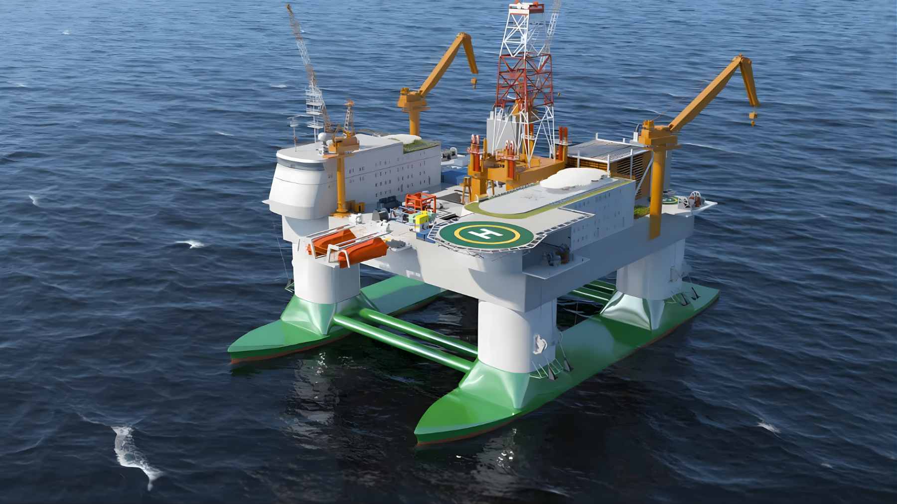
China has launched what it describes as the world’s first ultra-large deep-sea floating research platform in Shanghai, built to support work from marine ecosystems to advanced offshore equipment.
The platform is designed for full-ocean-depth exploration down to about 32,800 feet (roughly 6.2 miles), a range that reaches into parts of the sea we rarely study up close.
But the debut comes with a shadow. Days earlier, a Reuters investigation detailed years of Chinese seabed mapping across the Pacific, Indian, and Arctic oceans, activity naval experts say could also help prepare for undersea conflict.
Read More: {{post_title link:post}}
That overlap between science and strategy matters for the environment, because trust and transparency are the glue that holds ocean research together.
A floating island designed for six-mile depths
The new facility is being developed by Shanghai Jiao Tong University and uses a semi-submersible twin-hull design, a configuration known for stability in rough water. In plain terms, it is meant to act like a long-stay laboratory that can travel to remote seas and then hold steady for extended research.
Reports describe a displacement of about 86,000 U.S. tons (78,000 metric tons) and living space for up to 238 people for roughly four months without resupply. Chinese coverage says the overall project is expected to be completed around 2030.
One detail has drawn attention well beyond oceanography. A South China Morning Post report cited a peer-reviewed project paper that discussed nuclear blast protection for critical compartments and described “metamaterial” sandwich panels meant to absorb shock waves.
What deep-ocean research can do for climate and coastlines
The stakes are enormous because the ocean is doing much of the heavy lifting in climate change. The IPCC says it has taken up more than 90% of the excess heat in the climate system and between 20 and 30% of human-caused carbon dioxide emissions since the 1980s.
Chinese reporting around the platform says improved typhoon forecasting is one of the expected benefits, along with stronger disaster prevention and mitigation.
That is the kind of promise that hits home when a storm track shifts overnight and your phone starts buzzing with warnings, or when the power goes out in sticky summer heat.
Read More: {{post_title link:post}}
There is also a basic science gap this could help close. NOAA notes the ocean covers about 70% of Earth’s surface, yet much of the seafloor still is not mapped in detail using modern methods, and the deep seafloor makes up a huge share of the planet’s habitable space.
Seafloor mapping is not just about minerals or fish
Reuters tracked more than five years of activity by 42 research vessels and reported survey patterns consistent with systematic seabed mapping in strategically important areas. It highlighted repeated missions by the Dong Fang Hong 3 near Taiwan and the U.S. territory of Guam during 2024 and 2025.
So why does bathymetry make defense officials nervous? In congressional testimony cited by Reuters, Rear Admiral Mike Brookes of the U.S. Office of Naval Intelligence said expanded surveying provides data that “enables submarine navigation, concealment, and positioning of seabed sensors or weapons.”
Beijing says its ocean expeditions serve civilian goals, including mineral exploration, fisheries, and climate research, and Reuters noted some surveying does cover fishing grounds and mineral prospecting contracts. Still, the same investigation described concerns about “civil-military fusion” and the dual-use value of hydrographic and sensor data.
Deep-sea mining tests could outpace environmental safeguards
Chinese coverage says the floating platform is intended as an open-sea testing ground for deep-sea mining systems, critical marine equipment, and offshore oil and gas facilities. Testing matters because it is often the bridge between lab prototypes and commercial-scale operations.
Globally, the rules are still catching up. The International Seabed Authority’s (ISA) draft exploitation regulations remain under negotiation, and its public materials indicate commercial exploitation has not yet been approved while regulations are developed.
Meanwhile, the environmental science is full of caveats. A 2025 review in Frontiers in Marine Science summarized recurring concerns such as direct habitat destruction, sediment plumes, and underwater noise, while noting major gaps in baseline data for many deep-sea ecosystems.
If those plumes rise into the water column, the ripple effects could eventually touch fisheries and the seafood aisle, not just the seafloor.
What transparency would look like in practice
None of this means new ocean infrastructure is automatically a bad thing. It does mean the credibility of big projects will depend on what gets shared, what stays classified, and how environmental claims are verified by independent scientists.
Read More: {{post_title link:post}}
In practical terms, that can include publishing baseline biodiversity surveys, making environmental monitoring data open by default where possible, and documenting equipment trials so impacts can be compared over time.
It also means using peer-reviewed channels and international processes, especially as deep-sea mining regulations are still being negotiated at the ISA.
For readers, the takeaway is simple. Better ocean forecasts can protect lives and reduce damage, but ocean science works best when it is trusted across borders.
The official report was published on CGTN.