The San Andreas Fault has always had a way of grabbing attention. Movies imagine highways splitting open and cities shaking in seconds, but the real warning from a new study is quieter, slower, and in many ways more useful.
Researchers report that tectonic stress along the San Andreas and San Jacinto fault systems in Southern California has reached, and in some places passed, the highest levels seen in the past 1,000 years.
That does not mean an earthquake has been predicted for tomorrow, but it does mean scientists are watching a heavily loaded system that runs near millions of people.
A fault under pressure
A fault is a crack or zone of broken rock where parts of Earth’s crust move past each other. Stress builds when those blocks get stuck, a bit like pushing on a door that will not open until it suddenly gives way.
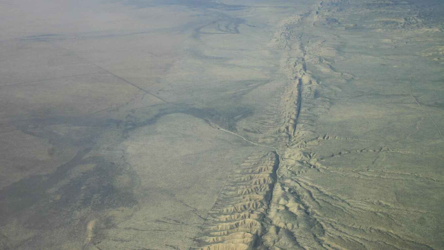
The San Andreas Fault marks the boundary between the Pacific Plate and the North American Plate in California. According to the U.S. Geological Survey, the full San Andreas system is more than 800 miles long and reaches at least 10 miles deep in the Earth.
That movement is slow, but it never really stops. The Pacific Plate moves northwest compared with the North American Plate at about 1.8 inches per year, roughly the speed fingernails grow.

A 1,000-year look back
To understand today’s risk, the team built a physics-based computer model of how stress has built up and been released since about the year 1100. The model used clues from radiocarbon dating, which estimates the age of old organic material, along with tree-ring evidence and records of past ground ruptures.
Liliane Burkhard, a research affiliate at the University of Hawaiʻi at Mānoa and a scientist at the University of Bern, led the work with Bridget R. Smith-Konter, Katherine M. Scharer, and David T. Sandwell. The wider research effort also involved scientists connected to the U.S. Geological Survey and the University of California, San Diego.
The numbers are striking. By 2025, the model placed one key San Jacinto section at about 522 pounds per square inch of stress, while a nearby San Andreas section reached about 406 pounds per square inch. In plain English, several sections appear to be loaded beyond the levels seen before major past ruptures in the model.
Why Cajon Pass matters
The study puts special attention on Cajon Pass, northeast of Los Angeles, where the San Andreas and San Jacinto systems come close together. Researchers describe it as an “earthquake gate” because it can either stop a rupture at the junction or let it continue into the neighboring fault.
History shows both outcomes. The 1857 Fort Tejon earthquake, estimated at magnitude 7.9, stopped at Cajon Pass, while the 1812 Wrightwood earthquake appears to have crossed through the junction and involved both systems.
That detail matters because a two-fault rupture could shake a wider region than a single-fault event. Los Angeles, San Bernardino, Riverside, and the Coachella Valley are all part of the broader area of concern, along with highways, rail lines, water systems, and energy infrastructure.
Not a countdown
Here is the part worth saying clearly. This study is not a clock, and it does not name a day, month, or year for the next major earthquake.
The U.S. Geological Survey says scientists cannot predict major earthquakes with exact time, place, and magnitude. What they can do is estimate probabilities and improve hazard maps, which help cities and engineers plan for the shaking that could come.
That may sound less dramatic than a movie trailer, but for people living with traffic jams on the freeway, schools built near faults, or hospitals that must stay open after a disaster, better planning is the point.
What the study adds
The new study’s unique angle is not just that stress is high. It is that stress on neighboring fault sections appears to be rising in a more aligned way, which may make it easier for a rupture to move across Cajon Pass.
A related 2026 U.S. Geological Survey publication also examined how stress before past earthquakes can help explain whether ruptures move through complicated fault zones. Together, this kind of work gives scientists more tools to study messy, real-world fault systems rather than treating each fault as if it acted alone.
This means better information for building codes, bridges, water lines, emergency routes, and public alerts. It is not glamorous work, but it is the kind that can matter when the shaking starts.
California’s quiet warning
So, will it be like the movies? For the most part, no. California is not going to split apart in a neat line, and the danger is not a single Hollywood-style crack racing across the state.
The real concern is ground shaking, damaged buildings, broken roads, fires, disrupted power, and the basic systems people rely on every day. That is why the study lands less like a prediction and more like a warning label on a system scientists already knew was dangerous.
At the end of the day, the message is simple. Southern California cannot stop the San Andreas and San Jacinto faults from moving, but it can use better science to prepare for what those faults may eventually do.
The main study has been published in Journal of Geophysical Research: Solid Earth.