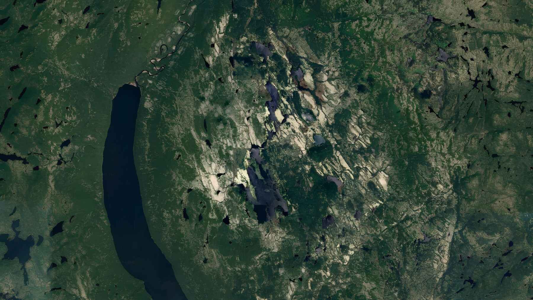
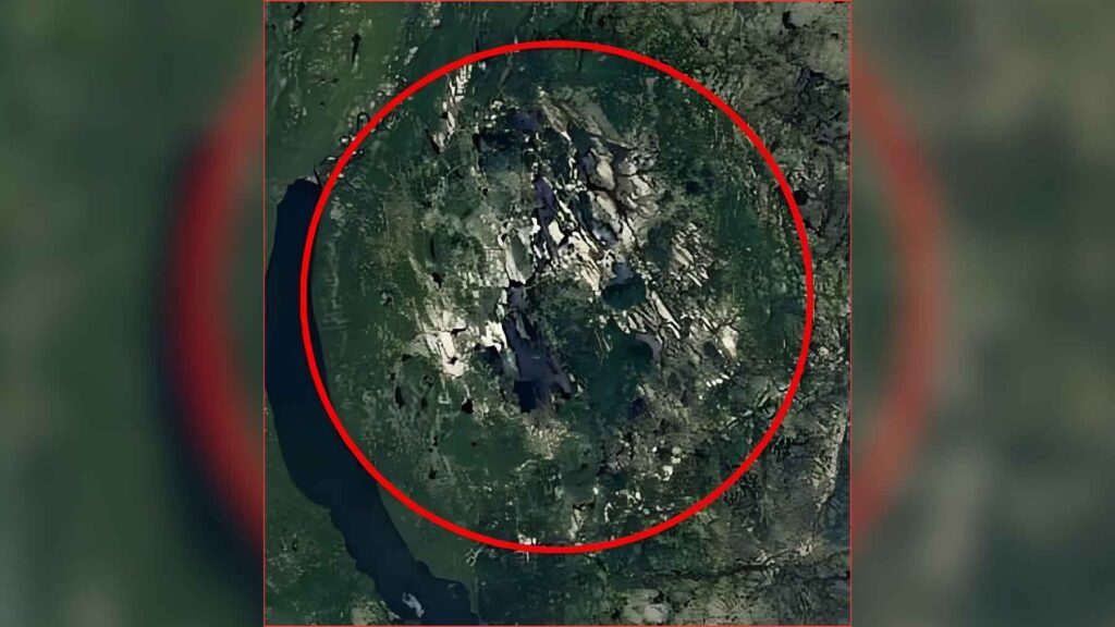
A circular pit noticed by a Quebec resident while browsing Google Maps has been confirmed as the remains of a meteorite impact from roughly 390 million years ago. The feature, located about 62 miles north of Magpie, Quebec, is around 15.5 miles wide and has now been named the Uhackatik crater.
What began as a road-trip planning session became a rare scientific discovery. Researchers found exceptionally well-preserved rock features created by extreme pressure and heat, turning an amateur astronomer’s hunch into Canada’s first newly reported impact crater since 2010.
A strange circle on Google Maps
In late 2023, amateur astronomer Joël Lapointe was studying forest roads on Google Maps while planning a summer trip. A round depression caught his attention, although his first reaction was to dismiss the idea that he had found anything unknown.
“I told myself, ‘You haven’t discovered anything, Joël. It’s not possible. They must already know about it,’” he recalled. Still, the shape stayed in his mind, partly because his interest in space and meteorites stretched back to childhood nights spent watching the stars at his grandmother’s home.
Lapointe searched crater databases but could not find a matching entry. After several attempts to interest researchers, he reached a French research center willing to examine whether the unusual landform could have been created by an ancient impact.
Why scientists were skeptical
Reports of possible meteorite craters are common, but most do not survive scientific scrutiny. Gordon Osinski, a professor in Western University’s Department of Earth Sciences, said he regularly receives claims through the Impact Earth website that later turn out not to be impact craters.
That made him cautious when French colleagues told him about the Quebec site, but the circular topography and early rock analyses were unusual enough to justify a closer look, and he eventually co-led an expedition to the crater in 2025.
The team reached the remote area by floatplane and found steep, difficult ground. They did not know exactly where they could land, reach the shoreline, or establish a camp, so the fieldwork began as a trip into largely unknown terrain.
Evidence hidden in the rocks
Confirming an impact crater requires more than a circular shape. Researchers generally look for pieces of the original meteorite or for signs that local rocks were transformed by the enormous pressure and heat produced when a space object struck the ground.
Finding the meteorite itself was unlikely here. Fragments are more often preserved in much smaller craters, while Uhackatik measures about 15.5 miles across and has survived for hundreds of millions of years.
The rocks provided the answer. The expedition found shatter cones, which are cone-shaped fracture patterns produced by powerful shock waves, along with impact-melted rock formed when the collision generated enough heat to liquefy part of the ground. Both features indicated that a meteorite impact had occurred, and their unusually good preservation strengthened the finding.
Older than anyone expected
Before dating the crater, Osinski believed it might be between 38 million and 200 million years old. The result pushed the site far deeper into Earth’s history at approximately 390 million years old.
That age places the impact long before dinosaurs, mammals, and humans appeared. Early amphibians were among the forms of life developing at the time, making the crater a surviving mark from a world that would look almost unrecognizable today.
The great age also makes Lapointe’s discovery especially striking. He did not spot a fresh scar in the landscape, but the worn outline of an event that happened hundreds of millions of years before anyone could have watched the sky. Somehow, the evidence remained.
A rare addition to Canada’s map
Researchers identify only one or two impact craters worldwide in a typical year, according to Osinski, and the newly recognized sites are usually smaller. Canada had not added a newly reported crater to its list since 2010.
After discussions with the Innu council of Ekuanitshit, the structure received the name Uhackatik. That step connected the scientific identification of the crater with the Indigenous community linked to the region.
The research team is preparing to present its findings at the upcoming annual meeting of the Meteoritical Society in Germany. There, the evidence behind the crater’s identification and estimated age will be shared with researchers who specialize in meteorites and impact processes.
An amateur observation becomes science
Lapointe was kept informed during the investigation but had to remain quiet while the researchers prepared the first public details. When they confirmed that the rocks carried the signature of an impact, he said he felt “euphoric” because the possibility had finally become real.
The discovery shows how digital mapping tools can open remote landscapes to curious observers. A person at home can notice a shape that specialists have never examined, but fieldwork and rock analysis are still needed to determine whether that shape was truly created by an impact. That is the key distinction.
Google Maps revealed the circle, yet the rocks told the story. For Lapointe, a casual look at forest trails led to evidence of a collision from an era before dinosaurs, preserved in Quebec’s terrain for nearly 400 million years.
The original report was published by The Canadian Press.
Most read
- US scientists poured 16,500 gallons of lye into the Gulf of Maine and dyed the water bright pink to track it, the first federally approved try at reversing ocean acidity
- Soviet scientists released giant red king crabs into the Barents Sea in the 1960s to build a fishery, but decades later those invaders are still changing the seafloor
- New Orleans is collecting thousands of used Christmas trees and dropping them from helicopters to slow the loss of land, which has already exceeded 5,000 square kilometers
- The U.S. will pay up to $65 million to leave Colorado River water in Lake Mead, and Hoover Dam explains why
- Britain is dropping 20 concrete reef cubes and 44 tons of scallop shells into the sea, and the goal is to bring back oysters down more than 95% since the 1800s