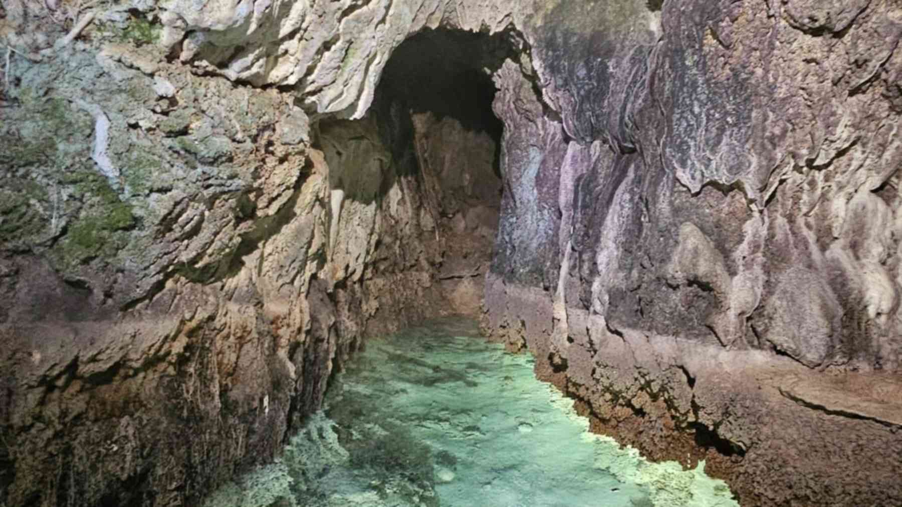
An ancient water tunnel explored in Monteleone Sabino, in Italy’s province of Rieti, is offering a closer look at how rural communities managed their land before Roman rule. Researchers have documented a passage that can currently be inspected for about 100 meters (328 feet). Its likely agricultural role makes the discovery a story about both engineering and the practical business of growing food.
According to Italy’s heritage authority for metropolitan Rome and Rieti, the aqueduct likely served agriculture by draining land, regulating water, and improving soil productivity. The findings suggest that local communities had the resources and organization to reshape their surroundings through substantial waterworks. For the people who depended on those fields, controlling water could have mattered as much as securing access to it.
A tunnel shaped by careful planning
The investigation was carried out by the Gruppo Speleo Archeologico Vespertilio under the scientific direction of the Soprintendenza Archeologia, Belle Arti e Paesaggio, with support from the municipal administration. The team documented a passage cut entirely into the hillside, with a pointed, archlike cross section known as an ogival profile.
Its builders worked through layers of conglomerate rock alternating with marl and clay. They first opened transverse tunnels at regular intervals, then excavated along the course of the hill’s ridge, where the entrance lies. That sequence is one reason investigators see considerable technical skill in the structure.
The spacing and arrangement of the passages also give researchers something more useful than a striking underground view. They preserve clues to the order in which the work proceeded, helping investigators reconstruct decisions made during excavation.
Water management started with the soil
What does an aqueduct have to do with draining farmland? In this case, the authority identifies drainage and water regulation as central agricultural functions of the channel. Moving water through a landscape can include carrying away an excess that makes soil difficult to cultivate.
The basic problem is familiar to anyone who has watched a garden stay soggy after heavy rain. University of Minnesota Extension explains that saturated soils can limit the oxygen available to crop roots, while drainage can improve growing conditions and allow fieldwork to proceed sooner. That modern explanation helps clarify why ancient farmers might have invested heavily in managing water around their fields.
The Monteleone Sabino announcement does not identify particular crops or calculate an increase in harvests. Its agricultural interpretation instead connects the channel to the broader organization of the surrounding countryside. Understanding that relationship is a central part of the discovery’s value.
Small villages with the means to build
Researchers place the infrastructure within a network of small settlements called vici. These communities were connected to a strategic road corridor between the inland Apennine areas and the Sabine territory toward the Tiber. The emerging picture is of an inhabited landscape shaped through planning and investment.
The authority associates the settlements with the pagus of the Mutuesci, a rural territorial district. It argues that the expense and technical complexity of the waterworks imply “a firmly organized central authority” (translated from Italian). In other words, the tunnel provides evidence from which researchers infer how people coordinated resources and labor.
How much labor did excavation take, and who directed it? Those remain useful questions for further investigation, because the announcement identifies an organized community without describing the people or institutions that ran the project. The physical channel offers a way to study that wider social history.
What “pre-Roman” actually tells us
The official announcement describes the aqueduct as pre-Roman but does not give a precise construction date. Here, the term places it before the Romanization of the local territory. Assigning it a specific age in years would go beyond the information released.
There is also a separate geological timeline to keep straight. The Pliocene-Pleistocene age mentioned in the description refers to the formations through which the passage was excavated, while the roughly 100-meter measurement describes the section currently inspectable. Neither detail establishes when the aqueduct was built or how far its complete route extended.
Reading the landscape underground
Work in the area continues through a combination of archaeology and speleology, the study and exploration of caves and underground spaces. Preliminary findings were presented at the 15th Lazio e Sabina studies meeting in 2026. Together, these approaches help researchers interpret surviving structures in relation to the territory above them.
For now, the discovery adds a tangible piece to the history of farming and water management in the Sabine countryside. The official statement was published on September 15, 2026, on SABAP MET RM, the heritage authority’s website.
Photo: SABAP Roma e Rieti